- Discover
-
Expertise
-
Alternative Delivery
- I-275 at I-4 Downtown Tampa Interchange Design-Build
- Wekiva Parkway Section 8 Interchange
- US 17/92 Interchange at SR 436
- SR 9B Extension from I-95 to US 1
- A. Max Brewer Bridge Replacement
- I-95 Widening from the Indian River/Brevard County Line to Malabar Road
- SR 528 (Beachline Expressway) at Innovation Way Interchange
- SR 570 Polk Parkway Widening from I-4 to Pace Road
- I-95 Express Lanes and Ramp Signals – Phase 3A-1
- Pollard Road Extension over Peace Creek
- I-485 Widening from I-77 to Rea Road
- Monroe Bypass/Connector Design-Build
- Construction Services
- Ecological Services
-
Federal Services
- Range of the Future Study
- US Coast Guard Air Station (Clearwater)
- Ascension Island Fire Station Renovation
- Patrick Space Force Base Water Lines Repair
- Patrick Space Force Base Living Shoreline Restoration
- P-505 Electrical Hardening and Black Start CHP at Marine Corps Air Station Beaufort
- Naval Station at Guantanamo Bay Survey Services
- Repair Phillips Parkway and Speed Limit Study
- Ascension Island Auxiliary Airfield Surveying and Mapping Services
-
Geographic Information Systems (GIS)
- Thermal Design/Comprehensive Campus LiDAR Collection
- Greater Orlando Aviation Authority (GOAA) Strategic Commerical Land Development Program
- University of Florida Sanitary Sewer GIS Mapping
- Ascension Island Auxiliary Airfield GIS Integration
- Santa Rosa County School District's School Transportation & Capacity GIS Analysis
- Gainesville Community Redevelopment Agency Socioeconomic Analysis and Site Suitability Report
- Real Estate Site Suitability and Development Analysis
- SR 836 (Dolphin Expressway) GIS Asset Inventory of Pre-Post Construction
- Alachua County Public Schools GIS and School Planning Professional Services
- Patrick Air Force Base Living Shoreline Restoration GIS Analysis
- Florida Army National Guard Readiness Center GIS Inventory & Integration
- Comprehensive Transit Study Puerto Rico GIS Analysis
- Land Development
- Structural Engineering
-
Subsurface Utility Engineering (SUE)
- Thermal Design/Comprehensive Campus LiDAR Collection
- P-505 Electrical Hardening and Black Start CHP at Marine Corps Air Station Beaufort
- Resurface & Safety Improvements Turnpike Mainline
- University of Florida Rabon Utility Mapping
- FP&L Subsurface Utility Engineering Continuing On-Call Contract
- Lockheed Martin Subsurface Utility Engineering Services
- Palm Coast Parkway Subsurface Utility Engineering Services
- Surveying & Mapping/Geospatial
-
Traffic Impact Analysis
- 505 West Chapel Hill Street
- 5th Street Station
- Beale Farm Industrial Park
- Blue Mountain Mist Resort
- The Villages at McCullers Walk
- Fredericksburg National Baseball Stadium
- Hendrick Southpoint Auto Mall
- Apex Friendship Elementary School
- Whole Foods Center
- Barclay West
- Grove 98
- Pullen Drive Extension/Catholic Diocese
- Trails/Parks & Recreation Facilities
- Transportation
-
Utilities Engineering
- Ascension Island Fire Station Renovation
- M-1 Canal Water Main Extension
- 5th Street Bridge Utility Replacement
- Captain’s Cove Wastewater Plant Revisions & Permit Renewal
- City of Fort Myers Downtown Utility & Streetscape Improvement
- Florida Caverns State Park Lift Station Rehab
- Tween Waters Inn Wastewater Plant Permit Renewal
- City of Fort Myers Wastewater Capacity Studies
- Patrick Air Force Base Water Lines Repair
- Big Lagoon Boat Ramp Wastewater System
- St. Joseph State Park Septic Tank Replacement
- WildBlue Development Wastewater Modeling
- A-1 Gator Wastewater Capacity Increase
- Visualization Services
- Water Resources/Stormwater Management
-
Alternative Delivery
- Careers
- News
- #DRMPerspective
- Team With Us
- Locations

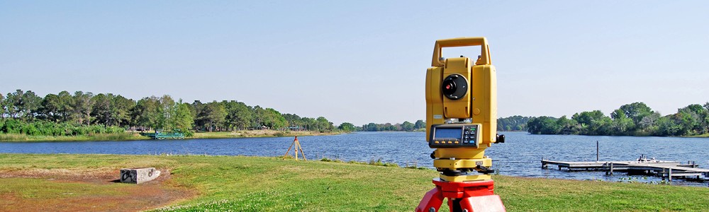
Thank the Egyptians; The History of Surveying & Mapping
March 19th, 2019


Since 1977, DRMP has been providing accurate survey deliverables that are critical to the success of our client’s projects. As we begin to celebrate National Surveyors Week, DRMP is looking back on some of the historical influences that have shaped the surveying and mapping services that we provide today.
The earliest known use of surveying practices is in 1400 BC by the Egyptians, whom first used it to accurately divide land into plots for taxation. They used measuring ropes to gauge the dimensions of various land plots. They did this by stretching a piece of rope and treating it with materials so that it would hold its length. Egyptian surveyors would then use it to measure distances and tie knots at various intervals with significance.
The next great revelation in early land surveying was the creation of the diopter by the Greeks in 120 BC. The diopter was the first piece of surveying equipment ever invented. It was a portable tool that featured a cogwheel, screw and water level used to measure terrestrial and astronomical elements on a property. This led to the Greek’s development of the first set of standards and guidelines for land surveying methods.
In 1571, Joshua Habermel invented a new land surveying tool, the theodolite. This is a precise surveying tool that uses a tripod and a compass. It was modified in 1725, when Jonathon Sission added a scope to the instrument. Theodolites are still used today in modern surveying practices, which makes the invention highly impactful on the development of modern surveying.
In the 21st century, we still rely on many of the basic methods that have been around since ancient times. However, with the development of modern technology such as GPS systems, geographic information systems (GIS) programs and advanced scanners, surveying has become more accurate, faster and user-friendly. At DRMP, we strive to train on the latest technologies and methods available to surveyors around the world, and in return this allows us to provide our clients with more reliable data than ever before. As land surveying propels into the future with new innovations and advancements in technology, one thing stands true, the practice will continue to stand the test of time.

Categories
- All
- Featured Posts
- Alternative Delivery
- Construction Services
- Ecological Services
- Geographic Information Systems
- Land Development
- Structural Engineering
- Subsurface Utility Engineering
- Surveying & Mapping
- Transportation
- Water Resources/Stormwater Management
- Federal Services
- Project Development & Environment
- NEPA
- Transportation Planning/Project Development
- Utilities Engineering
Contributors
- Michael K. Albano, PE
- Bruno J. Arriola, PE, ENV SP
- Martha Ayers
- Brent Bass, PE, PSM
- Cody Bayer, PE
- Donald W. Brown, PE
- Kyle Brown, PE
- Zach J. Carnahan, PE
- Brian Crowl, PE
- Patrick Day, PE
- Nick DeVito, PE
- J. Matt Floyd, PSM
- Deshon M. Fox, PE
- Scott Garth, PE LEED AP ND
- Ryan M. Grab, CST II
- Robyn Hartz
- TJ Lallathin, Jr., PE, DBIA
- Kelly Marton, GISP
- Meaghan McCarthy
- George McLatchey, PWS, CEP
- Shawn McLemore, PE
- Jeff Miller
- Ryan Mitchell, PE
- Lisa Moon, PE
- Megan E. Mott, PE
- Josh Norman
- Julian Poole, PE
- Mark Prochak, PE
- Abby Rains
- Leo Rodriguez, PE
- Kimberly Santiago-Ortiz, PE
- Rachel L. Schmidt, PWS
- Brian V. Smith
- Rynal Stephenson, PE
- Deston Taylor, EI
- August Thick, PLS
- Ron Wallace, PE
- Steven L. Wallace, PE
- Orville Williams
- Amanda E. Woods, PE


