- Discover
-
Expertise
-
Alternative Delivery
- I-275 at I-4 Downtown Tampa Interchange Design-Build
- Wekiva Parkway Section 8 Interchange
- US 17/92 Interchange at SR 436
- SR 9B Extension from I-95 to US 1
- A. Max Brewer Bridge Replacement
- I-95 Widening from the Indian River/Brevard County Line to Malabar Road
- SR 528 (Beachline Expressway) at Innovation Way Interchange
- SR 570 Polk Parkway Widening from I-4 to Pace Road
- I-95 Express Lanes and Ramp Signals – Phase 3A-1
- Pollard Road Extension over Peace Creek
- I-485 Widening from I-77 to Rea Road
- Monroe Bypass/Connector Design-Build
- Construction Services
- Ecological Services
-
Federal Services
- Range of the Future Study
- US Coast Guard Air Station (Clearwater)
- Ascension Island Fire Station Renovation
- Patrick Space Force Base Water Lines Repair
- Patrick Space Force Base Living Shoreline Restoration
- P-505 Electrical Hardening and Black Start CHP at Marine Corps Air Station Beaufort
- Naval Station at Guantanamo Bay Survey Services
- Repair Phillips Parkway and Speed Limit Study
- Ascension Island Auxiliary Airfield Surveying and Mapping Services
-
Geographic Information Systems (GIS)
- Thermal Design/Comprehensive Campus LiDAR Collection
- Greater Orlando Aviation Authority (GOAA) Strategic Commerical Land Development Program
- University of Florida Sanitary Sewer GIS Mapping
- Ascension Island Auxiliary Airfield GIS Integration
- Santa Rosa County School District's School Transportation & Capacity GIS Analysis
- Gainesville Community Redevelopment Agency Socioeconomic Analysis and Site Suitability Report
- Real Estate Site Suitability and Development Analysis
- SR 836 (Dolphin Expressway) GIS Asset Inventory of Pre-Post Construction
- Alachua County Public Schools GIS and School Planning Professional Services
- Patrick Air Force Base Living Shoreline Restoration GIS Analysis
- Florida Army National Guard Readiness Center GIS Inventory & Integration
- Comprehensive Transit Study Puerto Rico GIS Analysis
- Land Development
- Structural Engineering
-
Subsurface Utility Engineering (SUE)
- Thermal Design/Comprehensive Campus LiDAR Collection
- P-505 Electrical Hardening and Black Start CHP at Marine Corps Air Station Beaufort
- Resurface & Safety Improvements Turnpike Mainline
- University of Florida Rabon Utility Mapping
- FP&L Subsurface Utility Engineering Continuing On-Call Contract
- Lockheed Martin Subsurface Utility Engineering Services
- Palm Coast Parkway Subsurface Utility Engineering Services
- Surveying & Mapping/Geospatial
-
Traffic Impact Analysis
- 505 West Chapel Hill Street
- 5th Street Station
- Beale Farm Industrial Park
- Blue Mountain Mist Resort
- The Villages at McCullers Walk
- Fredericksburg National Baseball Stadium
- Hendrick Southpoint Auto Mall
- Apex Friendship Elementary School
- Whole Foods Center
- Barclay West
- Grove 98
- Pullen Drive Extension/Catholic Diocese
- Trails/Parks & Recreation Facilities
- Transportation
-
Utilities Engineering
- Ascension Island Fire Station Renovation
- M-1 Canal Water Main Extension
- 5th Street Bridge Utility Replacement
- Captain’s Cove Wastewater Plant Revisions & Permit Renewal
- City of Fort Myers Downtown Utility & Streetscape Improvement
- Florida Caverns State Park Lift Station Rehab
- Tween Waters Inn Wastewater Plant Permit Renewal
- City of Fort Myers Wastewater Capacity Studies
- Patrick Air Force Base Water Lines Repair
- Big Lagoon Boat Ramp Wastewater System
- St. Joseph State Park Septic Tank Replacement
- WildBlue Development Wastewater Modeling
- A-1 Gator Wastewater Capacity Increase
- Visualization Services
- Water Resources/Stormwater Management
-
Alternative Delivery
- Careers
- News
- #DRMPerspective
- Team With Us
- Locations

DRMP’s Environmental Services Delve Deep into the Proposed Lake Apopka Trail Connector
December 6th, 2023


In the heart of Central Florida, sprawling across vast acres of land and bodies of water, you’ll find a haven for countless species of wildlife, including alligators, black bears, bobcats, manatees, deer, snakes, gopher tortoises, and birds.
There’s a delicate balance between protecting this critical wildlife habitat and its native species while also meeting the demands of development. This is where DRMP’s Environmental Services experts play a critical role in ensuring transportation projects align with the stringent guidelines set by federal and state environmental protection laws.
Orange County, Florida, is proposing to construct the Lake Apopka Trail Connector from the Lake Apopka Trail Loop to the 22-mile West Orange Trail, a popular and widely used tree-lined trail near Orlando for cycling, jogging, and other recreational activities.
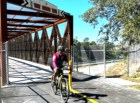
A cyclist rides on the West Orange Trail
The proposed trail would include a 10- to 14-foot-wide asphalt multi-use trail that will link the West Orange Trail to the Lake Apopka Loop Trail from Magnolia Park to McCormick Road, covering a 4.8-mile stretch. The purpose of the proposed trail is to connect the trail systems of Orange County, the St. Johns Water Management District, and Lake County.
DRMP is providing ongoing environmental services for this project as a subconsultant to WBQ. Our firm is providing environmental permitting services, wetland and surface water assessments, and threatened and endangered species surveys.
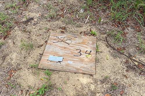
Sand Skink Coverboard Survey
One of the more interesting aspects of this project was surveying the proposed new trail limits for the presence of the state and federally protected sand skink (Neoseps reynoldsi). A sand skink is a small, sleek grey or light brown lizard with shiny scales protected as a “threatened” species by the federal Endangered Species Act and by Florida’s Endangered and Threatened Species Rule. Sand skinks can reach a length of 5 inches and are exclusively found on sandy ridges of interior Central Florida.
The project is located within an area designated by the U.S. Fish and Wildlife Service (USFWS) as a sand skink consultation area, which means suitable habitat may be present in this area. The three most important factors in determining the presence of skinks are location, elevation, suitable soils, and a distinctive sinusoidal (“S”-shaped) track.
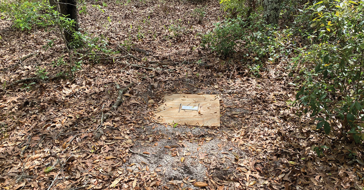
A coverboard survey identifies a mole skink
Surveys can be conducted throughout the year; however, tracks are most visible in the spring and fall. Visual pedestrian surveys were conducted to confirm these parameters were met, and suitable sand skink habitat was present.
The pedestrian survey indicated the project area did meet the criteria for suitable habitat for sand skink, but no tracks were detected. Per the USFWS survey protocol, if the pedestrian survey is negative for tracks or some portions of the site were determined not occupied, then a coverboard survey is necessary to reach a presumed absence conclusion. Coverboards, which consist of 2 foot by 2 foot plywood, are strategically placed within specific areas of bare sand or sparse vegetation. Prior to initiating coverboard surveys, we coordinated with USFWS biologists to gain concurrence on our proposed survey approach, such as survey dates and coverboard locations. When we surveyed the project area for sand skinks, we separated the survey area into two designations: Survey Area West and Survey Area East. Survey Area West is the proposed trail limits west of State Road 429 (SR 429), and Survey Area East is located east of SR 429. The two areas contain approximately 0.78 acres of suitable sand skink habitat.
One of several coverboards used to survey for sand skinks
Our survey entailed strategically positioning eight boards within the western survey area, spanning 0.20 acres of suitable sand skink habitat, and deploying an additional 27 boards in the eastern area, encompassing 0.58 acres of similarly favorable sand skink habitat.
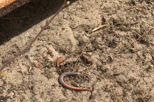
We meticulously checked each coverboard weekly for four weeks looking for the unique “S” tracks of the sand skink; however, our survey came back negative. Though our coverboard survey did not find any evidence of sand skinks, we did observe numerous other elusive critters, such as snakes, small mammals, and a mole skink, which is a similar looking lizard but is not protected. Since our coverboard survey produced negative results, we submitted our survey results to USFWS and got concurrence that the proposed project trail “may affect, not likely to adversely affect” the sand skink.
Surveying for Gopher Tortoises
The gopher tortoise, recognized by the Florida Fish and Wildlife Conservation Commission (FWC) as a threatened species, inhabits dry upland habitats and pine flatwoods. More than 350 other species of animals, known as commensal species, benefit from burrow systems created by gopher tortoises.
Due to the presence of potentially suitable habitat within the project area, DRMP undertook a comprehensive gopher tortoise survey. In my capacity as the Project Manager and an FWC Authorized Gopher Tortoise Agent, I personally conducted a survey of all the suitable gopher tortoise habitat within the project limits looking for gopher tortoise burrows.
During this process, I observed several potentially occupied gopher tortoise burrows within the project area and its immediate vicinity. All gopher tortoise burrows located within the project area or within 25 feet of the proposed project footprint are considered impacted burrows and are required to be excavated/relocated prior to the commencement of construction.
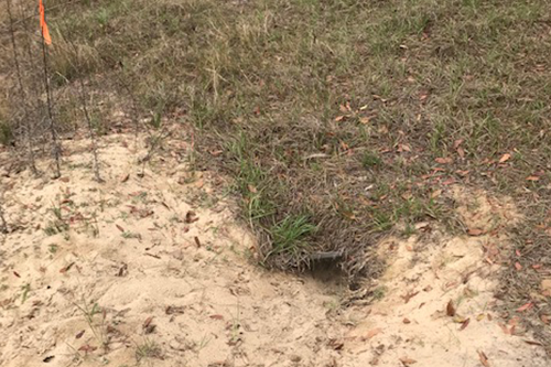
A gopher tortoise burrow
It is anticipated the proposed project will impact less than 10 gopher tortoise burrows and will qualify for an FWC gopher tortoise relocation permit, a crucial step DRMP will promptly secure on behalf of the client.
The Lake Apopka Connector Trail is one example of many projects in which DRMP demonstrates our commitment to environmental stewardship among the comprehensive services we offer. I’m proud to be a part of a robust team of scientists doing our part to help safeguard the environment.

Rachel L. Schmidt, PWS, serves as the Environmental Department Manager for DRMP’s Transportation Market Sector.
Posted in the categories All, Ecological Services.

Categories
- All
- Featured Posts
- Alternative Delivery
- Construction Services
- Ecological Services
- Geographic Information Systems
- Land Development
- Structural Engineering
- Subsurface Utility Engineering
- Surveying & Mapping
- Transportation
- Water Resources/Stormwater Management
- Federal Services
- Project Development & Environment
- NEPA
- Transportation Planning/Project Development
- Utilities Engineering
Contributors
- Michael K. Albano, PE
- Bruno J. Arriola, PE, ENV SP
- Martha Ayers
- Brent Bass, PE, PSM
- Cody Bayer, PE
- Donald W. Brown, PE
- Kyle Brown, PE
- Michael Bywaletz, PE, CPESC, ENV SP
- Zach J. Carnahan, PE
- Brian Crowl, PE
- Patrick Day, PE
- Nick DeVito, PE
- Matt Floyd, PSM
- Deshon M. Fox, PE
- Scott Garth, PE, LEED AP ND
- Ryan M. Grab, CST II
- Robyn Hartz
- TJ Lallathin, Jr., PE, DBIA
- Kelly Marton, GISP
- Meaghan McCarthy
- George McLatchey, PWS, CEP
- Shawn McLemore, PE
- Jeff Miller
- Ryan Mitchell, PE
- Lisa Moon, PE
- Megan E. Mott, PE
- Josh Norman
- Julian Poole, PE
- Mark Prochak, PE
- Abby Rains
- Leo Rodriguez, PE
- Kimberly Santiago-Ortiz, PE
- Rachel L. Schmidt, PWS
- Logan Shappell
- Brian V. Smith
- Rynal Stephenson, PE
- Deston Taylor, EI
- August Thick, PLS
- Ron Wallace, PE
- Steven L. Wallace, PE
- Orville Williams
- Amanda E. Woods, PE


