- Discover
-
Expertise
-
Alternative Delivery
- I-275 at I-4 Downtown Tampa Interchange Design-Build
- Wekiva Parkway Section 8 Interchange
- US 17/92 Interchange at SR 436
- SR 9B Extension from I-95 to US 1
- A. Max Brewer Bridge Replacement
- I-95 Widening from the Indian River/Brevard County Line to Malabar Road
- SR 528 (Beachline Expressway) at Innovation Way Interchange
- SR 570 Polk Parkway Widening from I-4 to Pace Road
- I-95 Express Lanes and Ramp Signals – Phase 3A-1
- Pollard Road Extension over Peace Creek
- I-485 Widening from I-77 to Rea Road
- Monroe Bypass/Connector Design-Build
- Construction Services
- Ecological Services
-
Federal Services
- Range of the Future Study
- US Coast Guard Air Station (Clearwater)
- Ascension Island Fire Station Renovation
- Patrick Space Force Base Water Lines Repair
- Patrick Space Force Base Living Shoreline Restoration
- P-505 Electrical Hardening and Black Start CHP at Marine Corps Air Station Beaufort
- Naval Station at Guantanamo Bay Survey Services
- Repair Phillips Parkway and Speed Limit Study
- Ascension Island Auxiliary Airfield Surveying and Mapping Services
-
Geographic Information Systems (GIS)
- Thermal Design/Comprehensive Campus LiDAR Collection
- Greater Orlando Aviation Authority (GOAA) Strategic Commerical Land Development Program
- University of Florida Sanitary Sewer GIS Mapping
- Ascension Island Auxiliary Airfield GIS Integration
- Santa Rosa County School District's School Transportation & Capacity GIS Analysis
- Gainesville Community Redevelopment Agency Socioeconomic Analysis and Site Suitability Report
- Real Estate Site Suitability and Development Analysis
- SR 836 (Dolphin Expressway) GIS Asset Inventory of Pre-Post Construction
- Alachua County Public Schools GIS and School Planning Professional Services
- Patrick Air Force Base Living Shoreline Restoration GIS Analysis
- Florida Army National Guard Readiness Center GIS Inventory & Integration
- Comprehensive Transit Study Puerto Rico GIS Analysis
- Land Development
- Structural Engineering
-
Subsurface Utility Engineering (SUE)
- Thermal Design/Comprehensive Campus LiDAR Collection
- P-505 Electrical Hardening and Black Start CHP at Marine Corps Air Station Beaufort
- Resurface & Safety Improvements Turnpike Mainline
- University of Florida Rabon Utility Mapping
- FP&L Subsurface Utility Engineering Continuing On-Call Contract
- Lockheed Martin Subsurface Utility Engineering Services
- Palm Coast Parkway Subsurface Utility Engineering Services
- Surveying & Mapping/Geospatial
-
Traffic Impact Analysis
- 505 West Chapel Hill Street
- 5th Street Station
- Beale Farm Industrial Park
- Blue Mountain Mist Resort
- The Villages at McCullers Walk
- Fredericksburg National Baseball Stadium
- Hendrick Southpoint Auto Mall
- Apex Friendship Elementary School
- Whole Foods Center
- Barclay West
- Grove 98
- Pullen Drive Extension/Catholic Diocese
- Trails/Parks & Recreation Facilities
- Transportation
-
Utilities Engineering
- Ascension Island Fire Station Renovation
- M-1 Canal Water Main Extension
- 5th Street Bridge Utility Replacement
- Captain’s Cove Wastewater Plant Revisions & Permit Renewal
- City of Fort Myers Downtown Utility & Streetscape Improvement
- Florida Caverns State Park Lift Station Rehab
- Tween Waters Inn Wastewater Plant Permit Renewal
- City of Fort Myers Wastewater Capacity Studies
- Patrick Air Force Base Water Lines Repair
- Big Lagoon Boat Ramp Wastewater System
- St. Joseph State Park Septic Tank Replacement
- WildBlue Development Wastewater Modeling
- A-1 Gator Wastewater Capacity Increase
- Visualization Services
- Water Resources/Stormwater Management
-
Alternative Delivery
- Careers
- News
- #DRMPerspective
- Team With Us
- Locations

DRMP's Emergency Drainage Design for Suncoast Parkway Holds Water
December 5th, 2022


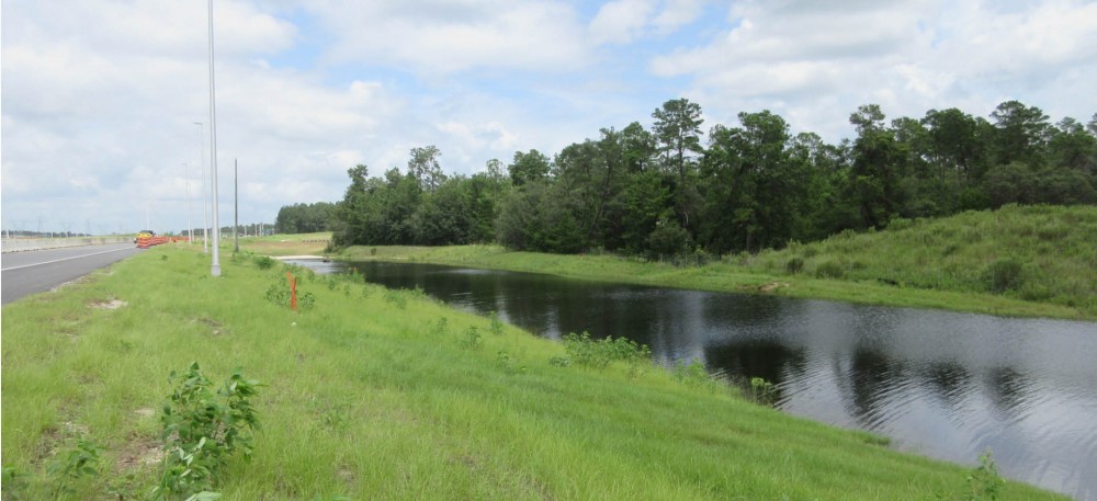
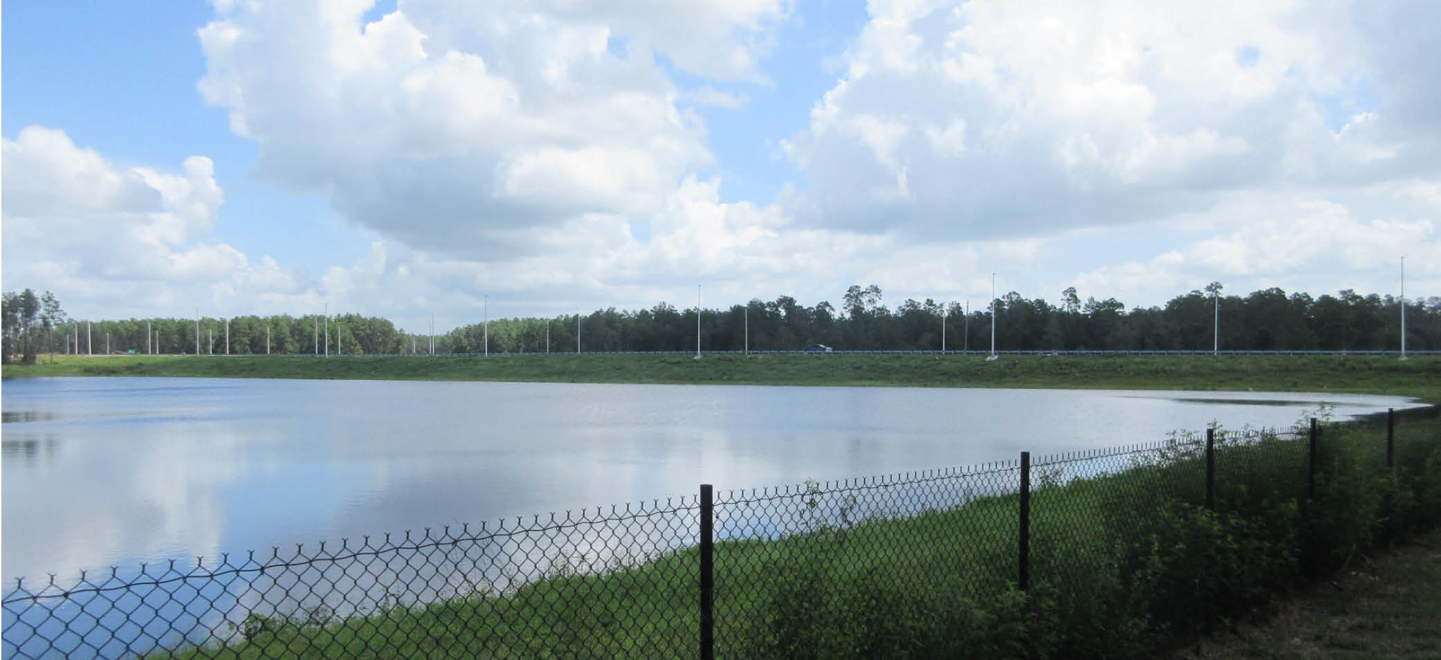
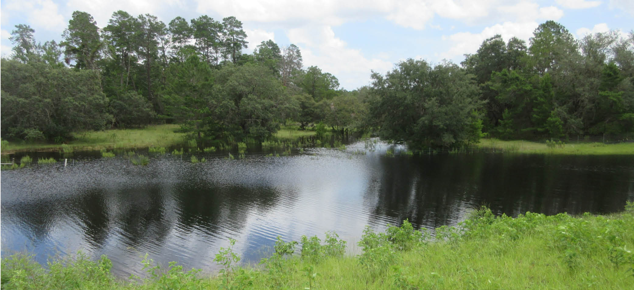
The emergency drainage project DRMP designed for the Suncoast Parkway in Hernando County, Fla., passed its first real test with Mother Nature in the summer of 2021. The project area received 3 feet of rainfall in a seven-week period from the end of June to the beginning of September.
Heavy rainfall caused parts of Hernando County to flood and open large sinkholes prompting the project’s Construction Engineering and Inspection (CEI) Consultant to raise concerns over the possibility of rising water inundating the roadway.
DRMP was under contract with Florida’s Turnpike Enterprise (FTE) designing the SR 589 extension north of US 98 when an emergency drainage project was necessary after Tropical Storm Debby flooded a section of State Road 589 and closed it to traffic south of the US 98 intersection. Rainfall data collected by the Southwest Florida Water Management District (SWFWMD) associated it with a 233-year storm event.
Despite the 2021 storm ushering in all too familiar conditions, our design proved effective and prevented the roadway from flooding. All existing lanes of SR 589 remained open and flood stages never reached the shoulder.
DRMP’s collaborative design of the Suncoast Parkway 2, State Road 589 Expansion project recently won the Florida Transportation Builders Association’s (FTBA) 2022 Rural Project of the Year award. More recently, it also received a 2022 Yearbook of Engineering Achievement Award from Zweig Group’s Civil+Structural Engineer Media. It is a $135 million FTE project that encompasses 13 miles of new roadway that extends Suncoast Parkway from US 98 to State Road 44 between Hernando and Citrus counties in Florida.
GIS Technology Advances Project
When we designed the emergency drainage project starting in late 2012, FTE was given direction by then-Gov. Rick Scott to advance the project far enough by the beginning of the next hurricane season in June 2013 such that the roadway could remain open in another high-volume rainfall event.
We exceeded that goal with the use of Geographic Information System (GIS) technology to advance the stormwater modeling and watershed analysis. This enabled us to finalize an approved solution for the client by February of 2013 so we could develop construction plans, permit the improvements, and work with the contractor to ensure the Suncoast Parkway would remain open in 2013 if similar flood stages occurred.
We had to design an emergency drainage system, permit it, and get it built before the next looming hurricane season per the governor’s order. We were able to ensure at least one lane in each direction was open for evacuation within nine months.
An Innovative Study
What’s remarkable and innovative about our analysis and solution is the limited scope watershed study that supported our alternatives analysis and how quickly we were able to complete the project ahead of schedule and under the governor’s order.
After Tropical Storm Debby flooded the roadway in June 2012, DRMP completed a limited scope watershed study of the impacted basins. The original design of this segment of the Suncoast Parkway correctly identified the area within a closed basin and applied the appropriate design criteria, but there was more to the story.
With the ability of GIS terrain modeling, we were able to efficiently expand the analysis away from the corridor and found the 2012 Tropical Storm Debby failure was the result of a cascading effect from upstream closed basins that overtopped with multi-day rainfall amounts well above design criteria.
This resulted in several upstream basins not accounted for flowing to the lowest basin, which the Parkway dissected and caused flooding of the road. Interestingly, one of the upstream basins was found to have a sinkhole that drained the basin during typical rainfall events. It was overwhelmed in these multi-day, high-volume rainfall events we were studying causing water to cascade to lower areas.
We determined it would not be feasible to purchase enough land within the basin to create enough storage to lower the flood levels. A hybrid solution of maximizing storage within the FTE property and raising the road to keep it above flood levels became the recommended alternative.
Designing drainage systems in the hurricane and thunderstorm capital of the United States brings many challenges to the job. So, it’s a rewarding experience designing systems that stand up to Mother Nature and help keep people in communities and on our roadways safe.

Don Brown, PE, is a Drainage Division Leader/Senior Project Manager in DRMP’s Water Resources Division.
Share This Page![]()


Categories
- All
- Featured Posts
- Alternative Delivery
- Construction Services
- Ecological Services
- Geographic Information Systems
- Land Development
- Structural Engineering
- Subsurface Utility Engineering
- Surveying & Mapping
- Transportation
- Water Resources/Stormwater Management
- Federal Services
- Project Development & Environment
- NEPA
- Transportation Planning/Project Development
- Utilities Engineering
Contributors
- Michael K. Albano, PE
- Bruno J. Arriola, PE, ENV SP
- Martha Ayers
- Brent Bass, PE, PSM
- Cody Bayer, PE
- Donald W. Brown, PE
- Kyle Brown, PE
- Michael Bywaletz, PE, CPESC, ENV SP
- Zach J. Carnahan, PE
- Brian Crowl, PE
- Patrick Day, PE
- Nick DeVito, PE
- Matt Floyd, PSM
- Deshon M. Fox, PE
- Scott Garth, PE, LEED AP ND
- Ryan M. Grab, CST II
- Robyn Hartz
- TJ Lallathin, Jr., PE, DBIA
- Kelly Marton, GISP
- Meaghan McCarthy
- George McLatchey, PWS, CEP
- Shawn McLemore, PE
- Jeff Miller
- Ryan Mitchell, PE
- Lisa Moon, PE
- Megan E. Mott, PE
- Josh Norman
- Julian Poole, PE
- Mark Prochak, PE
- Abby Rains
- Leo Rodriguez, PE
- Kimberly Santiago-Ortiz, PE
- Rachel L. Schmidt, PWS
- Logan Shappell
- Brian V. Smith
- Rynal Stephenson, PE
- Deston Taylor, EI
- August Thick, PLS
- Ron Wallace, PE
- Steven L. Wallace, PE
- Orville Williams
- Amanda E. Woods, PE


