- Discover
-
Expertise
-
Alternative Delivery
- I-275 at I-4 Downtown Tampa Interchange Design-Build
- Wekiva Parkway Section 8 Interchange
- US 17/92 Interchange at SR 436
- SR 9B Extension from I-95 to US 1
- A. Max Brewer Bridge Replacement
- I-95 Widening from the Indian River/Brevard County Line to Malabar Road
- SR 528 (Beachline Expressway) at Innovation Way Interchange
- SR 570 Polk Parkway Widening from I-4 to Pace Road
- I-95 Express Lanes and Ramp Signals – Phase 3A-1
- Pollard Road Extension over Peace Creek
- I-485 Widening from I-77 to Rea Road
- Monroe Bypass/Connector Design-Build
- Construction Services
- Ecological Services
-
Federal Services
- Range of the Future Study
- US Coast Guard Air Station (Clearwater)
- Ascension Island Fire Station Renovation
- Patrick Space Force Base Water Lines Repair
- Patrick Space Force Base Living Shoreline Restoration
- P-505 Electrical Hardening and Black Start CHP at Marine Corps Air Station Beaufort
- Naval Station at Guantanamo Bay Survey Services
- Repair Phillips Parkway and Speed Limit Study
- Ascension Island Auxiliary Airfield Surveying and Mapping Services
-
Geographic Information Systems (GIS)
- Thermal Design/Comprehensive Campus LiDAR Collection
- Greater Orlando Aviation Authority (GOAA) Strategic Commerical Land Development Program
- University of Florida Sanitary Sewer GIS Mapping
- Ascension Island Auxiliary Airfield GIS Integration
- Santa Rosa County School District's School Transportation & Capacity GIS Analysis
- Gainesville Community Redevelopment Agency Socioeconomic Analysis and Site Suitability Report
- Real Estate Site Suitability and Development Analysis
- SR 836 (Dolphin Expressway) GIS Asset Inventory of Pre-Post Construction
- Alachua County Public Schools GIS and School Planning Professional Services
- Patrick Space Force Base Living Shoreline Restoration GIS Analysis
- Florida Army National Guard Readiness Center GIS Inventory & Integration
- Comprehensive Transit Study Puerto Rico GIS Analysis
- Land Development
- Structural Engineering
-
Subsurface Utility Engineering (SUE)
- Thermal Design/Comprehensive Campus LiDAR Collection
- P-505 Electrical Hardening and Black Start CHP at Marine Corps Air Station Beaufort
- Resurface & Safety Improvements Turnpike Mainline
- University of Florida Rabon Utility Mapping
- FP&L Subsurface Utility Engineering Continuing On-Call Contract
- Lockheed Martin Subsurface Utility Engineering Services
- Palm Coast Parkway Subsurface Utility Engineering Services
- Surveying & Mapping/Geospatial
-
Traffic Impact Analysis
- 505 West Chapel Hill Street
- 5th Street Station
- Beale Farm Industrial Park
- Blue Mountain Mist Resort
- The Villages at McCullers Walk
- Fredericksburg National Baseball Stadium
- Hendrick Southpoint Auto Mall
- Apex Friendship Elementary School
- Whole Foods Center
- Barclay West
- Grove 98
- Pullen Drive Extension/Catholic Diocese
- Trails/Parks & Recreation Facilities
- Transportation
-
Utilities Engineering
- Ascension Island Fire Station Renovation
- M-1 Canal Water Main Extension
- 5th Street Bridge Utility Replacement
- Captain’s Cove Wastewater Plant Revisions & Permit Renewal
- City of Fort Myers Downtown Utility & Streetscape Improvement
- Florida Caverns State Park Lift Station Rehab
- Tween Waters Inn Wastewater Plant Permit Renewal
- City of Fort Myers Wastewater Capacity Studies
- Patrick Space Force Base Water Lines Repair
- Big Lagoon Boat Ramp Wastewater System
- St. Joseph State Park Septic Tank Replacement
- WildBlue Development Wastewater Modeling
- A-1 Gator Wastewater Capacity Increase
- Water Resources/Stormwater Management
-
Alternative Delivery
- Careers
- News
- #DRMPerspective
- Team With Us
- Locations

Understanding Traffic Impact Analysis for Smarter Development
August 13th, 2025


Every new project, whether it's a residential neighborhood, a commercial plaza, or a mixed-use development, has an impact that stretches beyond its physical footprint. New homes mean more cars. New stores mean more visitors. And all of it means more pressure on the roads people rely on to get where they need to go.
Before breaking ground on a project, it’s important to consider how the added traffic will impact the existing transportation network. That’s where a Traffic Impact Analysis (TIA) comes in, and DRMP’s experts are ready to support clients with these services nationwide.
A TIA is a decision-making tool used by engineers, planners, and local governments to understand how a proposed development will affect traffic flow, intersection performance, and overall roadway safety. It helps identify potential issues early and provides solutions to keep traffic moving smoothly.
Whether required by a local municipality or a state Department of Transportation (DOT), a TIA is often triggered when a project is expected to generate a certain volume of new vehicle trips.
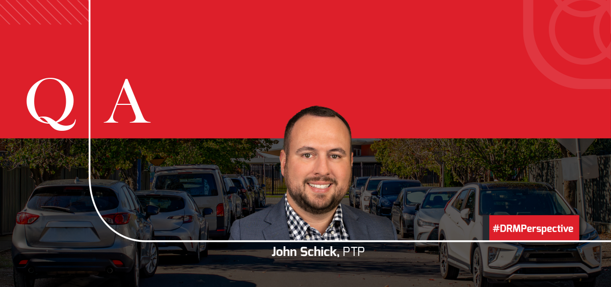
In this Q&A, DRMP Traffic Analysis Group Leader John Schick, PTP, explains why a TIA is essential for responsible, well-planned development.
Could you explain the role of a TIA in helping municipalities and developers make informed decisions about transportation planning?
A TIA provides a systematic process to evaluate the potential effects of a proposed development on the surrounding transportation network. It also can help in predicting traffic growth, road capacity, and evaluating accident risk, as well as identifying necessary mitigation improvements.
What are the key factors you consider when conducting a TIA for a new development or project?
Some key factors we consider, include:
Scoping – Define the geographic area, transportation options, and timeframe for the assessment.
Data Collection – Gather information on current traffic conditions, including vehicle, pedestrian, bicycle, and transit activity, as well as land uses and field observations to establish a baseline of existing conditions.
Impact Evaluation – Assess the potential impacts of the development, such as increased traffic volumes and changes to existing traffic patterns.
Mitigation Measures – Identify potential strategies to address any negative impacts the development may have on the transportation system.
State/County Guidelines – Understand and follow applicable state and county development impact guidelines to ensure a comprehensive and compliant assessment.
How do you determine the baseline traffic conditions for a TIA, and what kind of data do you need to gather?
Each development has different needs depending on the surrounding road networks. To fully understand the current traffic situation, a range of data should be collected, including (but not limited to):
Traffic Turning Movement Counts
Traffic Signal Timings
Travel Time and Delay Studies
Pedestrian and Bicycle Counts
Public Transportation Data
Geographic/Sight Distance Data
What are some common challenges you face when assessing traffic impacts in urban versus rural areas?
In urban areas, high traffic density and a constantly changing environment can make data collection and analysis more complex. In contrast, rural areas may present challenges due to limited infrastructure and varied travel patterns. In urban settings, it’s also important to consider all modes of transportation, such as walking, biking, and public transit since roadway space for vehicles is often limited.
Traffic impacts can vary depending on land use. How are school sites handled differently in a TIA, particularly when it comes to traffic counts?
A TIA provides schools with a comprehensive assessment of the potential traffic impacts of a proposed development or change. It allows schools to plan for efficient vehicle stacking on campus to minimize congestion and prevent stopped vehicles from parking on surrounding roads. Additionally, it helps ensure that the traffic flow meets the community’s needs, while optimizing safety and efficiency.
Can you walk us through the process of forecasting future traffic conditions and how accurate these projections typically are?
We start by estimating how current traffic will grow over time, using a growth rate approved by local or state agencies like the North Carolina Department of Transportation (NCDOT). Then we add in traffic from the proposed development, along with other nearby projects, to get a full picture of what future traffic might look like.
To estimate how much traffic the new development will generate, we use the Institute of Transportation Engineers (ITE) Trip Generation Manual. This manual provides standard formulas based on real-world data to predict the number of vehicle trips during a typical weekday, including the morning and evening rush hours.
Next, we estimate where those trips will come from and go to, using surrounding population data, existing traffic patterns, any previously approved traffic studies for nearby sites, and engineering judgment. Finally, we map those trips onto key roads and intersections to see how traffic will flow.
How do you work with local government agencies to ensure that a TIA addresses the specific concerns of the community?
We work closely with local agencies to review and respond to their comments and ensure a clear understanding of the proposed development and its potential impacts. Together, we develop mitigation strategies to help reduce or manage those impacts in a way that reflects community needs and concerns.
How do you handle situations where a TIA reveals that a proposed development could cause significant traffic disruptions?
Identifying potential traffic issues early in the development process allows us to work proactively with developers and agencies to minimize impacts on the surrounding transportation network. We recommend appropriate mitigation measures, such as roadway improvements, signal timing adjustments, or access changes to address any anticipated disruptions.
What’s the typical timeline for completing a TIA, and how do you ensure the analysis is thorough without delaying the project?
While the depth of a TIA depends on the surrounding transportation network and project scope, the typical timeline ranges from six to 10 weeks. Factors such as data collection, agency coordination, and scoping can affect the schedule. We work efficiently and communicate early with stakeholders to keep the process on track while ensuring a thorough and reliable analysis.
How do you handle public feedback or concerns related to traffic impacts once a TIA is complete?
We prioritize active listening and empathy to ensure the public feels heard and their concerns are understood. By keeping lines of communication open and providing regular updates on potential solutions or mitigation efforts, we build trust with the community and maintain a strong emphasis on addressing local needs.

John Schick, PTP, serves as Traffic Analysis Group Leader for DRMP’s Transportation Market Sector.
Posted in the categories All, Traffic Impact Analysis, Transportation, Transportation Planning/Project Development .
Related Articles
 Aug8How DRMP’s Teams in The Carolinas are Elevating Business Development to Better Serve ClientsAs DRMP continues to expand its services...See Details
 Aug6Exploring RIEGL’s Latest LiDAR Technologies at the VIP Customer Summit in AustriaDRMP Geospatial Services Division Manage...See Details
 Jul31Survey Says… DRMP Knows How to Celebrate Interns Each year, DRMP finds fresh, creative wa...See Details
 Jul25DRMP Delivers Hope on Two Wheels
For many families serve...See Details
Jul25DRMP Delivers Hope on Two Wheels
For many families serve...See Details

Categories
- All
- Alternative Delivery
- Civil Services
- Construction Services
- Disaster Resilience and Sustainability
- DRMPCares
- Ecological Services
- Electrical Engineering
- eWIRE
- Federal Services
- Geographic Information Systems
- Hurricane
- Land Development
- Learning & Development
- NEPA
- Project Development & Environment
- Structural Engineering
- Subsurface Utility Engineering
- Surveying & Mapping
- Traffic Impact Analysis
- Transportation
- Transportation Planning/Project Development
- Utilities Engineering
- Water Resources/Stormwater Management
Contributors
- Michael K. Albano, PE
- Bruno J. Arriola, PE, ENV SP
- Brent Bass, PE, PSM
- Cody Bayer, PE
- Maria Bazemore, PWS, AICP
- Paul Benvie, PE
- Donald W. Brown, PE
- Kyle Brown, PE
- Jake Burton
- Zach J. Carnahan, PE
- Brian Crowl, PE
- Patrick Day, PE
- Nick DeVito, PE
- Matt Floyd, PSM
- Deshon M. Fox, PE
- Scott Garth, PE, LEED AP ND
- Ryan M. Grab, CST II
- Robyn Hartz, INCE
- Justin Hayes, EI
- Lucas S. Helms, PE
- Jim Highland, PE
- Ryan Ianacone, CST II
- TJ Lallathin, Jr., PE, DBIA
- Jay McInnis, PE, CPM
- George McLatchey, PWS, CEP
- Michael McNeese
- Ryan Mitchell, PE
- Megan E. Mott, PE
- Josh Norman
- Melissa Padilla Cintron, SIT
- Pavan Paiavula, PE
- Ryan Pellarin, PE, CCM
- AJ Perkinson, PLS
- Julian Poole, PE
- Joce Pritchett, PE
- Leo Rodriguez, PE
- John Schick
- Rachel L. Schmidt, PWS
- Logan Shappell
- Rynal Stephenson, PE
- Deston Taylor, PE, PTOE
- August Thick II, PLS, CST III
- Orville Williams
- Amanda E. Woods, PE
Recent Articles
- 08/13/25Understanding Traffic Impact Analysis for Smarter Development
- 08/8/25How DRMP’s Teams in The Carolinas are Elevating Business Development to Better Serve Clients
- 08/6/25Exploring RIEGL’s Latest LiDAR Technologies at the VIP Customer Summit in Austria
- 07/31/25Survey Says… DRMP Knows How to Celebrate Interns


