- Discover
-
Expertise
-
Alternative Delivery
- I-275 at I-4 Downtown Tampa Interchange Design-Build
- Wekiva Parkway Section 8 Interchange
- US 17/92 Interchange at SR 436
- SR 9B Extension from I-95 to US 1
- A. Max Brewer Bridge Replacement
- I-95 Widening from the Indian River/Brevard County Line to Malabar Road
- SR 528 (Beachline Expressway) at Innovation Way Interchange
- SR 570 Polk Parkway Widening from I-4 to Pace Road
- I-95 Express Lanes and Ramp Signals – Phase 3A-1
- Pollard Road Extension over Peace Creek
- I-485 Widening from I-77 to Rea Road
- Monroe Bypass/Connector Design-Build
- Construction Services
- Ecological Services
-
Federal Services
- Range of the Future Study
- US Coast Guard Air Station (Clearwater)
- Ascension Island Fire Station Renovation
- Patrick Space Force Base Water Lines Repair
- Patrick Space Force Base Living Shoreline Restoration
- P-505 Electrical Hardening and Black Start CHP at Marine Corps Air Station Beaufort
- Naval Station at Guantanamo Bay Survey Services
- Repair Phillips Parkway and Speed Limit Study
- Ascension Island Auxiliary Airfield Surveying and Mapping Services
-
Geographic Information Systems (GIS)
- Thermal Design/Comprehensive Campus LiDAR Collection
- Greater Orlando Aviation Authority (GOAA) Strategic Commerical Land Development Program
- University of Florida Sanitary Sewer GIS Mapping
- Ascension Island Auxiliary Airfield GIS Integration
- Santa Rosa County School District's School Transportation & Capacity GIS Analysis
- Gainesville Community Redevelopment Agency Socioeconomic Analysis and Site Suitability Report
- Real Estate Site Suitability and Development Analysis
- SR 836 (Dolphin Expressway) GIS Asset Inventory of Pre-Post Construction
- Alachua County Public Schools GIS and School Planning Professional Services
- Patrick Space Force Base Living Shoreline Restoration GIS Analysis
- Florida Army National Guard Readiness Center GIS Inventory & Integration
- Comprehensive Transit Study Puerto Rico GIS Analysis
- Land Development
- Structural Engineering
-
Subsurface Utility Engineering (SUE)
- Thermal Design/Comprehensive Campus LiDAR Collection
- P-505 Electrical Hardening and Black Start CHP at Marine Corps Air Station Beaufort
- Resurface & Safety Improvements Turnpike Mainline
- University of Florida Rabon Utility Mapping
- FP&L Subsurface Utility Engineering Continuing On-Call Contract
- Lockheed Martin Subsurface Utility Engineering Services
- Palm Coast Parkway Subsurface Utility Engineering Services
- Surveying & Mapping/Geospatial
-
Traffic Impact Analysis
- 505 West Chapel Hill Street
- 5th Street Station
- Beale Farm Industrial Park
- Blue Mountain Mist Resort
- The Villages at McCullers Walk
- Fredericksburg National Baseball Stadium
- Hendrick Southpoint Auto Mall
- Apex Friendship Elementary School
- Whole Foods Center
- Barclay West
- Grove 98
- Pullen Drive Extension/Catholic Diocese
- Trails/Parks & Recreation Facilities
- Transportation
-
Utilities Engineering
- Ascension Island Fire Station Renovation
- M-1 Canal Water Main Extension
- 5th Street Bridge Utility Replacement
- Captain’s Cove Wastewater Plant Revisions & Permit Renewal
- City of Fort Myers Downtown Utility & Streetscape Improvement
- Florida Caverns State Park Lift Station Rehab
- Tween Waters Inn Wastewater Plant Permit Renewal
- City of Fort Myers Wastewater Capacity Studies
- Patrick Space Force Base Water Lines Repair
- Big Lagoon Boat Ramp Wastewater System
- St. Joseph State Park Septic Tank Replacement
- WildBlue Development Wastewater Modeling
- A-1 Gator Wastewater Capacity Increase
- Water Resources/Stormwater Management
-
Alternative Delivery
- Careers
- News
- #DRMPerspective
- Team With Us
- Locations

Hitting the Road with Mobile LiDAR, Amplifying Our Reach
October 16th, 2024


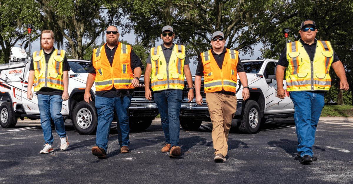
At DRMP, we’re staying ahead of the curve with our Terrestrial Mobile LiDAR services and expanding this game-changing technology. Back in 2018, we jumped on board with Mobile LiDAR, and since then, it’s been a vital component behind our success in the Survey and Mapping market sector.
And now, with our upgrade to the latest RIEGL VMX-2HA mobile mapping system, we’re taking our capabilities to the next level to continue to deliver top-notch results for our clients. DRMP has a dedicated and skilled staff that strives for perfection. We have spent a lot of time perfecting our craft and creating high standards we uphold in every project.
Advantages of Mobile LiDAR
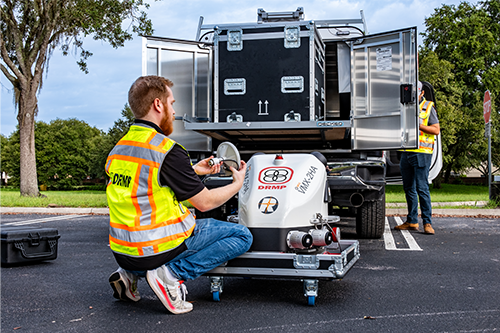
Mobile LiDAR is a growing geospatial technology used for topographic mapping and assessing infrastructure safely, efficiently, quickly, and accurately. Mobile LiDAR generates 3D point clouds or models of environments by rapidly scanning its surroundings with laser scanners from a moving platform, such as a vehicle or unmanned aerial vehicle (UAV).
Our new upgrade to the RIEGL VMX-2HA mobile mapping system offers a significant improvement over the current system in both data collection and image resolution. This enhancement means the new system can collect data at nearly double the rate, 3.6 million points per second compared with 2 million points per second for the existing system. The increased point collection capability translates to higher precision and more detailed datasets in a shorter amount of time, optimizing operational efficiency and reducing project timelines.
We also upgraded to the latest 360-degree camera technology that produces 12-megapixel photos (MP) rather than the previous 5 MP photos. Upgrading the photos results in much sharper and more detailed images. The higher resolution allows for better clarity and more accurate visual representation, which is crucial for detailed analysis, data extraction, quality assurance, and quality control.
Without Mobile LiDAR, surveys typically rely on other methods for data collection, including using total stations, GPS (Global Positioning System), or manual measurements to gather data. Each method comes with its own set of advantages and limitations, and the choice between them depends on factors, such as the survey area's scale, the level of detail needed, and the resources available.
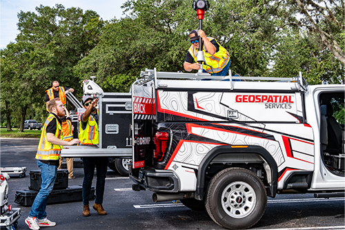
With Mobile LiDAR, we can collect an entire roadway project in a day or two compared with traditional surveying methods. We gather all the information in one go, allowing us to adjust the extraction amount to match the service scope. This saves time by avoiding the need to revisit the field for additional data if there are any changes to the scope. Aside from standard Design Surveys, we also use Mobile LiDAR to assist in pursuits, Design-Build projects, and As-Builts for construction.
Significant Investment
Mobile LiDAR is a big investment and one that DRMP Senior Vice President and Director of Surveying and Mapping Joe Di Benedetto, PLS, brought to the firm in 2018. Not every engineering firm provides Mobile LiDAR services, primarily because of its substantial cost and the requirement for a proficient team capable of effectively processing and managing the data involved.
One of our most recent projects, the Tampa Westshore Interchange Phase Design-Build in Florida, is the most difficult and challenging project we have ever took on with Mobile LiDAR. The highway itself is complicated with over 20 bridges and ramps going in all directions. We were also tasked with collecting all side streets and parking lots within the area. That, combined with the heavy traffic in Tampa, makes this project our most intense yet.
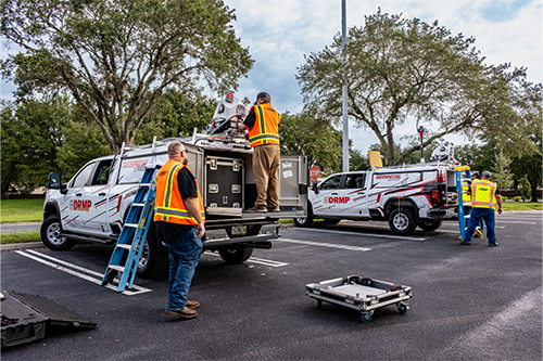
The biggest challenge with Mobile LiDAR is data management. We have multiple storage locations containing many Terabytes of data. It is a constant flow of data in and out, and we have a lot of information on our hands at any given moment.
Regardless of the challenges, Mobile LiDAR can be a crucial part of any successful transportation project. The benefits have exceeded our expectations, and it has become one of the most used pieces of technology that we offer at DRMP. Thanks to support from our leadership, we are one of the top firms that offer this service in Florida and soon to be the best in the eastern part of the United States.
As DRMP’s Geospatial Services Division Manager, my vision for Mobile LiDAR at DRMP is to expand our reach to support our Trilon partner firms across the eastern part of the country so we can better serve our clients. I also envision having multiple LiDAR teams to support those areas with extraction and data processing.
Brent Bass, PE, PSM, is a Geospatial Services Division Manager in DRMP's Surveying and Mapping/Geospatial Department.
Related Articles
 Oct23DRMP’s TIA Expertise Clears the Way for Southeast Industrial GrowthWith industrial development rapidly expa...See Details
 Oct22Meet the Instructional Designer Reinventing Learning at DRMPInstructional designers are expert trans...See Details
 Oct16DRMP Aces a Hole-in-One with Roadway Design for U.S. Open in Pinehurst , N.C. DRMP serves as the prime designer for th...See Details
 Oct9Behind the Scenes of DRMP’s Evolving Learning and Development ExperienceDRMP’s Learning and Development (L&...See Details

Categories
- All
- Alternative Delivery
- Civil Services
- Construction Services
- Disaster Resilience and Sustainability
- DRMPCares
- Ecological Services
- Electrical Engineering
- eWIRE
- Federal Services
- Geographic Information Systems
- Hurricane
- Land Development
- Learning & Development
- NEPA
- Project Development & Environment
- Structural Engineering
- Subsurface Utility Engineering
- Surveying & Mapping
- Traffic Impact Analysis
- Transportation
- Transportation Planning/Project Development
- Utilities Engineering
- Water Resources/Stormwater Management
Contributors
- Michael K. Albano, PE
- Bruno J. Arriola, PE, ENV SP
- Brent Bass, PE, PSM
- Cody Bayer, PE
- Maria Bazemore, PWS, AICP
- Paul Benvie, PE
- Donald W. Brown, PE
- Kyle Brown, PE
- Jake Burton
- Zach J. Carnahan, PE
- Brian Crowl, PE
- Patrick Day, PE
- Nick DeVito, PE
- Matt Floyd, PSM
- Deshon M. Fox, PE
- Scott Garth, PE, LEED AP ND
- Ryan M. Grab, CST II
- Robyn Hartz, INCE
- Justin Hayes, EI
- Lucas S. Helms, PE
- Jim Highland, PE
- Ryan Ianacone, CST II
- David Johnson, PE
- TJ Lallathin, Jr., PE, DBIA
- Jay McInnis, PE, CPM
- George McLatchey, PWS, CEP
- Michael McNeese
- Ryan Mitchell, PE
- Megan E. Mott, PE
- Josh Norman
- Melissa Padilla Cintron, SIT
- Pavan Paiavula, PE
- Ryan Pellarin, PE, CCM
- AJ Perkinson, PLS
- Julian Poole, PE
- Kayla Poulos, PE
- Joce Pritchett, PE
- Leo Rodriguez, PE
- John Schick
- Rachel L. Schmidt, PWS
- Logan Shappell
- Rynal Stephenson, PE
- Albert Taylor
- Deston Taylor, PE, PTOE
- Keelyn Taylor, PhD
- August Thick II, PLS, CST III
- Orville Williams
- Amanda E. Woods, PE
Recent Articles
- 10/23/25DRMP’s TIA Expertise Clears the Way for Southeast Industrial Growth
- 10/22/25Meet the Instructional Designer Reinventing Learning at DRMP
- 10/16/25DRMP Aces a Hole-in-One with Roadway Design for U.S. Open in Pinehurst , N.C.
- 10/9/25Behind the Scenes of DRMP’s Evolving Learning and Development Experience
- 10/7/25When Judgment Defines SUE: Bridging Records, Reality, and Responsibility


