- Discover
-
Expertise
-
Alternative Delivery
- I-275 at I-4 Downtown Tampa Interchange Design-Build
- Wekiva Parkway Section 8 Interchange
- US 17/92 Interchange at SR 436
- SR 9B Extension from I-95 to US 1
- A. Max Brewer Bridge Replacement
- I-95 Widening from the Indian River/Brevard County Line to Malabar Road
- SR 528 (Beachline Expressway) at Innovation Way Interchange
- SR 570 Polk Parkway Widening from I-4 to Pace Road
- I-95 Express Lanes and Ramp Signals – Phase 3A-1
- Pollard Road Extension over Peace Creek
- I-485 Widening from I-77 to Rea Road
- Monroe Bypass/Connector Design-Build
- Construction Services
- Ecological Services
-
Federal Services
- Range of the Future Study
- US Coast Guard Air Station (Clearwater)
- Ascension Island Fire Station Renovation
- Patrick Space Force Base Water Lines Repair
- Patrick Space Force Base Living Shoreline Restoration
- P-505 Electrical Hardening and Black Start CHP at Marine Corps Air Station Beaufort
- Naval Station at Guantanamo Bay Survey Services
- Repair Phillips Parkway and Speed Limit Study
- Ascension Island Auxiliary Airfield Surveying and Mapping Services
-
Geographic Information Systems (GIS)
- Thermal Design/Comprehensive Campus LiDAR Collection
- Greater Orlando Aviation Authority (GOAA) Strategic Commerical Land Development Program
- University of Florida Sanitary Sewer GIS Mapping
- Ascension Island Auxiliary Airfield GIS Integration
- Santa Rosa County School District's School Transportation & Capacity GIS Analysis
- Gainesville Community Redevelopment Agency Socioeconomic Analysis and Site Suitability Report
- Real Estate Site Suitability and Development Analysis
- SR 836 (Dolphin Expressway) GIS Asset Inventory of Pre-Post Construction
- Alachua County Public Schools GIS and School Planning Professional Services
- Patrick Space Force Base Living Shoreline Restoration GIS Analysis
- Florida Army National Guard Readiness Center GIS Inventory & Integration
- Comprehensive Transit Study Puerto Rico GIS Analysis
- Land Development
- Structural Engineering
-
Subsurface Utility Engineering (SUE)
- Thermal Design/Comprehensive Campus LiDAR Collection
- P-505 Electrical Hardening and Black Start CHP at Marine Corps Air Station Beaufort
- Resurface & Safety Improvements Turnpike Mainline
- University of Florida Rabon Utility Mapping
- FP&L Subsurface Utility Engineering Continuing On-Call Contract
- Lockheed Martin Subsurface Utility Engineering Services
- Palm Coast Parkway Subsurface Utility Engineering Services
- Surveying & Mapping/Geospatial
-
Traffic Impact Analysis
- 505 West Chapel Hill Street
- 5th Street Station
- Beale Farm Industrial Park
- Blue Mountain Mist Resort
- The Villages at McCullers Walk
- Fredericksburg National Baseball Stadium
- Hendrick Southpoint Auto Mall
- Apex Friendship Elementary School
- Whole Foods Center
- Barclay West
- Grove 98
- Pullen Drive Extension/Catholic Diocese
- Trails/Parks & Recreation Facilities
- Transportation
-
Utilities Engineering
- Ascension Island Fire Station Renovation
- M-1 Canal Water Main Extension
- 5th Street Bridge Utility Replacement
- Captain’s Cove Wastewater Plant Revisions & Permit Renewal
- City of Fort Myers Downtown Utility & Streetscape Improvement
- Florida Caverns State Park Lift Station Rehab
- Tween Waters Inn Wastewater Plant Permit Renewal
- City of Fort Myers Wastewater Capacity Studies
- Patrick Space Force Base Water Lines Repair
- Big Lagoon Boat Ramp Wastewater System
- St. Joseph State Park Septic Tank Replacement
- WildBlue Development Wastewater Modeling
- A-1 Gator Wastewater Capacity Increase
- Visualization Services
- Water Resources/Stormwater Management
-
Alternative Delivery
- Careers
- News
- #DRMPerspective
- Team With Us
- Locations
« Back
Celebrating National GIS Day 2024
November 20th, 2024
As we celebrate National GIS Day, DRMP’s GIS team has plenty to reflect on after a year filled with exciting projects and professional growth. From designing an application to display school zones for Hillsborough County Public Schools in Florida to using LiDAR and GIS to enhance roadway safety, each team member has made an impact. Our year in review looks back at some of their noteworthy highlights and proudest achievements from the past year.
Meet Kelly Marton, GISP
GIS Project Manager
I studied Geography at the University of Florida and started my career as a GIS Intern at the City of Gainesville Public Works Department. I started my employment with DRMP in 2015 in the Gainesville office and later transferred to Tampa in 2019. I earned my GISP certification in 2018 and have more recently been completing geomatics certificate courses at the University of Florida with the goal of someday becoming a licensed surveyor, too.
What was your favorite project this past year?
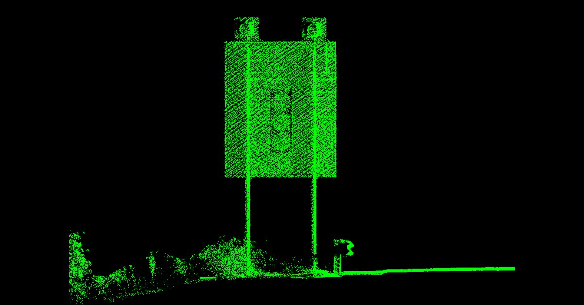
My favorite project was partnering with our sister firm Mannik & Smith Group to use LiDAR and GIS to inventory road signs along US 19 in West Virginia. We created automated, custom sign data reports that display all of the information about each sign assembly in one place in an informative and visually appealing manner, and our client was very happy with them.
What was a career highlight for you this past year?
My proudest moments professionally this year were presenting with DRMP GIS Analyst Meaghan McCarthy at the American Public Works Association (APWA) Florida West Coast Branch meeting about all of our inspection and inventory projects and starting to work for the City of St. Petersburg, Fla., to use GIS to digitize as-built information. As a St. Petersburg resident and involved community member, it has been a professional goal of mine for years to work with the City.
Meet mark brown, GISP
GIS Project Manager
My GIS career started 18 years ago as a college intern developing a suitable site location model for commercial business placement. That’s where I first fully grasped the importance of location intelligence. Then I relocated to Gainesville, Fla., for my first professional employment at a firm that specialized in aerial data acquisition and GIS data development for NAVFAC (Naval Facilities Engineering Systems Command). This is where I honed my skills in GIS mapping for utility systems and had the opportunity to travel across the United States and Europe, collecting and compiling data to be integrated with internal asset management systems. Now since I've joined DRMP in 2017, we have expanded our GIS mapping and data development services to municipal, federal and higher education clients.
What was your favorite project this past year?
Spaceport of the Future (Infrastructure) – This project incorporates mapping and analysis for the infrastructure projects to be carried out at Cape Canaveral Space Force Base in Florida over the next four years. Our role on this project focuses on data verification and data visualization of the concepts that will shape the capabilities of the Spaceport Complex.
What was a career highlight for you this past year?
A career highlight of this year is being able to learn and leverage new technologies, such as Power Bi and Power Apps, which are not traditionally associated with GIS and integrating them into our processes and skill offerings.
Meet ravneet kathuria
GIS Analyst
I began my career in GIS as an assistant at Strathcona County in Sherwood Park, Alberta, Canada, where I had the opportunity to familiarize myself with the ArcGIS Product Suite, including tools such as Field Maps, Experience Builder, ArcGIS Pro, ArcGIS Dashboards, and more. This was a pivotal experience that helped me build a solid foundation in GIS right after graduation. It also gave me valuable experience working with both public and private sector clients, allowing me to gain a deeper understanding of how GIS is used to address real-world problems. I was drawn to GIS because of its potential to solve meaningful challenges for governments and communities and to contribute directly to solving some of today’s most pressing issues. After completing my contract, I joined Esri Canada as a GIS Analyst, working on the Community Basemap project for Canada. Seeking to further develop my skills, I looked for an opportunity to transition into a more intermediate-level GIS role where I could continue to build on my foundational knowledge. This led me to DRMP in 2023 where I was excited to find a position focused on custom workflows, ArcGIS Enterprise setups, and a variety of clients and projects.
What was your favorite project this past year?
One of my favorite projects this year was the Hillsborough County Public Schools Growth Management App. This application is designed to help the County track development concurrency data and estimate potential increases in student populations based on new developments. The data generated is crucial for assigning students to specific schools and producing detailed reports for planning purposes. My role in the project was to design the overall framework for the app and develop custom tools that would enable the client to easily understand and use the system. This involved automating backend calculations, creating custom print workflows and implementing advanced data manipulation techniques to ensure a smooth user experience. The goal was to make the entire system intuitive, efficient, and seamless for the end users.
What was a career highlight for you this past year?
One of the highlights of my career so far was attending the Central Florida GIS (CFGIS) Workshop Conference in Daytona Beach, Fla. It was my first GIS conference, and it was an eye-opening experience. The conference exposed me to a wealth of new information and insights about how other companies are using GIS. I had the opportunity to learn about the transition from Geometric Networks to Utility Networks, the use of Python in different applications, and how tools like Site Scan are being utilized for 3D analysis. It was an inspiring experience that expanded my understanding of GIS technologies and their potential applications across various industries.
Meet Meaghan mccarthy
GIS Analyst
I am a GIS analyst as well as map enthusiast and have been with DRMP since 2021. I started my career in GIS in my undergraduate program working in local government as well as a student researcher at the University of South Florida. GIS interested me due to its vast array of uses, and it originally surprised me how much a map can do and the important points it can convey. I am very involved with our local West Coast Branch of the APWA (American Public Works Association) as an executive board member and as their Young Professionals committee chair. I love getting to show my board and fellow members how valuable GIS can be in their public works operations.
What was your favorite project this past year?
My favorite project was our work with DRMP’s Tampa Engineering Department on the Hillsborough County Critical Culvert Inspection project because our involvement with the project as a GIS team started out small and grew exponentially throughout the timeline of the project as we realized how much we could do to make the project run smoothly and streamline the workflow for our engineers and field staff.
What was a career highlight for you this past year?
I have two career highlights for the year. The first is receiving the American Public Works Association (APWA) Young Professional of the Year award at our West Coast Branch yearly banquet, and the second was attending the ESRI User Conference in San Diego, Calif., one of the largest and most prestigious conferences for GIS in the world.
Explore more about our GIS solutions and how they can elevate your projects by clicking here.
Posted in the categories All, Geographic Information Systems.
Related Articles
- Jan15Restoring the Indian River Lagoon with Advanced Stormwater TreatmentThe Indian River Lagoon, spanning 156 mi...See Details
- Jan9How LiDAR and GIS are Modernizing Road Sign Inventories for Safer Travel in West VirginiaThe West Virginia Division of Highways (...See Details
- Nov21Giving Buses a Head Start in Raleigh, N.C. Raleigh's bustling corridors can make it...See Details
- Nov6Expertise Highlight: Flooding Solutions Bring Relief to Arkansas CommunitiesIn many predominantly Black rural towns ...See Details
Categories
- All
- Alternative Delivery
- Construction Services
- Disaster Resilience and Sustainability
- DRMPCares
- Ecological Services
- eWire
- Federal Services
- Geographic Information Systems
- Land Development
- NEPA
- Project Development & Environment
- Structural Engineering
- Subsurface Utility Engineering
- Surveying & Mapping
- Traffic Impact Analysis
- Transportation
- Transportation Planning/Project Development
- Utilities Engineering
- Water Resources/Stormwater Management
Contributors
- Michael K. Albano, PE
- Bruno J. Arriola, PE, ENV SP
- Brent Bass, PE, PSM
- Cody Bayer, PE
- Donald W. Brown, PE
- Kyle Brown, PE
- Zach J. Carnahan, PE
- Brian Crowl, PE
- Patrick Day, PE
- Nick DeVito, PE
- Samir Farra Otero, PE
- Matt Floyd, PSM
- Deshon M. Fox, PE
- Scott Garth, PE, LEED AP ND
- Ryan M. Grab, CST II
- Robyn Hartz
- Jim Highland, PE
- TJ Lallathin, Jr., PE, DBIA
- Kelly Marton, GISP
- Meaghan McCarthy
- Jay McInnis, PE, CPM
- George McLatchey, PWS, CEP
- Michael McNeese
- Jeff Miller
- Ryan Mitchell, PE
- Lisa Moon, PE
- Megan E. Mott, PE
- Josh Norman
- Melissa Padilla Cintron, SIT
- Pavan Paiavula, PE
- Julian Poole, PE
- Joce Pritchett, PE
- Abby Rains
- Leo Rodriguez, PE
- Rachel L. Schmidt, PWS
- Logan Shappell
- Brian V. Smith
- Rynal Stephenson, PE
- Deston Taylor, EI
- August Thick II, PLS, CST III
- Steven L. Wallace, PE
- Orville Williams
- Amanda E. Woods, PE