- Discover
-
Expertise
-
Alternative Delivery
- I-275 at I-4 Downtown Tampa Interchange Design-Build
- Wekiva Parkway Section 8 Interchange
- US 17/92 Interchange at SR 436
- SR 9B Extension from I-95 to US 1
- A. Max Brewer Bridge Replacement
- I-95 Widening from the Indian River/Brevard County Line to Malabar Road
- SR 528 (Beachline Expressway) at Innovation Way Interchange
- SR 570 Polk Parkway Widening from I-4 to Pace Road
- I-95 Express Lanes and Ramp Signals – Phase 3A-1
- Pollard Road Extension over Peace Creek
- I-485 Widening from I-77 to Rea Road
- Monroe Bypass/Connector Design-Build
- Construction Services
- Ecological Services
-
Federal Services
- Range of the Future Study
- US Coast Guard Air Station (Clearwater)
- Ascension Island Fire Station Renovation
- Patrick Space Force Base Water Lines Repair
- Patrick Space Force Base Living Shoreline Restoration
- P-505 Electrical Hardening and Black Start CHP at Marine Corps Air Station Beaufort
- Naval Station at Guantanamo Bay Survey Services
- Repair Phillips Parkway and Speed Limit Study
- Ascension Island Auxiliary Airfield Surveying and Mapping Services
-
Geographic Information Systems (GIS)
- Thermal Design/Comprehensive Campus LiDAR Collection
- Greater Orlando Aviation Authority (GOAA) Strategic Commerical Land Development Program
- University of Florida Sanitary Sewer GIS Mapping
- Ascension Island Auxiliary Airfield GIS Integration
- Santa Rosa County School District's School Transportation & Capacity GIS Analysis
- Gainesville Community Redevelopment Agency Socioeconomic Analysis and Site Suitability Report
- Real Estate Site Suitability and Development Analysis
- SR 836 (Dolphin Expressway) GIS Asset Inventory of Pre-Post Construction
- Alachua County Public Schools GIS and School Planning Professional Services
- Patrick Space Force Base Living Shoreline Restoration GIS Analysis
- Florida Army National Guard Readiness Center GIS Inventory & Integration
- Comprehensive Transit Study Puerto Rico GIS Analysis
- Land Development
- Structural Engineering
-
Subsurface Utility Engineering (SUE)
- Thermal Design/Comprehensive Campus LiDAR Collection
- P-505 Electrical Hardening and Black Start CHP at Marine Corps Air Station Beaufort
- Resurface & Safety Improvements Turnpike Mainline
- University of Florida Rabon Utility Mapping
- FP&L Subsurface Utility Engineering Continuing On-Call Contract
- Lockheed Martin Subsurface Utility Engineering Services
- Palm Coast Parkway Subsurface Utility Engineering Services
- Surveying & Mapping/Geospatial
-
Traffic Impact Analysis
- 505 West Chapel Hill Street
- 5th Street Station
- Beale Farm Industrial Park
- Blue Mountain Mist Resort
- The Villages at McCullers Walk
- Fredericksburg National Baseball Stadium
- Hendrick Southpoint Auto Mall
- Apex Friendship Elementary School
- Whole Foods Center
- Barclay West
- Grove 98
- Pullen Drive Extension/Catholic Diocese
- Trails/Parks & Recreation Facilities
- Transportation
-
Utilities Engineering
- Ascension Island Fire Station Renovation
- M-1 Canal Water Main Extension
- 5th Street Bridge Utility Replacement
- Captain’s Cove Wastewater Plant Revisions & Permit Renewal
- City of Fort Myers Downtown Utility & Streetscape Improvement
- Florida Caverns State Park Lift Station Rehab
- Tween Waters Inn Wastewater Plant Permit Renewal
- City of Fort Myers Wastewater Capacity Studies
- Patrick Space Force Base Water Lines Repair
- Big Lagoon Boat Ramp Wastewater System
- St. Joseph State Park Septic Tank Replacement
- WildBlue Development Wastewater Modeling
- A-1 Gator Wastewater Capacity Increase
- Visualization Services
- Water Resources/Stormwater Management
-
Alternative Delivery
- Careers
- News
- #DRMPerspective
- Team With Us
- Locations

UAV LiDAR & Aerial Imaging: Smarter, Faster Data Collection
March 18th, 2025


Not all project details are visible from the ground – some only come into focus from above. That’s where unmanned aerial vehicles (UAVs) come in to capture hard-to-reach data that projects rely on. When combined with other data sources, this comprehensive view delivers an unmatched level of accuracy and insight for projects.
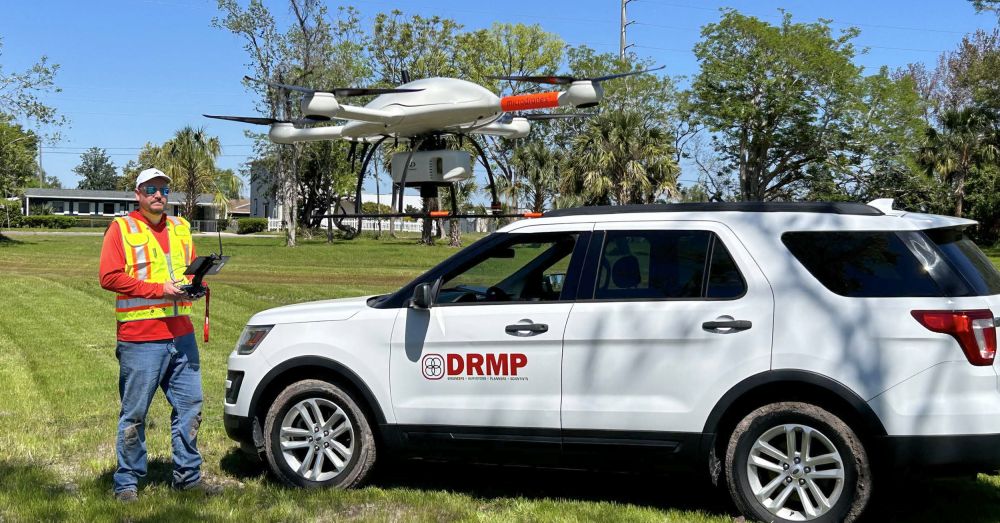
To enhance our data collection capabilities, DRMP has invested in a versatile UAV fleet to support a range of projects for our clients, including documenting construction progress with high-resolution photography and gathering dense LiDAR data in areas that are difficult to access by land or water. While UAVs do not replace traditional survey and inspection methods, they complement them and help our teams work more efficiently and safely.
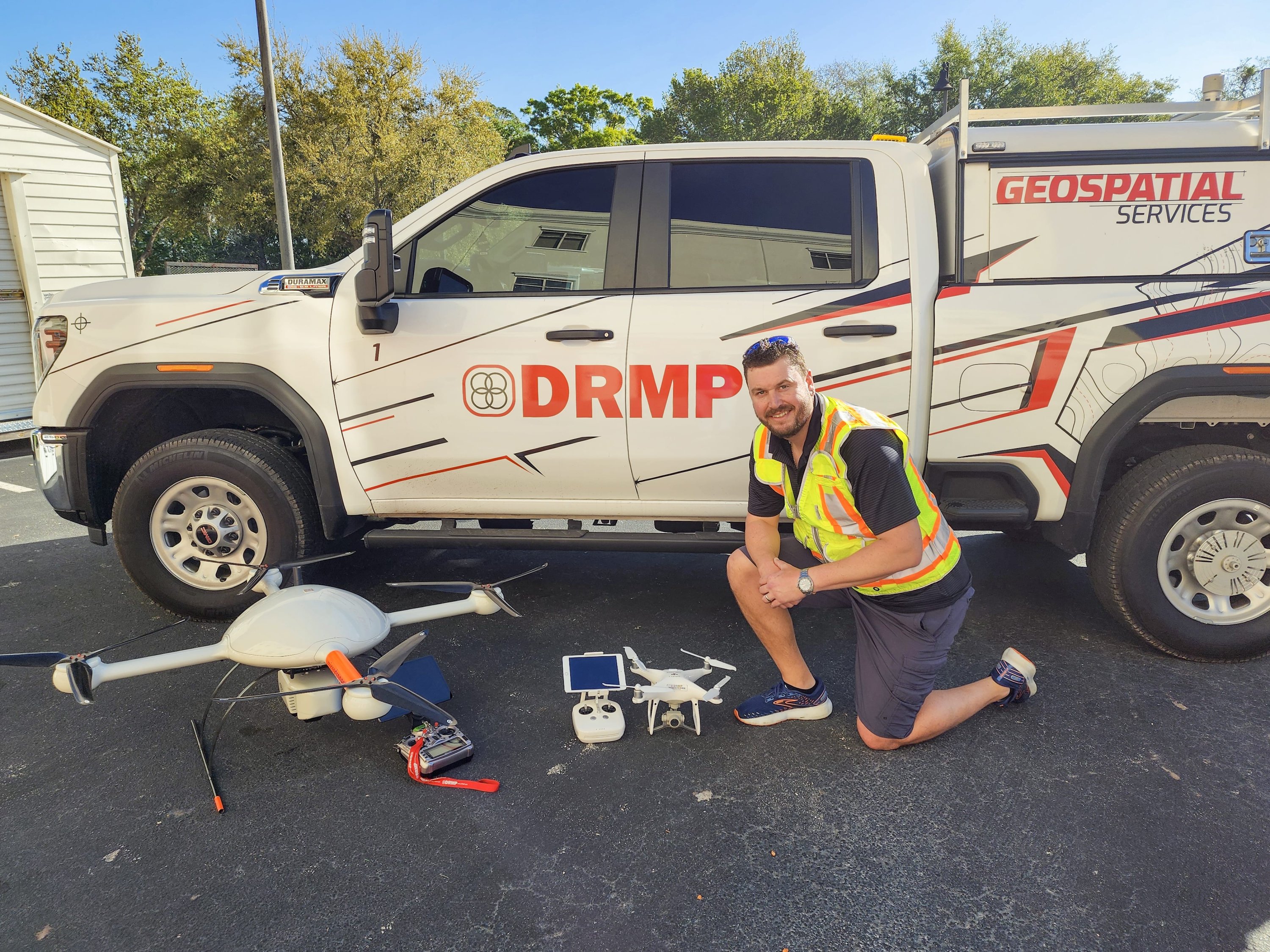
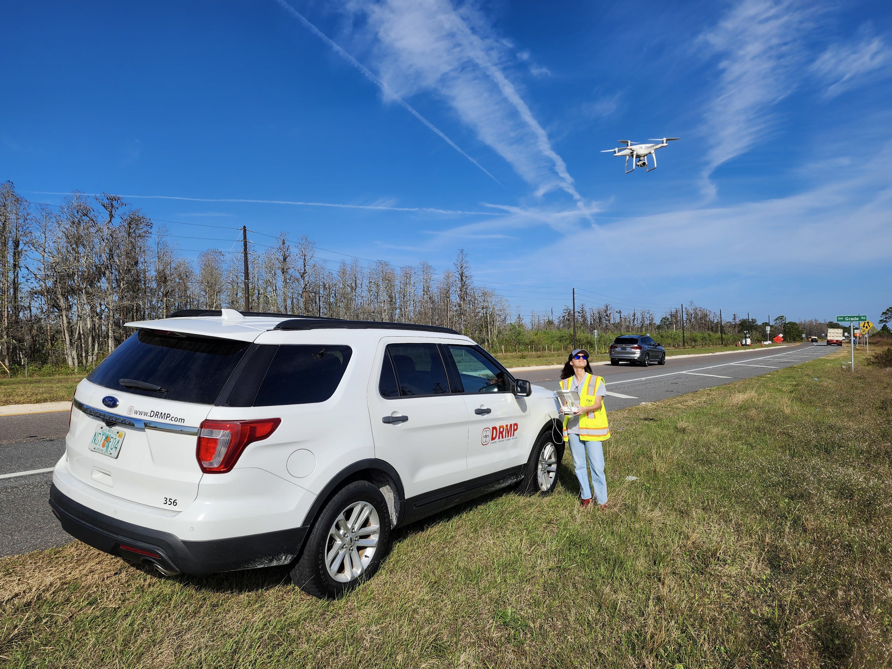
Most of our UAVs are light-duty and are primarily used for photography and video to document a project’s progress, provide images for marketing and award submittals, or support photogrammetry, which allows us to create a digital terrain module from just photos. However, we also have a specialized “heavy lift” UAV. This MicroDrone carries a RIEGL LiDAR sensor and a 40-megapixel Sony camera, which allows us to collect dense LiDAR data in areas our mobile unit or Z-Boat cannot reach. For hydrographic data collection, we use the Z-Boat, a high-performance remote survey vessel with multi-beam sonar designed for water-based mapping.
While UAVs certainly have specific advantages over traditional survey and inspection methods, they are another tool used in tandem with others to create the best product we can for our clients. Aerial LiDAR enhances ground elevation accuracy by scanning straight down from above. This allows it to penetrate grass, brush, and trees that a mobile scanner cannot get. By flying over walls or fences, we can capture data that would not be accessible with the Mobile LiDAR scan truck. A UAV helps to create a full point cloud that when combined with mobile and boat data is second to none.
Streamlined workflows are key to efficiently managing the massive scale of UAV LiDAR data – we’re talking terabytes, not gigabytes. At DRMP, we use a software suite designed to work natively with our field-collected data, reducing time-consuming conversions and manual adjustments. This integration ensures a more efficient process from data collection to final deliverables. Our software tools include RiPROCESS, RiPRECISION, POSPac, TopoDOT and Correlator3D.
When to Use UAVs
DRMP evaluates every project individually to assess how to meet and exceed our clients’ unique challenges to determine the best data collection strategy. We collaborate with several of our team members, using each of their expertise to create a plan. That plan often includes using UAVs for any number of specific reasons. Sometimes the UAV is the only tool needed, but more often it is another tool we use in synchrony with other technologies to achieve the best product for our clients.
Take LiDAR data collection, for instance. A UAV flight can capture high-quality data over water and uneven terrain. However, we still need field crews to locate our aerial control points using more traditional methods like GPS to ensure accuracy. It is a team effort.
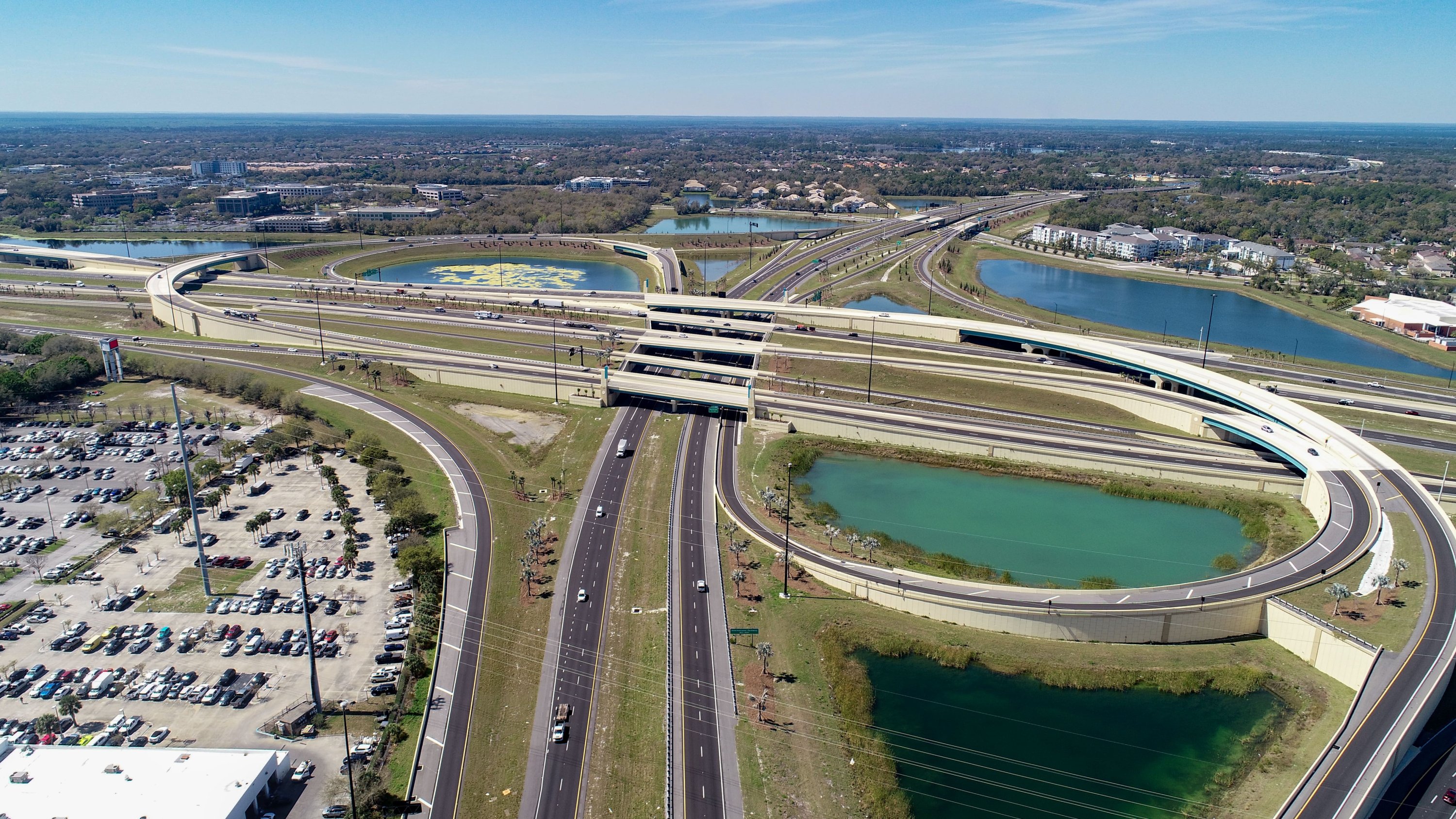
UAVs are also invaluable for construction monitoring and inspections and provide high-resolution images. Flying up to 400 feet gives us a perspective that would be impossible to achieve from the ground. This aerial advantage helps us identify potential issues early in a project.
On a recent project, UAV images revealed an underwater pipe inside of a pond that conventional surveys had missed. Catching it early allowed our team to survey it immediately, which saved time and prevented costly rework.
Our partnership with TopoDOT is a great example of how UAVs make a difference. In collaboration with Josh Norman, DRMP’s Disaster Resilience and Sustainability Practice Leader, we deploy multiple pilots after hurricanes for storm damage assessment, coastal tide monitoring, and bridge inspections.
FAA Regulations and Certifications
To fly UAVs commercially, every DRMP pilot must pass the FAA Part 107 certification exam. I obtained mine in 2019, and we are required to take a recurrent test every two years to stay updated with regulations. We also comply with FAA airspace restrictions, which means submitting requests for authorization when operating near airports or military installations. Our firm maintains detailed records of all pilots and certification dates to ensure compliance.
While UAVs greatly enhance efficiency and safety, they come with challenges. Restricted airspace can require extra time for flight approvals, and maintaining a clear line of sight is crucial for safe operation. But despite these hurdles, UAVs have expanded our capabilities as a firm.
The Future of UAV
Looking ahead, UAVs are becoming as essential as any other surveying tool. As we move away from large conventional survey crews, we will see even more integration of UAVs for LiDAR scanning, site monitoring, and inspections. In the future, we are excited to explore new applications like thermal imaging payloads for power line inspections or search-and-rescue operations using heat detection.
DRMP always strives to stay at the front of new emerging technology. Our goal is to be a flexible, capable firm ready to creatively and efficiently meet and exceed our clients’ expectations. Learn more about our Survey and Mapping/Geospatial Services here.
Ryan D. Ianacone, CST II, serves as a LiDAR Technician and Unmanned Aircraft Systems (UAS) Pilot in DRMP’s Surveying and Mapping/Geospatial Division.
Posted in the categories All, Disaster Resilience and Sustainability , Surveying & Mapping, Transportation.
Related Articles
 May20DRMP Transforms Pinellas County, Fla., Corridor with Award-Winning Infrastructure DesignAs the prime consultant for the 42nd Ave...See Details
 May14Fast Track: DRMP Employees Accelerate Career Growth Through Mentorship and Professional DevelopmentCareer growth at DRMP comes from mentors...See Details
 Apr30DRMP Marks Growth with Series of FirstsAs we scale regionally across the Caroli...See Details
 Apr16Work-Life Integration: Blending Motherhood and Career in the Transportation IndustryBalancing the demands of motherhood with...See Details

Categories
- All
- Alternative Delivery
- Civil Services
- Construction Services
- Disaster Resilience and Sustainability
- DRMPCares
- Ecological Services
- eWIRE
- Federal Services
- Geographic Information Systems
- Land Development
- Learning & Development
- NEPA
- Project Development & Environment
- Structural Engineering
- Subsurface Utility Engineering
- Surveying & Mapping
- Traffic Impact Analysis
- Transportation
- Transportation Planning/Project Development
- Utilities Engineering
- Water Resources/Stormwater Management
Contributors
- Michael K. Albano, PE
- Bruno J. Arriola, PE, ENV SP
- Brent Bass, PE, PSM
- Cody Bayer, PE
- Maria Bazemore, PWS, AICP
- Paul Benvie, PE
- Donald W. Brown, PE
- Kyle Brown, PE
- Jake Burton
- Zach J. Carnahan, PE
- Brian Crowl, PE
- Patrick Day, PE
- Nick DeVito, PE
- Samir Farra Otero, PE
- Matt Floyd, PSM
- Deshon M. Fox, PE
- Scott Garth, PE, LEED AP ND
- Ryan M. Grab, CST II
- Robyn Hartz, INCE
- Jim Highland, PE
- Ryan Ianacone, CST II
- TJ Lallathin, Jr., PE, DBIA
- Jay McInnis, PE, CPM
- George McLatchey, PWS, CEP
- Michael McNeese
- Jeff Miller
- Ryan Mitchell, PE
- Lisa Moon, PE
- Megan E. Mott, PE
- Josh Norman
- Melissa Padilla Cintron, SIT
- Pavan Paiavula, PE
- AJ Perkinson, PLS
- Julian Poole, PE
- Joce Pritchett, PE
- Leo Rodriguez, PE
- Rachel L. Schmidt, PWS
- Logan Shappell
- Rynal Stephenson, PE
- Deston Taylor, PE, PTOE
- August Thick II, PLS, CST III
- Orville Williams
- Amanda E. Woods, PE


