Widening a roadway involves much more than simply adding extra lanes; it requires extensive preparation before even entering the design phase. For the US 601 Widening Project, a crucial link from US 74 to the Monroe Bypass, DRMP provided Surveying, Mapping, and Subsurface Utility Engineering (SUE) services for the North Carolina Department of Transportation (NCDOT). This project stands out as one of our largest surveying endeavors in Union County, N.C., in recent years.
Our team meticulously researched 285 parcels along the corridor, determining property boundaries through deeds, plats, monumentation, and maintenance limits to identify available rights-of-way. We also located approximately 150 storm drainage structures and 75 gravity sanitary sewer structures within the project limits, covering 357 acres.
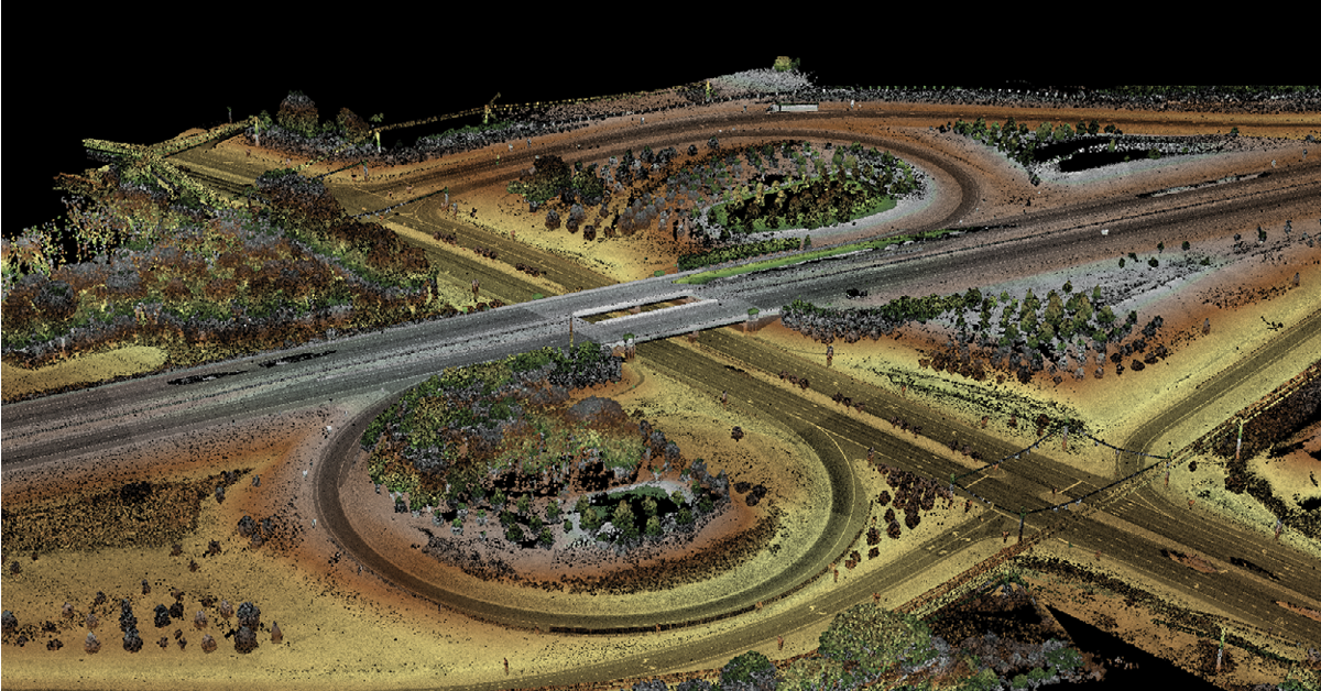
Safety and innovation were paramount for this project. We used Mobile LiDAR to survey 15.4 lane miles of pavement, ensuring our crew’s safety by avoiding on-road risks. By integrating Mobile LiDAR with conventional survey methods, aerial photogrammetry, and SUE, we created a comprehensive data set for the drainage and transportation engineers. This information was processed and combined into a single, cohesive design file, streamlining project management for the engineers.
Our use of Mobile LiDAR was a standout feature, placing us among a select group of firms providing this service for NCDOT. By combining surveying, aerial photogrammetry, LiDAR scans, control, and SUE, we delivered a complete digital terrain model (DTM) for the engineers. This 3D model is critical in the road-widening design process.
Considering the 285 property owners along the corridor, we sent letters informing them that survey crews and engineers would be near their property conducting survey work and setting panels for aerial photogrammetry. We worked closely with NCDOT to manage the aerial mapping for these properties.
In addition to surveying, our role involved extensive coordination with property owners and utility companies to conduct Quality level “B” SUE utility designations. Our SUE services create precise maps of underground utilities, essential for effective project planning and design. We located 175,665 linear feet of underground utilities for this project. Using SUE helps minimize unnecessary utility relocations, uncovers potential conflicts with design elements, improves safety during construction, and lowers the design engineer’s professional liability risk.
This required careful coordination and clear communication, particularly when working with 13 different utility companies, such as Duke Energy, Verizon, and Spectrum. Each utility presented its own challenges, especially when records were incomplete, necessitating precise location of underground infrastructure. When utility providers couldn’t supply maps, we determined the locations ourselves.
In some cases, we used 811 for assistance, a service in North Carolina designed to prevent damage to underground utilities by marking their locations ahead of digging projects. By law, calling 811 at least three business days before excavation is required to ensure safety and avoid interruptions to critical services, such as gas, water, and electricity. The volume of utilities and the numerous properties along the route kept our team challenged and busy throughout the project. We began this project in November 2023 and completed our part on time in May 2024.
This project is a good example of successful coordination with all stakeholders. It also showcased our expertise in Mobile LiDAR and reinforced the importance of using advanced technology to streamline complex roadway projects, saving our clients time and money while keeping our survey crews safe.


