Florida’s municipalities and transportation agencies are increasingly turning to roundabouts to improve traffic safety and congestion and reduce vehicular collisions. In fact, Florida ranks No. 1 with more roundabouts than any other state in the country, according to a 2022 Washington Post roundabout report. The rise is part of a national trend in which more cities and towns across the United States, including those in DRMP’s service areas, are constructing roundabouts as a safer alternative to traditional signage and signalized intersections.
Left-turn collisions, for example, are the most frequent and common types of vehicle crashes at signalized intersections. Typically, roundabouts are safer because their circular design improves traffic flow, minimizes traffic delays and congestion, lowers driver speeds, and significantly prevents vehicles from colliding with each other or pedestrians.
From mini- to multi-lane in size and complexity, roundabouts have contributed to a nearly 50 percent reduction in all crashes and an 80 percent reduction in serious injuries and fatalities, according to the Florida Department of Transportation (FDOT).
Safety Lies in Tailored Design
For a roundabout to be truly safe, it must be specifically designed for the area with the safety of both drivers and pedestrians in mind.
To determine specific design criteria, DRMP roadway engineers, like Steven D’Uva, PE, use data about the area and volumetrics studies where the roundabout will be constructed.
The volumetrics studies and data reveal several factors that come into play, including traffic volume, area demographics, the number of vehicles expected to use the roundabout, and the types of vehicles that would use the roundabout.
“For example, if a roundabout is being constructed in a residential area, there’s less need to account for a high volume of commercial trucks traveling through the area versus a major roadway that sees both traditional and commercial vehicles,” D’Uva said.
The area’s speed limit is another determinant. Designers take into consideration the speed of vehicles going through a roundabout with the goal for vehicles to travel at a maximum speed of 30 mph.
“We do that by designing a chicane, an artificial narrowing turn on the road, that introduces curves for drivers to slow down and yield,” D’Uva said. “Within the roundabout, we’re getting rid of some of the movements where drivers can cross over into another driver’s path.”
“We design the angles of the entry points such that the drivers are able to see oncoming cars in a circle and lower the speed by introducing curves before the roundabout. That way the driver must slow down to enter, or they must yield because cars are coming toward them,” he added.
Visibility is also important for an effective roundabout. DRMP’s designers consider factors, such as sight lines, placement of signs and signals, and other elements that could block visibility. Clear visibility helps drivers and pedestrians see each other and make safe decisions.
Special considerations are made for bicyclists and pedestrians at or near roundabouts. Angled bicycle ramps are added prior to the roundabout to encourage bicyclists to exit the roadway onto a wider sidewalk and re-enter on the opposite side of the roundabout.
Pedestrians and bicyclists alike would then cross the legs of the roundabout at a perpendicular angle with a much shorter crossing. Each leg of the roundabout would also be designed to have a pedestrian refuge area allowing them to have a safer place to wait for vehicles to come to a stop.
The ultimate goal, D’Uva said, is to eliminate as many conflict points as possible.
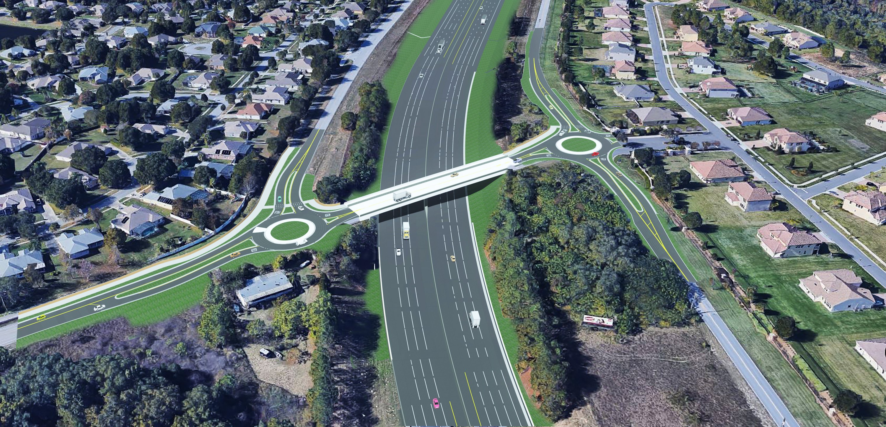
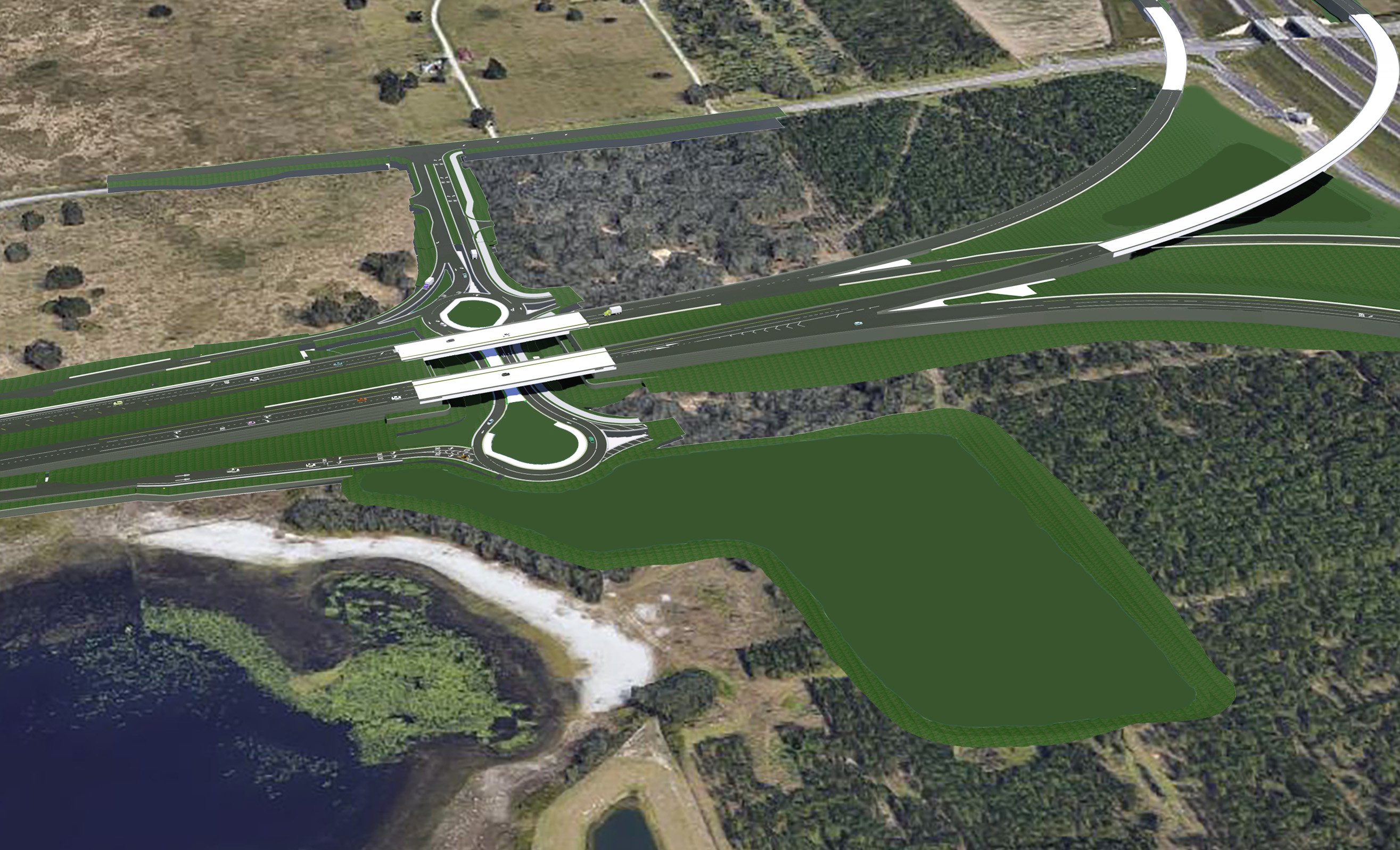
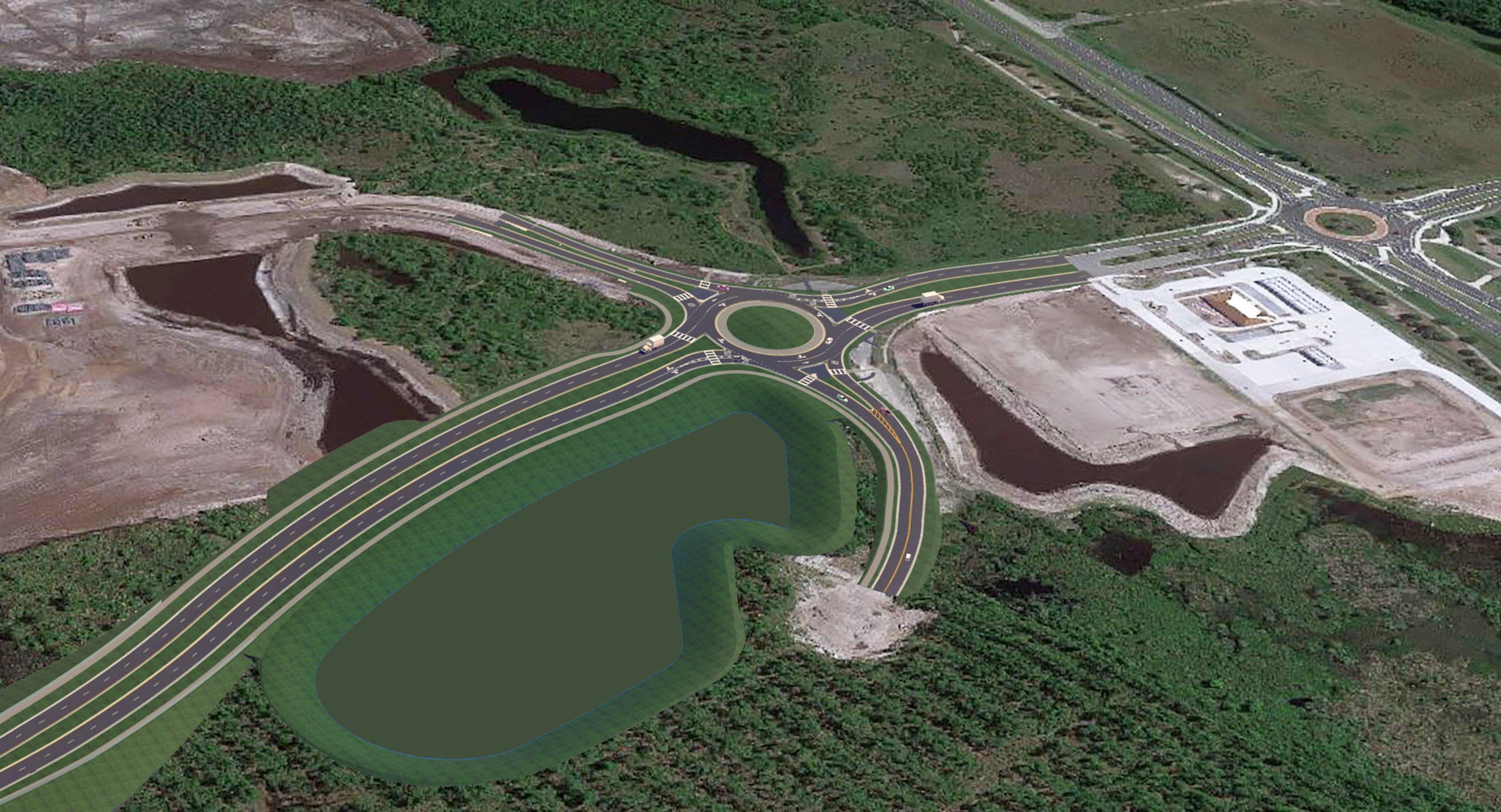
Here are just a few of the wide-ranging roundabout projects, shown in renderings, that DRMP engineers have supported:
SR 91 (Florida’s Turnpike Mainline) Widening from SR 50 Interchange to Minneola Interchange
Florida’s Turnpike Enterprise

The $162 million project called for the widening of 6 miles of SR 91 from a 4-lane to an 8-lane limited access facility. The design consisted of 6.5 miles of roadway reconstruction, including two interchanges and two roundabouts along CR 455 adjacent to an overpass structure. Florida’s Turnpike Enterprise tasked DRMP with designing a “dog bone” roundabout, a double roundabout, due to challenges with vehicles experiencing cross-over conflict.
The roundabouts were designed to reconfigure the angles to make it safer for drivers. The project also features a shared use path for pedestrians and cyclists to go across the bridge that is between the roundabouts. By providing separate entry and exit paths and minimizing conflict points, the dog bone roundabout design helps reduce congestion and improve safety at intersections.
SR 516 (Lake Orange Expressway) from Orange/Lake County Line to SR 429 (Segment 3)
Central Florida Expressway Authority

This project design involved a new systems interchange connecting SR 429 to SR 516, a new 4-lane limited access toll facility that extends to US 27. The project features a new intersection. The project features a new intersection with an original design to provide signalization, but the volume of traffic in the area was not enough to warrant a signal installation. DRMP engineers determined a “dog bone” double roundabout would be a safer alternative to slow down drivers at the interchanges.
The design also allows for future infrastructure changes if necessary and features a shared use path for future pedestrians. By providing separate entry and exit paths and minimizing conflict points, the dog bone roundabout design helps reduce congestion and improve safety at intersections.
West Matanzas Woods Parkway Extension
City of Palm Coast, Flagler County, Florida

This project design featured the modification of an existing roundabout that served as an entrance to the Sawmill Development. Due to a new 4-lane facility and a new public works facility being introduced near the neighborhood that would generate more traffic, DRMP provided a modified design of the existing single-lane roundabout to a multi-lane roundabout.


