- Discover
-
Expertise
-
Alternative Delivery
- I-275 at I-4 Downtown Tampa Interchange Design-Build
- Wekiva Parkway Section 8 Interchange
- US 17/92 Interchange at SR 436
- SR 9B Extension from I-95 to US 1
- A. Max Brewer Bridge Replacement
- I-95 Widening from the Indian River/Brevard County Line to Malabar Road
- SR 528 (Beachline Expressway) at Innovation Way Interchange
- SR 570 Polk Parkway Widening from I-4 to Pace Road
- I-95 Express Lanes and Ramp Signals – Phase 3A-1
- Pollard Road Extension over Peace Creek
- I-485 Widening from I-77 to Rea Road
- Monroe Bypass/Connector Design-Build
- Construction Services
- Ecological Services
-
Federal Services
- Range of the Future Study
- US Coast Guard Air Station (Clearwater)
- Ascension Island Fire Station Renovation
- Patrick Space Force Base Water Lines Repair
- Patrick Space Force Base Living Shoreline Restoration
- P-505 Electrical Hardening and Black Start CHP at Marine Corps Air Station Beaufort
- Naval Station at Guantanamo Bay Survey Services
- Repair Phillips Parkway and Speed Limit Study
- Ascension Island Auxiliary Airfield Surveying and Mapping Services
-
Geographic Information Systems (GIS)
- Thermal Design/Comprehensive Campus LiDAR Collection
- Greater Orlando Aviation Authority (GOAA) Strategic Commerical Land Development Program
- University of Florida Sanitary Sewer GIS Mapping
- Ascension Island Auxiliary Airfield GIS Integration
- Santa Rosa County School District's School Transportation & Capacity GIS Analysis
- Gainesville Community Redevelopment Agency Socioeconomic Analysis and Site Suitability Report
- Real Estate Site Suitability and Development Analysis
- SR 836 (Dolphin Expressway) GIS Asset Inventory of Pre-Post Construction
- Alachua County Public Schools GIS and School Planning Professional Services
- Patrick Space Force Base Living Shoreline Restoration GIS Analysis
- Florida Army National Guard Readiness Center GIS Inventory & Integration
- Comprehensive Transit Study Puerto Rico GIS Analysis
- Land Development
- Structural Engineering
-
Subsurface Utility Engineering (SUE)
- Thermal Design/Comprehensive Campus LiDAR Collection
- P-505 Electrical Hardening and Black Start CHP at Marine Corps Air Station Beaufort
- Resurface & Safety Improvements Turnpike Mainline
- University of Florida Rabon Utility Mapping
- FP&L Subsurface Utility Engineering Continuing On-Call Contract
- Lockheed Martin Subsurface Utility Engineering Services
- Palm Coast Parkway Subsurface Utility Engineering Services
- Surveying & Mapping/Geospatial
-
Traffic Impact Analysis
- 505 West Chapel Hill Street
- 5th Street Station
- Beale Farm Industrial Park
- Blue Mountain Mist Resort
- The Villages at McCullers Walk
- Fredericksburg National Baseball Stadium
- Hendrick Southpoint Auto Mall
- Apex Friendship Elementary School
- Whole Foods Center
- Barclay West
- Grove 98
- Pullen Drive Extension/Catholic Diocese
- Trails/Parks & Recreation Facilities
- Transportation
-
Utilities Engineering
- Ascension Island Fire Station Renovation
- M-1 Canal Water Main Extension
- 5th Street Bridge Utility Replacement
- Captain’s Cove Wastewater Plant Revisions & Permit Renewal
- City of Fort Myers Downtown Utility & Streetscape Improvement
- Florida Caverns State Park Lift Station Rehab
- Tween Waters Inn Wastewater Plant Permit Renewal
- City of Fort Myers Wastewater Capacity Studies
- Patrick Space Force Base Water Lines Repair
- Big Lagoon Boat Ramp Wastewater System
- St. Joseph State Park Septic Tank Replacement
- WildBlue Development Wastewater Modeling
- A-1 Gator Wastewater Capacity Increase
- Visualization Services
- Water Resources/Stormwater Management
-
Alternative Delivery
- Careers
- News
- #DRMPerspective
- Team With Us
- Locations
« Back
DRMP’s Visualization Services Illuminate Projects with Real-World Perspectives
February 28th, 2024
Visualization Services play a valuable role in depicting modern infrastructure projects, particularly within the realm of transportation and civil engineering.
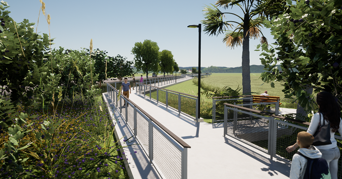
DRMP’s Visualization Services provide real-world representations of projects and translate technical data into high-level visual narratives. These visualizations can help demonstrate the potential impacts of a project and aid in building consensus among all stakeholders and the public, which is essential for successful project implementation.
As DRMP’s Lead Visualization Designer, I have witnessed the evolution and significance of visualization in our field. Visual aids have evolved over the years with software/hardware advancements and demonstrate a clearer understanding of a project’s aesthetic appeal, dimensions, and suitability within the local community.
Our Visualization experts look to support all divisions within DRMP, our partner firms, and public and private clients. Our services have been used for presentations to win work, 3D roadway typical sections, 3D modeling of bridge structures, interchanges, complex designs, maintenance of traffic (MOT), and Project Development and Environment (PD&E) studies for public involvement and public hearings. As DRMP continues to expand and welcome new partner firms, we are growing our Visualization Services team to meet the evolving needs of our clients.
Visualizing Projects
Once considered a luxury, high-end visualizations have transitioned from extravagance to necessity and are now considered in most budgets. Some clients have attributed their project successes to the power of these visuals. The evolution of visualization extends beyond mere video presentations. Augmented reality (AR) has emerged as a groundbreaking tool and provides an immersive experience akin to being physically present. Using software, apps, cell phones and tablets, and AR glasses, augmented reality overlays digital content onto real-life environments and objects. It is one of the cutting edges of visualization.
Attendees at public meetings can no longer be expected to grasp project intricacies through 2D visualizations. Rather, a three-dimensional (3D) visualization better explains the design and scale of a proposed project.
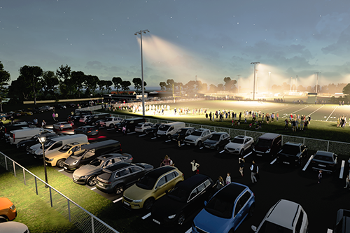
DRMP was recently entrusted by The Plantation at Ponte Vedra Beach homeowners association, a suburb near Jacksonville, Fla., to create a comprehensive 3D modeling for proposed lighting enhancements at the Cornerstone Park sportsplex.
We provided a detailed visualization and lighting analysis of the proposed installation of 60-70-foot light poles within the sportsplex and an assessment on their potential impact on The Plantation community and the environment. Our team recreated the environment in a 3D format, which enabled our client to effectively convey the potential effects of the project to the St. Johns County Commission.
For the State Road 31 Project and Environment (PD&E) Study and its final public hearing in Lee County, Fla., DRMP delivered a slide presentation and 25 display boards exhibiting 2D aerial plan views and 3D roadway and bridge typical sections. Additionally, we provided 3D bird’s-eye views of the project layout, while a Fly-Thru 3D animation depicted traffic movements and the project’s overall design. These visualizations significantly enhanced the public’s understanding of the project details.
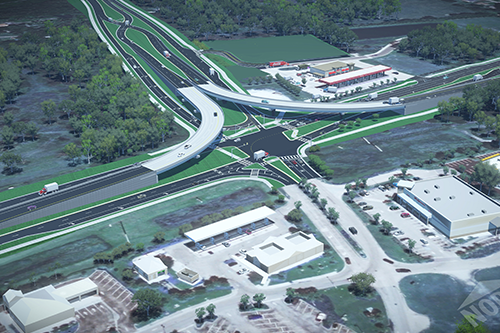
Real-World Precision
Many clients stand to gain substantial benefits from incorporating visualization at key stages of their projects, particularly at junctures of 30 percent, 60 percent, and 90 precent completion. Through the use of 3D visualization tools, engineers can identify and rectify potential issues that may not be as evident through traditional 2D analysis.
To keep up with the latest visualization software, DRMP invests considerable time and resources toward ongoing professional development and proficiency in software technologies to stay current with industry trends. Our engineers have transitioned to designing their projects in 3D, a significant upgrade from the previous 2D Computer-Aided Design (CAD) work.
The Visualization team actively collaborates with the engineers and designers throughout the entire process, working side by side to achieve a polished final product.
Our visualizations undergo multiple rounds of review to ensure precision and real-world accuracy. While the engineers and designers tackle the technical aspects of CAD, our Visualization team adds the finishing touches, transforming designs into visually appealing and lifelike representations.
DRMP’s Visualization Services are critical for today’s civil engineering projects. They provide real-world representations that help everyone agree on plans and make projects run smoothly. DRMP remains committed to meeting client needs and growing with the times with our Visualization services.
To view examples of our project visualizations, please click here.
Jeff Miller serves as Lead Visualization Designer in DRMP's Marketing and Communications Department.
Posted in the categories All, Alternative Delivery, Ecological Services, NEPA , Project Development & Environment , Structural Engineering, Transportation, Transportation Planning/Project Development , Water Resources/Stormwater Management .
Related Articles
- Nov21Giving Buses a Head Start in Raleigh, N.C. Raleigh's bustling corridors can make it...See Details
- Nov20Celebrating National GIS Day 2024As we celebrate National GIS Day, DRMP�...See Details
- Nov6Ewire Featured Story: PDES Team Guides Projects for Federal Compliance and SuccessLed by an experienced and versatile grou...See Details
- Nov6Expertise Highlight: Combating Flooding in Underserved Arkansas Communities In many predominantly Black rural towns ...See Details
Categories
- All
- Alternative Delivery
- Construction Services
- Disaster Resilience and Sustainability
- DRMPCares
- Ecological Services
- Federal Services
- Geographic Information Systems
- Land Development
- NEPA
- Project Development & Environment
- Structural Engineering
- Subsurface Utility Engineering
- Surveying & Mapping
- Traffic Impact Analysis
- Transportation
- Transportation Planning/Project Development
- Utilities Engineering
- Water Resources/Stormwater Management
Contributors
- Michael K. Albano, PE
- Bruno J. Arriola, PE, ENV SP
- Brent Bass, PE, PSM
- Cody Bayer, PE
- Donald W. Brown, PE
- Kyle Brown, PE
- Zach J. Carnahan, PE
- Brian Crowl, PE
- Patrick Day, PE
- Nick DeVito, PE
- Matt Floyd, PSM
- Deshon M. Fox, PE
- Scott Garth, PE, LEED AP ND
- Ryan M. Grab, CST II
- Robyn Hartz
- Jim Highland, PE
- TJ Lallathin, Jr., PE, DBIA
- Kelly Marton, GISP
- Meaghan McCarthy
- Jay McInnis, PE, CPM
- George McLatchey, PWS, CEP
- Michael McNeese
- Jeff Miller
- Ryan Mitchell, PE
- Lisa Moon, PE
- Megan E. Mott, PE
- Josh Norman
- Melissa Padilla Cintron, SIT
- Pavan Paiavula, PE
- Julian Poole, PE
- Joce Pritchett, PE
- Abby Rains
- Leo Rodriguez, PE
- Rachel L. Schmidt, PWS
- Logan Shappell
- Brian V. Smith
- Rynal Stephenson, PE
- Deston Taylor, EI
- August Thick II, PLS, CST III
- Steven L. Wallace, PE
- Orville Williams
- Amanda E. Woods, PE
Recent Articles
- 11/21/24Giving Buses a Head Start in Raleigh, N.C.
- 11/20/24Celebrating National GIS Day 2024
- 11/6/24Ewire Featured Story: PDES Team Guides Projects for Federal Compliance and Success
- 11/6/24Expertise Highlight: Combating Flooding in Underserved Arkansas Communities
- 11/6/24 DRMP Employees Join Forces to Create Lasting Impact in Local Communities