- Discover
-
Expertise
-
Alternative Delivery
- I-275 at I-4 Downtown Tampa Interchange Design-Build
- Wekiva Parkway Section 8 Interchange
- US 17/92 Interchange at SR 436
- SR 9B Extension from I-95 to US 1
- A. Max Brewer Bridge Replacement
- I-95 Widening from the Indian River/Brevard County Line to Malabar Road
- SR 528 (Beachline Expressway) at Innovation Way Interchange
- SR 570 Polk Parkway Widening from I-4 to Pace Road
- I-95 Express Lanes and Ramp Signals – Phase 3A-1
- Pollard Road Extension over Peace Creek
- I-485 Widening from I-77 to Rea Road
- Monroe Bypass/Connector Design-Build
- Construction Services
- Ecological Services
-
Federal Services
- Range of the Future Study
- US Coast Guard Air Station (Clearwater)
- Ascension Island Fire Station Renovation
- Patrick Space Force Base Water Lines Repair
- Patrick Space Force Base Living Shoreline Restoration
- P-505 Electrical Hardening and Black Start CHP at Marine Corps Air Station Beaufort
- Naval Station at Guantanamo Bay Survey Services
- Repair Phillips Parkway and Speed Limit Study
- Ascension Island Auxiliary Airfield Surveying and Mapping Services
-
Geographic Information Systems (GIS)
- Thermal Design/Comprehensive Campus LiDAR Collection
- Greater Orlando Aviation Authority (GOAA) Strategic Commerical Land Development Program
- University of Florida Sanitary Sewer GIS Mapping
- Ascension Island Auxiliary Airfield GIS Integration
- Santa Rosa County School District's School Transportation & Capacity GIS Analysis
- Gainesville Community Redevelopment Agency Socioeconomic Analysis and Site Suitability Report
- Real Estate Site Suitability and Development Analysis
- SR 836 (Dolphin Expressway) GIS Asset Inventory of Pre-Post Construction
- Alachua County Public Schools GIS and School Planning Professional Services
- Patrick Space Force Base Living Shoreline Restoration GIS Analysis
- Florida Army National Guard Readiness Center GIS Inventory & Integration
- Comprehensive Transit Study Puerto Rico GIS Analysis
- Land Development
- Structural Engineering
-
Subsurface Utility Engineering (SUE)
- Thermal Design/Comprehensive Campus LiDAR Collection
- P-505 Electrical Hardening and Black Start CHP at Marine Corps Air Station Beaufort
- Resurface & Safety Improvements Turnpike Mainline
- University of Florida Rabon Utility Mapping
- FP&L Subsurface Utility Engineering Continuing On-Call Contract
- Lockheed Martin Subsurface Utility Engineering Services
- Palm Coast Parkway Subsurface Utility Engineering Services
- Surveying & Mapping/Geospatial
-
Traffic Impact Analysis
- 505 West Chapel Hill Street
- 5th Street Station
- Beale Farm Industrial Park
- Blue Mountain Mist Resort
- The Villages at McCullers Walk
- Fredericksburg National Baseball Stadium
- Hendrick Southpoint Auto Mall
- Apex Friendship Elementary School
- Whole Foods Center
- Barclay West
- Grove 98
- Pullen Drive Extension/Catholic Diocese
- Trails/Parks & Recreation Facilities
- Transportation
-
Utilities Engineering
- Ascension Island Fire Station Renovation
- M-1 Canal Water Main Extension
- 5th Street Bridge Utility Replacement
- Captain’s Cove Wastewater Plant Revisions & Permit Renewal
- City of Fort Myers Downtown Utility & Streetscape Improvement
- Florida Caverns State Park Lift Station Rehab
- Tween Waters Inn Wastewater Plant Permit Renewal
- City of Fort Myers Wastewater Capacity Studies
- Patrick Space Force Base Water Lines Repair
- Big Lagoon Boat Ramp Wastewater System
- St. Joseph State Park Septic Tank Replacement
- WildBlue Development Wastewater Modeling
- A-1 Gator Wastewater Capacity Increase
- Visualization Services
- Water Resources/Stormwater Management
-
Alternative Delivery
- Careers
- News
- #DRMPerspective
- Team With Us
- Locations
« Back
DRMP’s Strategic Plan Enhances Coastal Resilience in Cedar Key, Fla.
July 10th, 2024
Sometimes the most effective shield against a powerful storm or hurricane is a natural defense. After Hurricane Idalia swept past Cedar Key, Fla., on Aug. 30, 2023 as a Category 3 hurricane, causing nearly 9 feet of storm surge, Levy County began accelerating a plan to protect its shoreline, residences, businesses, and infrastructure from future storms.
This led to DRMP preparing the Levy County Shoreline Resiliency – Preserving Historic Cedar Key plan. Central to the plan is a proposed living breakwater, which was recently included in the County’s Local Mitigation Strategy (LMS), positioning the project for future funding.
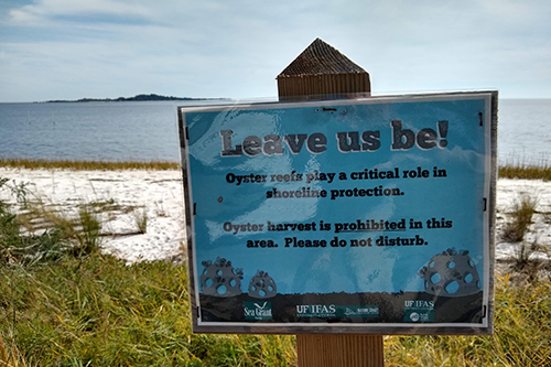
A living breakwater, or artificial reef, is a structure designed near the shore to reduce erosion and wave energy. It incorporates natural elements, such as oyster beds, mussels, seagrass, fish, and other marine life. This project also will integrate Wave Attenuation Devices (WADs) – partially submerged concrete structures designed to reduce wave energy from severe storms. These devices protect coastal shorelines and infrastructure, trap heavy sediment, and promote seagrass restoration.
The Florida Department of Environmental Protection (FDEP) recently gave the green light to the plan, marking a big step forward for coastal resilience.
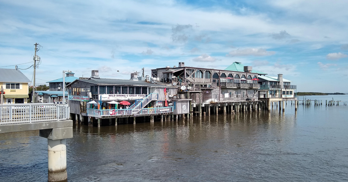
DRMP’s comprehensive plan will help safeguard Cedar Key against intense storms and hurricanes, specifically in the Dock Street business district – a bustling hub of shops, bars, and restaurants along Florida’s Gulf Coast.
As DRMP’s Disaster Resilience and Sustainability Practice Leader and Project Manager for this initiative, the successful development and implementation of this plan relied on invaluable contributions from a public work group consisting of business owners and residents of Cedar Key. Public engagement and stakeholder collaboration helped us develop projects that effectively meet Cedar Key’s specific needs.
Through extensive discussions and evaluations of past studies and best practices, the work group identified that the most efficient, cost-effective, and least intrusive method to mitigate damage to the Dock Street district was the construction of a living breakwater and shoreline. This solution will effectively reduce the velocity of storm surges, preventing repetitive scouring and erosion.
Creating Coastal Resilience
Our plan for Cedar Key allows for improved access and mobility into the community, risk prevention, mitigation and remediation, and long-range planning for improvements to the Dock Street business district. The plan focuses on shoreline and sea wall resiliency, preserving roadways, and preventing nuisance flooding with the goal of protecting the coastal community and enhancing stormwater infrastructure.
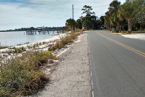
The strategy draws on extensive vulnerability studies, including detailed assessments of critical infrastructure, bathymetric studies, and wave models before and after the impact of Hurricane Idalia. As such, Levy County and Cedar Key were able to evaluate estimated and actual bathymetric models to confirm “surge mapping” and present viable solutions to identified vulnerabilities to Dock Street. Hurricane Idalia, despite not making direct landfall in Cedar Key, provided valuable insights that informed post-storm evaluations and adjustments to the strategy.
As a mitigation strategy, the living breakwater project to protect Dock Street is aligned with the Cedar Key Shoreline Management Master Plan and is included in the Dock Street Resilience Strategy.
By constructing a living breakwater, the Dock Street business district can protect its infrastructure from short- and long-term weather disruptions. Gulf-facing properties, which rely on pier systems, are vulnerable to wave action but also depend on the natural beauty of the waters. The living breakwater offers a solution that maintains the area's ambiance while safeguarding properties.
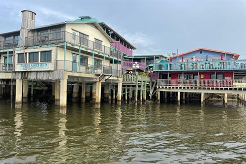
The living breakwater will create a new and iconic piece of infrastructure that slightly alters the view for patrons but does not significantly reduce access or the experience of dining "on" the water. Additionally, the breakwater is expected to boost local vegetation, marine life, and bird populations that will enhance the rustic and natural charm that attracts visitors to Cedar Key.
Additional Dock Street projects include constructing a revetment along the landward side of Dock Street to provide erosion protection; relocating exposed utility lines on Dock Street; groin field with beach renourishment (a groin is a physical barrier running perpendicular to the shoreline to stop sediment transport in the direction of longshore drift); and harbor dredging to maintain a functional and accessible public marina.
Project Funding
DRMP’s resilience services also strategically identify and pursue grants to ensure support for resilience projects.
Our plan for the Dock Street business district strategy identifies key funding sources, including FEMA’s Hazard Mitigation Grant Program (HMGP), Building Resilient Infrastructure and Communities (BRIC), and Pre-Disaster Mitigation (PDM) grants.
Following Hurricane Idalia, Levy County received $8.2 million for mitigation projects that reduce future damage and loss to the County. The Dock Street Infrastructure and Shoreline Protection project was submitted and included in the County’s Local Mitigation Strategy. As part of the plan, DRMP completed a preliminary Benefit Cost Analysis and a HMGP application was started for use by the County.
The Resilient Florida Program and National Coastal Resilience Fund also offer substantial funding opportunities with upcoming deadlines and cycles over the next few years.
The implementation of the Levy County Shoreline Resiliency – Preserving Historic Cedar Key plan signifies a progressive and resilient approach to coastal protection. The plan blends the natural environment with human infrastructure to protect against future storms while keeping the community's unique charm and liveliness intact.
Josh Norman serves as the Disaster Resilience and Sustainability Practice Leader for DRMP.
Posted in the categories All, Disaster Resilience and Sustainability .
Related Articles
- Nov21Giving Buses a Head Start in Raleigh, N.C. Raleigh's bustling corridors can make it...See Details
- Nov20Celebrating National GIS Day 2024As we celebrate National GIS Day, DRMP�...See Details
- Nov6Ewire Featured Story: PDES Team Guides Projects for Federal Compliance and SuccessLed by an experienced and versatile grou...See Details
- Nov6Expertise Highlight: Combating Flooding in Underserved Arkansas Communities In many predominantly Black rural towns ...See Details
Categories
- All
- Alternative Delivery
- Construction Services
- Disaster Resilience and Sustainability
- DRMPCares
- Ecological Services
- Federal Services
- Geographic Information Systems
- Land Development
- NEPA
- Project Development & Environment
- Structural Engineering
- Subsurface Utility Engineering
- Surveying & Mapping
- Traffic Impact Analysis
- Transportation
- Transportation Planning/Project Development
- Utilities Engineering
- Water Resources/Stormwater Management
Contributors
- Michael K. Albano, PE
- Bruno J. Arriola, PE, ENV SP
- Brent Bass, PE, PSM
- Cody Bayer, PE
- Donald W. Brown, PE
- Kyle Brown, PE
- Zach J. Carnahan, PE
- Brian Crowl, PE
- Patrick Day, PE
- Nick DeVito, PE
- Matt Floyd, PSM
- Deshon M. Fox, PE
- Scott Garth, PE, LEED AP ND
- Ryan M. Grab, CST II
- Robyn Hartz
- Jim Highland, PE
- TJ Lallathin, Jr., PE, DBIA
- Kelly Marton, GISP
- Meaghan McCarthy
- Jay McInnis, PE, CPM
- George McLatchey, PWS, CEP
- Michael McNeese
- Jeff Miller
- Ryan Mitchell, PE
- Lisa Moon, PE
- Megan E. Mott, PE
- Josh Norman
- Melissa Padilla Cintron, SIT
- Pavan Paiavula, PE
- Julian Poole, PE
- Joce Pritchett, PE
- Abby Rains
- Leo Rodriguez, PE
- Rachel L. Schmidt, PWS
- Logan Shappell
- Brian V. Smith
- Rynal Stephenson, PE
- Deston Taylor, EI
- August Thick II, PLS, CST III
- Steven L. Wallace, PE
- Orville Williams
- Amanda E. Woods, PE
Recent Articles
- 11/21/24Giving Buses a Head Start in Raleigh, N.C.
- 11/20/24Celebrating National GIS Day 2024
- 11/6/24Ewire Featured Story: PDES Team Guides Projects for Federal Compliance and Success
- 11/6/24Expertise Highlight: Combating Flooding in Underserved Arkansas Communities
- 11/6/24 DRMP Employees Join Forces to Create Lasting Impact in Local Communities