- Discover
-
Expertise
-
Alternative Delivery
- I-275 at I-4 Downtown Tampa Interchange Design-Build
- Wekiva Parkway Section 8 Interchange
- US 17/92 Interchange at SR 436
- SR 9B Extension from I-95 to US 1
- A. Max Brewer Bridge Replacement
- I-95 Widening from the Indian River/Brevard County Line to Malabar Road
- SR 528 (Beachline Expressway) at Innovation Way Interchange
- SR 570 Polk Parkway Widening from I-4 to Pace Road
- I-95 Express Lanes and Ramp Signals – Phase 3A-1
- Pollard Road Extension over Peace Creek
- I-485 Widening from I-77 to Rea Road
- Monroe Bypass/Connector Design-Build
- Construction Services
- Ecological Services
-
Federal Services
- Range of the Future Study
- US Coast Guard Air Station (Clearwater)
- Ascension Island Fire Station Renovation
- Patrick Space Force Base Water Lines Repair
- Patrick Space Force Base Living Shoreline Restoration
- P-505 Electrical Hardening and Black Start CHP at Marine Corps Air Station Beaufort
- Naval Station at Guantanamo Bay Survey Services
- Repair Phillips Parkway and Speed Limit Study
- Ascension Island Auxiliary Airfield Surveying and Mapping Services
-
Geographic Information Systems (GIS)
- Thermal Design/Comprehensive Campus LiDAR Collection
- Greater Orlando Aviation Authority (GOAA) Strategic Commerical Land Development Program
- University of Florida Sanitary Sewer GIS Mapping
- Ascension Island Auxiliary Airfield GIS Integration
- Santa Rosa County School District's School Transportation & Capacity GIS Analysis
- Gainesville Community Redevelopment Agency Socioeconomic Analysis and Site Suitability Report
- Real Estate Site Suitability and Development Analysis
- SR 836 (Dolphin Expressway) GIS Asset Inventory of Pre-Post Construction
- Alachua County Public Schools GIS and School Planning Professional Services
- Patrick Space Force Base Living Shoreline Restoration GIS Analysis
- Florida Army National Guard Readiness Center GIS Inventory & Integration
- Comprehensive Transit Study Puerto Rico GIS Analysis
- Land Development
- Structural Engineering
-
Subsurface Utility Engineering (SUE)
- Thermal Design/Comprehensive Campus LiDAR Collection
- P-505 Electrical Hardening and Black Start CHP at Marine Corps Air Station Beaufort
- Resurface & Safety Improvements Turnpike Mainline
- University of Florida Rabon Utility Mapping
- FP&L Subsurface Utility Engineering Continuing On-Call Contract
- Lockheed Martin Subsurface Utility Engineering Services
- Palm Coast Parkway Subsurface Utility Engineering Services
- Surveying & Mapping/Geospatial
-
Traffic Impact Analysis
- 505 West Chapel Hill Street
- 5th Street Station
- Beale Farm Industrial Park
- Blue Mountain Mist Resort
- The Villages at McCullers Walk
- Fredericksburg National Baseball Stadium
- Hendrick Southpoint Auto Mall
- Apex Friendship Elementary School
- Whole Foods Center
- Barclay West
- Grove 98
- Pullen Drive Extension/Catholic Diocese
- Trails/Parks & Recreation Facilities
- Transportation
-
Utilities Engineering
- Ascension Island Fire Station Renovation
- M-1 Canal Water Main Extension
- 5th Street Bridge Utility Replacement
- Captain’s Cove Wastewater Plant Revisions & Permit Renewal
- City of Fort Myers Downtown Utility & Streetscape Improvement
- Florida Caverns State Park Lift Station Rehab
- Tween Waters Inn Wastewater Plant Permit Renewal
- City of Fort Myers Wastewater Capacity Studies
- Patrick Space Force Base Water Lines Repair
- Big Lagoon Boat Ramp Wastewater System
- St. Joseph State Park Septic Tank Replacement
- WildBlue Development Wastewater Modeling
- A-1 Gator Wastewater Capacity Increase
- Visualization Services
- Water Resources/Stormwater Management
-
Alternative Delivery
- Careers
- News
- #DRMPerspective
- Team With Us
- Locations

Mobile LiDAR Surveys Identify Safety and Accessibility Needs at North Carolina Bus Stations
February 12th, 2025


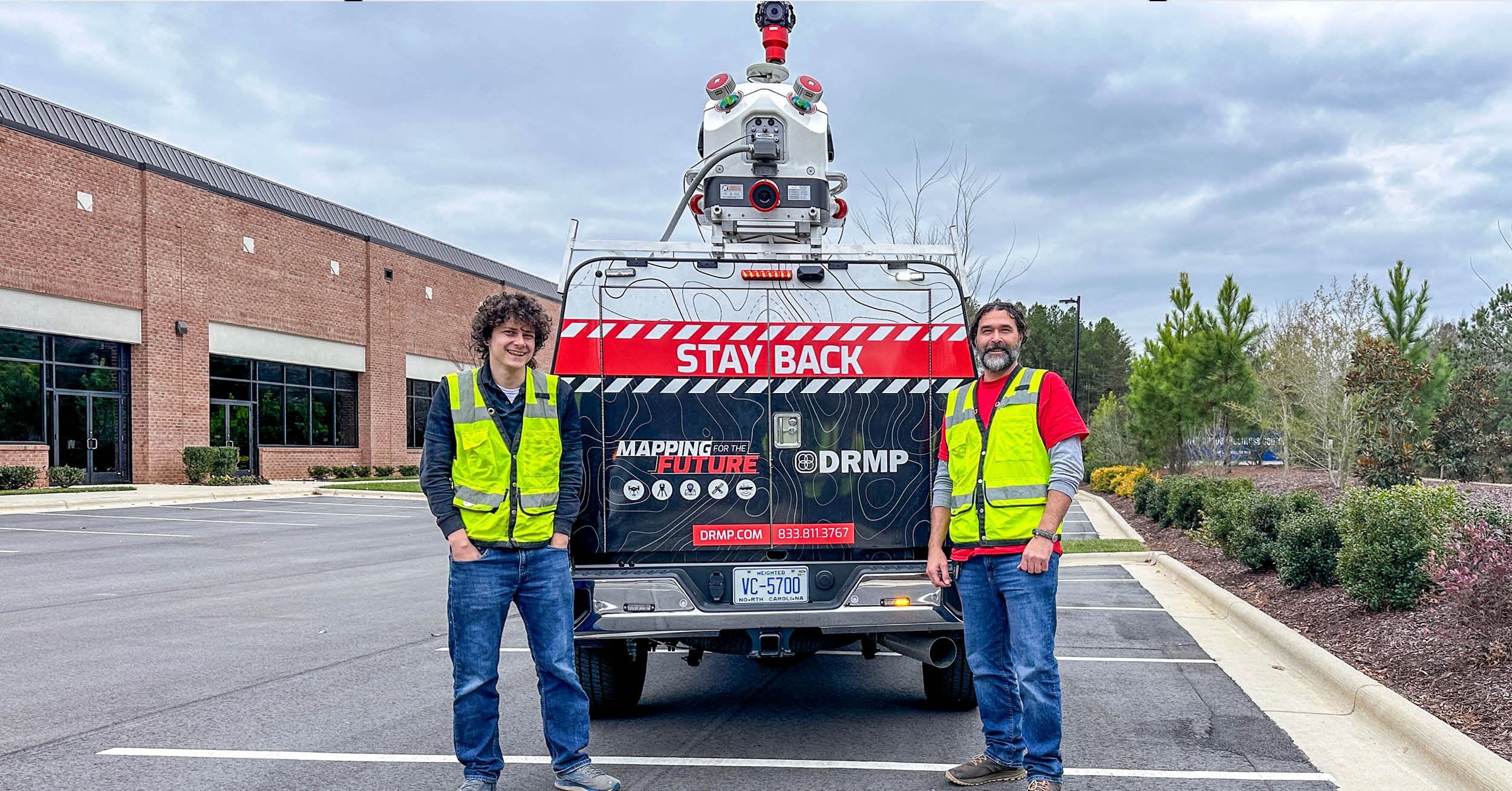
As populations grow in major cities, DRMP is helping North Carolina municipalities assess bus transit stations and plan infrastructure upgrades using mobile liDAR to support the increasing demand for public transportation.
In celebration of World LiDAR Day on Feb. 12, we're highlighting how this technology is shaping the future of transit planning. With mobile liDAR, we’re surveying more than 200 bus stations in Raleigh, Durham, Concord, and Chapel Hill to determine if they have the room or right-of-way to construct bus lanes, bus shelters, ADA safety ramps, lighting, amenities, and signage. This project helps communities enhance connectivity and prepare their transit infrastructure for current and future needs.
The goal of these projects is to improve community access to transportation by offering an affordable, convenient alternative that reduces commute costs, eases traffic congestion, and provides a more efficient way to travel.
For Chapel Hill, we are conducting a full survey and mobile liDAR scan of about 30 existing bus stations to capture crucial infrastructure details. Since inheriting the contract in 2024, we’ve already completed 30 bus station scans overall for all municipal contracts for these projects using just two operators: one driving the truck and the other running the scanner.
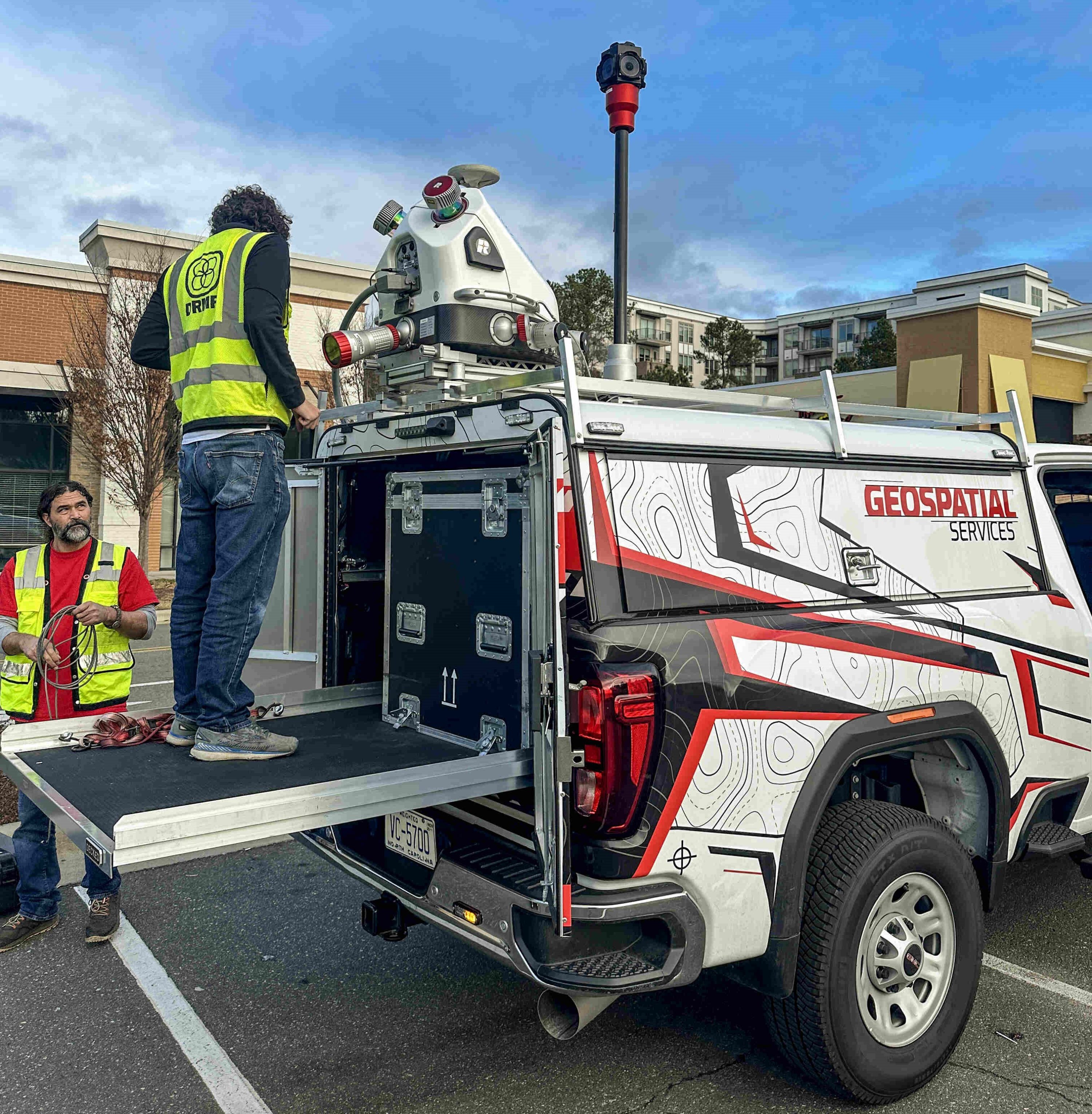
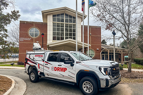
With the addition of our new mobile liDAR truck featuring a high-performance RIEGL system, we’ve strengthened our ability to offer mobile scanning services not only across North Carolina but also in Virginia, South Carolina, Tennessee, and the broader Mid-Atlantic region, delivering faster and more cost-effective results.
As the Raleigh Survey Manager leading this project, I couldn't be more excited for my team. Initially, we were using traditional survey methods on this project, which required more personnel, took up more time, and posed greater safety risks to our field experts who had to perform tasks on-site versus scanning from a vehicle.
Unlike conventional survey methods, which often require multiple visits to the site, mobile liDAR enables us to complete the work in one trip. Plus, the technology captures a broader range of data, allowing us to cover more ground. We can also easily identify potential hazards like ADA ramp issues or low-hanging power lines, which would be harder to detect with conventional surveying.
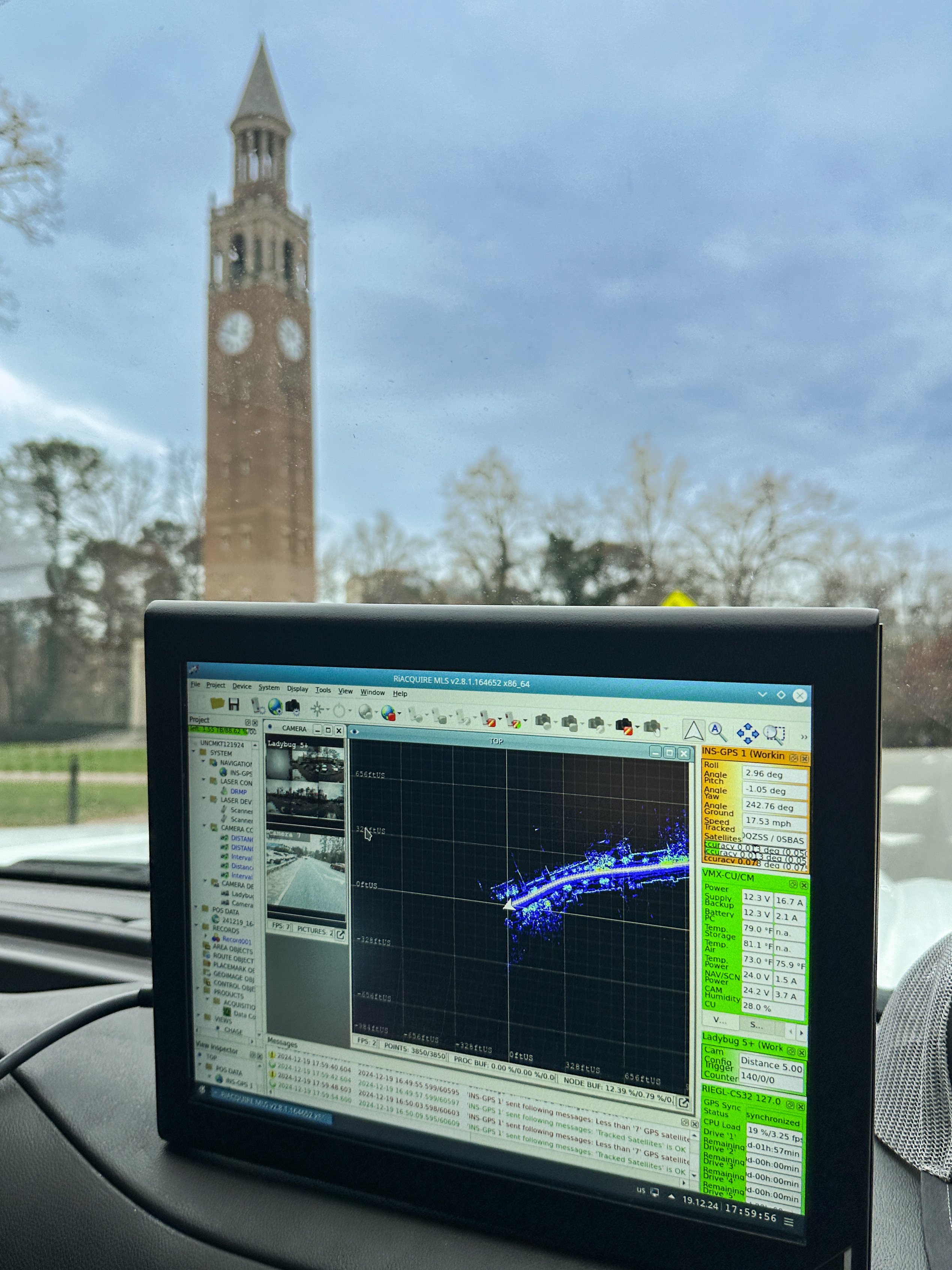
The mobile liDAR system’s capabilities are a significant asset in our work and helps both our team and our clients save time and resources.
This is just the beginning of our commitment to delivering high-quality, accurate results for our clients in the region while using advanced data collection techniques.
AJ Perkinson, PLS, serves as the Raleigh Survey Department Manager for DRMP’s Survey Market Sector.
Posted in the categories All, Surveying & Mapping, Transportation, Transportation Planning/Project Development .
Related Articles
 Feb2Protecting Wetlands for Cape Canaveral Space Force’s Range of the Future Project Wetlands provide critical wildlife habit...See Details
 Jan23Mentorship Builds Lasting Relationships for Career SuccessIn celebration of National Mentoring Mon...See Details
 Jan15Fighting Pollution to Revive the Indian River Lagoon with Innovative Stormwater SolutionsThe Indian River Lagoon, spanning 156 mi...See Details
 Jan9How LiDAR and GIS are Modernizing Road Sign Inventories for Safer Travel in West VirginiaThe West Virginia Division of Highways (...See Details

Categories
- All
- Alternative Delivery
- Construction Services
- Disaster Resilience and Sustainability
- DRMPCares
- Ecological Services
- eWire
- Federal Services
- Geographic Information Systems
- Land Development
- Learning & Development
- NEPA
- Project Development & Environment
- Structural Engineering
- Subsurface Utility Engineering
- Surveying & Mapping
- Traffic Impact Analysis
- Transportation
- Transportation Planning/Project Development
- Utilities Engineering
- Water Resources/Stormwater Management
Contributors
- Michael K. Albano, PE
- Bruno J. Arriola, PE, ENV SP
- Brent Bass, PE, PSM
- Cody Bayer, PE
- Maria Bazemore, PWS, AICP
- Donald W. Brown, PE
- Kyle Brown, PE
- Jake Burton
- Zach J. Carnahan, PE
- Brian Crowl, PE
- Patrick Day, PE
- Nick DeVito, PE
- Samir Farra Otero, PE
- Matt Floyd, PSM
- Deshon M. Fox, PE
- Scott Garth, PE, LEED AP ND
- Ryan M. Grab, CST II
- Robyn Hartz
- Jim Highland, PE
- TJ Lallathin, Jr., PE, DBIA
- Kelly Marton, GISP
- Meaghan McCarthy
- Jay McInnis, PE, CPM
- George McLatchey, PWS, CEP
- Michael McNeese
- Jeff Miller
- Ryan Mitchell, PE
- Lisa Moon, PE
- Megan E. Mott, PE
- Josh Norman
- Melissa Padilla Cintron, SIT
- Pavan Paiavula, PE
- AJ Perkinson, PLS
- Julian Poole, PE
- Joce Pritchett, PE
- Abby Rains
- Leo Rodriguez, PE
- Rachel L. Schmidt, PWS
- Logan Shappell
- Brian V. Smith
- Rynal Stephenson, PE
- Deston Taylor, EI
- August Thick II, PLS, CST III
- Steven L. Wallace, PE
- Orville Williams
- Amanda E. Woods, PE


