- Discover
-
Expertise
-
Alternative Delivery
- I-275 at I-4 Downtown Tampa Interchange Design-Build
- Wekiva Parkway Section 8 Interchange
- US 17/92 Interchange at SR 436
- SR 9B Extension from I-95 to US 1
- A. Max Brewer Bridge Replacement
- I-95 Widening from the Indian River/Brevard County Line to Malabar Road
- SR 528 (Beachline Expressway) at Innovation Way Interchange
- SR 570 Polk Parkway Widening from I-4 to Pace Road
- I-95 Express Lanes and Ramp Signals – Phase 3A-1
- Pollard Road Extension over Peace Creek
- I-485 Widening from I-77 to Rea Road
- Monroe Bypass/Connector Design-Build
- Construction Services
- Ecological Services
-
Federal Services
- Range of the Future Study
- US Coast Guard Air Station (Clearwater)
- Ascension Island Fire Station Renovation
- Patrick Space Force Base Water Lines Repair
- Patrick Space Force Base Living Shoreline Restoration
- P-505 Electrical Hardening and Black Start CHP at Marine Corps Air Station Beaufort
- Naval Station at Guantanamo Bay Survey Services
- Repair Phillips Parkway and Speed Limit Study
- Ascension Island Auxiliary Airfield Surveying and Mapping Services
-
Geographic Information Systems (GIS)
- Thermal Design/Comprehensive Campus LiDAR Collection
- Greater Orlando Aviation Authority (GOAA) Strategic Commerical Land Development Program
- University of Florida Sanitary Sewer GIS Mapping
- Ascension Island Auxiliary Airfield GIS Integration
- Santa Rosa County School District's School Transportation & Capacity GIS Analysis
- Gainesville Community Redevelopment Agency Socioeconomic Analysis and Site Suitability Report
- Real Estate Site Suitability and Development Analysis
- SR 836 (Dolphin Expressway) GIS Asset Inventory of Pre-Post Construction
- Alachua County Public Schools GIS and School Planning Professional Services
- Patrick Space Force Base Living Shoreline Restoration GIS Analysis
- Florida Army National Guard Readiness Center GIS Inventory & Integration
- Comprehensive Transit Study Puerto Rico GIS Analysis
- Land Development
- Structural Engineering
-
Subsurface Utility Engineering (SUE)
- Thermal Design/Comprehensive Campus LiDAR Collection
- P-505 Electrical Hardening and Black Start CHP at Marine Corps Air Station Beaufort
- Resurface & Safety Improvements Turnpike Mainline
- University of Florida Rabon Utility Mapping
- FP&L Subsurface Utility Engineering Continuing On-Call Contract
- Lockheed Martin Subsurface Utility Engineering Services
- Palm Coast Parkway Subsurface Utility Engineering Services
- Surveying & Mapping/Geospatial
-
Traffic Impact Analysis
- 505 West Chapel Hill Street
- 5th Street Station
- Beale Farm Industrial Park
- Blue Mountain Mist Resort
- The Villages at McCullers Walk
- Fredericksburg National Baseball Stadium
- Hendrick Southpoint Auto Mall
- Apex Friendship Elementary School
- Whole Foods Center
- Barclay West
- Grove 98
- Pullen Drive Extension/Catholic Diocese
- Trails/Parks & Recreation Facilities
- Transportation
-
Utilities Engineering
- Ascension Island Fire Station Renovation
- M-1 Canal Water Main Extension
- 5th Street Bridge Utility Replacement
- Captain’s Cove Wastewater Plant Revisions & Permit Renewal
- City of Fort Myers Downtown Utility & Streetscape Improvement
- Florida Caverns State Park Lift Station Rehab
- Tween Waters Inn Wastewater Plant Permit Renewal
- City of Fort Myers Wastewater Capacity Studies
- Patrick Space Force Base Water Lines Repair
- Big Lagoon Boat Ramp Wastewater System
- St. Joseph State Park Septic Tank Replacement
- WildBlue Development Wastewater Modeling
- A-1 Gator Wastewater Capacity Increase
- Water Resources/Stormwater Management
-
Alternative Delivery
- Careers
- News
- #DRMPerspective
- Team With Us
- Locations
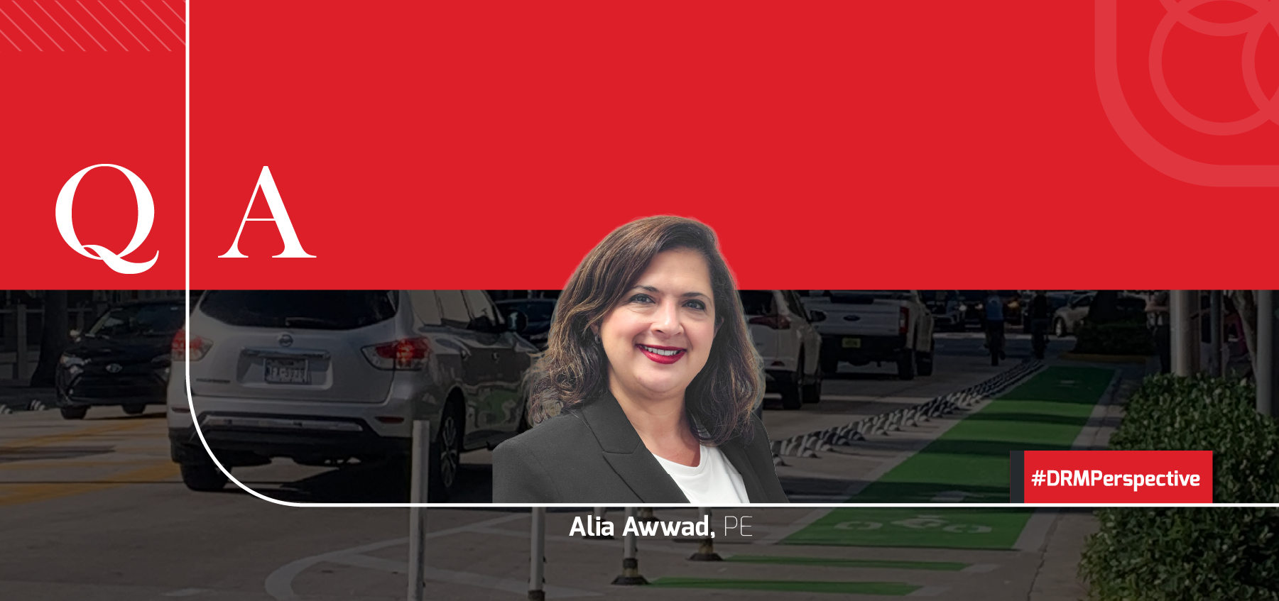
DRMP Makes Streets Safer and More Accessible Through Multimodal Transportation Safety Planning
November 13th, 2025


Transportation is a key part of how we function and move about in our day-to-day lives, whether we're driving to work, walking our kids to school, biking through our neighborhoods, or taking public transit. The safety, efficiency, and accessibility of our streets directly affect our quality of life, our communities' economic vitality, and our personal well-being.
About 40,000 people die using U.S. roadways every year, with crashes disproportionately affecting disadvantaged communities. Traffic congestion is costing Americans billions of dollars every year. DRMP’s Planning Group is committed to making transportation safer, more reliable, and more equitable for everyone. In this Q&A, DRMP's Planning Group Leader Alia Awwad, PE, shares insights on how multimodal planning, innovative safety strategies, and data-driven decision-making are improving communities in the Southeast.
Could you tell us a bit about your background and what led you to focus on transportation planning and safety?
I have nearly 25 years of experience in transportation planning and engineering. Before joining DRMP, I served as Florida regional director for Alta Planning + Design – DRMP’s partner firm within the Trilon family of companies – and led multimodal planning and engineering efforts across the state. Throughout my career, safety has been a central theme. Starting out in roadway design, integrating traffic operations and design into my background, and later taking on transportation planning, I found that if we planned and designed roads with safety in mind for every single road user, it would be more effective to communicate transportation investment benefits and implement a more balanced roadway network. The goal of “speaking” the languages of both planners and engineers to facilitate safer streets has, in turn, became my passion.
What services does your department provide to DRMP’s clients, and how do those services support safer, more efficient transportation systems?
DRMP’s Planning Group offers multimodal transportation planning, grant writing, feasibility and traffic evaluations, and design. At the core of all these services is safety for all road users. We strongly believe that roadway fatalities are preventable and that it is our responsibility, as transportation professionals, to proactively work toward preventing them.
Understanding Multimodal Safety
For readers who may not be familiar, what does “multimodal safety” mean, and why is it an essential part of modern transportation planning?
Multimodal safety means that everyone should feel and be safe while using the street, regardless of how they move. For the last several decades, we have focused on efficiently moving cars through the transportation system and have done so at the expense of other modes. Just like the profession of city and urban planning was born out of a public health and sanitation crisis, we are now dealing with a traffic fatality crisis that requires immediate attention in the transportation planning and engineering realm. What multimodal safety is not is the overburdening of one mode over another – a common misconception that often gets in the way of creating safer streets for communities. Through a Safe System Approach, which views safety through a comprehensive lens of education, engineering, and enforcement, we can build communities that are not only safe but also economically sustainable. Rather than reactively integrating safety treatments in response to crashes, we must change the way we think about designing our streets. Our streets that line our communities are not just a means to an end but are also a public space that should incorporate and accommodate every user. It comes full circle with land-use planning, as transportation and land use work hand in hand to create a synergistic co-dependence.
DRMP promotes safety for all road users, whether they're walking, biking, driving, or using public transit. How does your team bring that vision to life?
The Transportation Planning Group aims to create communities that foster providing safe, comfortable, and convenient transportation modes, where driving, walking, biking, or taking transit is a choice rather than a necessity. To achieve this, our group works closely with clients and interdisciplinary teams to view transportation from a 10,000-foot level, where the following elements are considered:
• What options do people have to go to work, school, or places of entertainment?
• Are all modes of transportation connected and accessible?
• Do people feel safe walking or biking on the street?
• What are the barriers (policy, public consensus, education, etc.) currently preventing the creation of a cohesive urban fabric where land uses and transportation options are conducive to a safer, more accessible built environment?
In your view, what does DRMP do best when it comes to advancing multimodal planning and transportation safety? Can you share an example that illustrates that strength in action?
DRMP has full transportation planning and engineering services that are integrated, supporting collaboration and the smooth transition of multimodal projects from vision to fruition. An example is the East Palmetto Park Road Streetscape project in Boca Raton, Fla. The project started as a visioning process of reimagining the corridor in the City’s core downtown. A robust analysis and community engagement process took place, resulting in the proposal of several conceptual alternatives. This was followed by the evaluation and design of several safety improvements in downtown near the East Palmetto Park Road corridor, such as “quick build” multimodal improvement installations, integrating safer intersection design into ongoing design projects and evaluating safer access opportunities across the railroad tracks. DRMP was able to offer the City transportation planning-to-engineering services that visualized, analyzed, designed, and implemented safety improvements.
Funding and Key Safety Strategies
Does DRMP assist clients with grant funding (including identifying funding opportunities, writing grant applications, and administering awarded grants)?
Yes! DRMP has an extensive grant writing and management assistance group with a diverse set of skills and expertise. We have experience in researching, storytelling, and quantifying project benefits for grants focused on safety, resilience, environmental, and multimodal transportation.
Your department works with strategies like Safe Routes to School, Vision Zero, and Transportation Demand Management (TDM). Could you explain what these efforts are, and how do they fit into a larger safety strategy for communities?
Safe Routes to School (SRTS) is an initiative that includes educational and implementation components, aimed at creating a safer environment for students to walk and bike to school. Schools often struggle with vehicular backups during drop-off and pickup times, and over the last few decades, fewer students are walking or biking to school. This is primarily due to the dominance of car travel, which has created an unsafe walking and biking environment near schools.
To combat that, SRTS programs partner with local law enforcement and offer educational materials and campaigns for students and parents.
They also implement a coordinated, prioritized set of infrastructure safety improvements focused on facilitating foot and bike traffic to school. SRTS programs and funding vary by state; however, federal and private funding is also available. SRTS programs in disadvantaged and rural areas, in particular, have had a tremendous impact on the well-being of children accessing schools.
Vision Zero is a commitment to achieving zero traffic deaths. It’s not a slogan or ambitious/ambiguous vision, but rather a commitment to get to zero through intentional, data-driven policy, design, and programmatic change. Vision Zero is a term that has been adopted in the United States for just over a decade, after being adopted from Sweden, where in the early 1990s, the country decided to cut its traffic deaths and successfully achieved just that.
Communities across the United States have adopted Vision Zero resolutions and Action Plans, and many have successfully adopted policies, implemented improvements, and secured funding to reduce and ultimately eliminate traffic deaths and serious injuries. The main principles of Vision Zero include acknowledging that traffic deaths are preventable, that humans make mistakes, that our roadways should be forgiving toward those mistakes, and that speed management is at the core of reducing fatalities. Over the last decade, there have been many lessons learned on what factors contribute to successful applications of Vision Zero in American communities. Leadership commitment is crucial for advancing goals and objectives. Breaking down silos between agency departments and partner organizations promotes safer designs, and changing policies to remove barriers and facilitate implementation illustrates key lessons learned.
Transportation Demand Management (TDM): When we think about providing access to traveling by whichever transportation mode, we usually think of adding physical “capacity.” With TDM, we are resolving traffic congestion and transportation needs through another dimension. By offering incentives and partnering with employers and agencies, we’re providing people with options that influence how people choose to travel. For example, if an employer offers incentives to carpooling and/or vanpooling…etc., they promote non-single occupancy vehicle travel for their employees; thereby reducing traffic congestion and other byproduct issues such as parking shortages and air pollution. Similarly, through TDM strategies, agencies can work with the development community, as well as leverage technology, to implement congestion relief measures such as smart parking strategies. The above strategies and initiatives, if implemented collectively and collaboratively, along with other policy, design, and programmatic strategies, would create a safer environment for everyone using the street. That is essentially what the Safe System Approach is – an overarching safety framework that accounts for and accepts human error, and proactively addresses safety through safer roads, speeds, designs, emergency response, and vehicle design and operation. The goal is to induce a culture of safety, where everyone is accountable for a safer street environment.
Can you explain what the Safe Streets and Roads for All (SS4A) program is, and how it has helped local agencies improve road safety?
The SS4A program was integrated into the Infrastructure Investment and Jobs Act (IIJA) with the former presidential administration’s focus on advancing safety, equity, and climate resilience. The goal of the SS4A program is to provide communities with funding to establish a Safe System Approach blueprint through adopting a Safety Action Plan, as well as providing funds for implementation and analysis. The 5-year, $5 billion program continues to fund hundreds of communities across the country and has had numerous benefits on communities, including:
• Increasing awareness of roadway safety and traffic deaths and serious injuries.
• Jump-starting safety initiatives in communities, even the ones where safety was not always a proactive goal.
• Securing funding to implement critical safety improvements in disadvantaged areas that had no other source of funding available.
• Catalyzing safety improvements and funding.
• Fostering partnerships among agencies.
• Prioritizing safety capital improvements where funding is scarce.
With SS4A sunsetting next year, what should communities and agencies be doing now to maintain or build on the safety progress it supported?
Communities should continue to foster safety efforts through:
• Establishing a safety “blueprint” through adopting a Safety Action Plan that is adopted by leadership and decision-makers and facilitates implementing critical infrastructure.
• For communities that have already adopted Safety Action Plans, there are many federal, state, and local funding opportunities where safety is a core factor. The Action Plan serves as a data-driven process to secure additional funding and continue to build momentum in improving safety through implementation and programs.
• Approaching infrastructure, policy, and program decision-making through the lens of the Safe System Approach is a different way of thinking. Once we shape our priorities to focus on saving lives and giving people safe, viable options to travel, we build communities that prioritize livability and quality of life.
Implementation and Decision-Making
How does DRMP integrate safety considerations into the earliest phases of project development, before design or construction begins?
With DRMP’s Transportation Planning and Project Development & Environmental (PD&E) groups in place, it provides the opportunity to consider safety before project design options are even considered. When safety is integrated into the visioning, data gathering, analysis, and community input phases, multimodal safety is integrated into the fabric of every design and construction project, rather than being an afterthought. One example is the Tradition and Village Parkway intersection design project in Port St. Lucie, Fla. What started out as a safety improvement project with the intent of building a protected intersection with added “protection” for pedestrians and bicyclists remained a critical part of the design even after traffic analysis showed that additional travel lanes were needed. The project demonstrates that even when car capacity is needed, it should not be at the expense of multimodal safety.
What role does data play in identifying safety concerns and contributing to smarter design or policy solutions?
A data-driven approach to safety is a cornerstone of creating a sustainable path to a safer built environment. Safety and traffic deaths are an emotional topic, and it is important to humanize the topic to emphasize the toll it takes to lose 40,000 people every year in the United States to traffic deaths, a preventable manner of death. At the same time, to be able to effectively “reach” all audiences and platforms, it is also important to present an objective case to the issue to come up with logical, implementable, and sustainable solutions to safer streets.
For example, the Vision Zero process starts by analyzing data to identify the root causes of traffic deaths and serious injuries and prioritizing the corridors and intersections where this is happening the most. The idea is that by targeting the “worst of the worst,” you can maximize return on investment – both figuratively and literally. To demonstrate the success of a safety effort and gain support and consensus, it’s essential to implement solutions that directly address the specific issue. Figuratively, by focusing on the “high injury” corridors, you are aiming to eradicate traffic deaths as soon as possible.
The power of data also lies in the ability to “translate” and “communicate” it in ways that resonate. And this is not a one-size-fits-all undertaking. For example, in New York City, aggressive driving and speeding were major factors in causing traffic fatalities. The Vision Zero effort highlighted this through graphic billboards that illustrated the gravity of the situation to maximize impact. This worked for a community like New York City; however, it might not work for other communities. What worked in other communities, particularly in more conservative ones, is to “test’ safety design solutions that have not been implemented in the community before. The “piloting” of these improvements allowed the community to view and assess the results in real-time, allowing potential future and larger applications.
Finally, data and technology continue to rapidly evolve, and the safety field can benefit from technological advancements that facilitate more efficient safety installations. For example, after determining that intersection crashes were a major contributor to traffic fatalities and serious injuries, the City/County of Nashville applied for and secured a $2 million federal SMART grant that integrates “near-miss” technology through video detection at intersections.
You’ve mentioned policy intervention as part of DRMP’s approach. Could you explain what policy intervention is, and how can local or regional policy decisions help create safer streets?
Policy interventions are often the key to unlocking barriers to safer streets. For example, while Osceola County has a policy for street lighting, the policy restricts improvements to roadways over a certain posted speed limit. When the Vision Zero Action Plan showed that lighting is a contributing factor to roadway fatalities, a recommendation to change the policy would have a significant impact on improving safety. Policy intervention, however, should be viewed in tandem with design and fiscal implications. For example, in changing the street lighting policy, it is also important to consider the capital improvement project prioritization process, where safety is a core factor, and where revising a policy does not misalign with available funding. When considering safety improvements at DRMP, we take a step back as part of a Safe System Approach to evaluate the transportation system more comprehensively, including policies, land use patterns, public support, and programmatic interventions.
Accessibility and the Future of Multimodal Safety
How does your work align with broader goals like equity and accessibility in transportation planning?
Unfortunately, there is a linear relationship between traffic casualties and disadvantaged communities. Publications such as Dangerous by Design consistently show that pedestrian fatalities are not distributed equally amongst income brackets or race. Decades of federal and state “redlining” transportation policies have created inequitable access to opportunity.
Interstates bisected once thriving communities, leaving them blighted, and the population of carless households in a car-dominated country is concentrated in these blighted communities. When we work with communities, the transportation planning process typically starts by gathering and analyzing data, which then reveals patterns and trends, including inequities in access and safety. This helps inform the next phases of the transportation planning process, including targeted community engagement and outreach methods, prioritizing efforts, and reshaping policy. It is also important to recognize that equity means different things in different communities. For many, it means providing access to amenities for the aging population. In other communities, it means offering safe access to transit for the workforce population. Our practice works through these distinctions to be able to truly make a difference in the recommendations we make.
What excites you most about the future of multimodal planning at DRMP and the impact you hope to make across the Southeast?
DRMP has a well-established transportation engineering and construction practice that has been serving communities for decades. By integrating multimodal transportation safety planning at the front end of these services, I am excited and energized by the potential of influencing how we plan and design cities and places. DRMP has always put integrity and quality front and center. Building upon its mission, the multimodal transportation safety practice will expand these offerings to communities and will maintain a lead on how best to design transportation with safety, evolving travel modes, and resilience in mind. I believe multimodal transportation safety planning “completes” DRMP’s services in a true, sustainable sense of the word.
Alia Awwad, PE, serves as a Planning Group Leader for DRMP’s Transportation Market Sector.

Related Articles
 Mar26DRMP’s Gainesville Team Enhances Infrastructure with Survey and SUE ExpertiseDRMP delivers comprehensive survey and s...See Details
 Mar2650 Years in Surveying: Joe Di Benedetto, PLS, LS, Shares Wisdom and ForesightDRMP Senior Vice President and Director ...See Details
 Mar6Women in Construction: Rising, Leading, and Inspiring at DRMP For Women in Construction Week, DRMP Sen...See Details
 Feb25DRMP Design Revitalizes Florida College Renamed Payne AmphitheaterFlorida College engaged DRMP to restore ...See Details

Categories
- All
- Alternative Delivery
- Civil Services
- Construction Services
- Disaster Resilience and Sustainability
- DRMPCares
- Ecological Services
- Electrical Engineering
- eWIRE
- Federal Services
- Geographic Information Systems
- Hurricane
- Land Development
- Learning & Development
- NEPA
- Project Development & Environment
- Structural Engineering
- Subsurface Utility Engineering
- Surveying & Mapping
- Traffic Impact Analysis
- Transportation
- Transportation Planning/Project Development
- Utilities Engineering
- Water Resources/Stormwater Management
Contributors
- Michael K. Albano, PE
- Bruno J. Arriola, PE, ENV SP
- Alia Awwad, PE
- Brent Bass, PE, PSM
- Cody Bayer, PE
- Maria Bazemore, PWS, AICP
- Paul Benvie, PE
- Donald W. Brown, PE
- Kyle Brown, PE
- Jake Burton
- Zach J. Carnahan, PE
- Brian Crowl, PE
- Patrick Day, PE
- Nick DeVito, PE
- Joe Di Benedetto, PLS, LS
- Scott Garth, PE, LEED AP ND
- Ryan M. Grab, CST II
- Robyn Hartz, INCE
- Justin Hayes, EI
- Lucas S. Helms, PE
- Jim Highland, PE
- Ryan Ianacone, CST II
- Erica Jernigan, PE
- TJ Lallathin, Jr., PE, DBIA
- Jay McInnis, PE, CPM
- George McLatchey, PWS, CEP
- Ryan Mitchell, PE
- Megan E. Mott, PE
- Josh Norman
- Melissa Padilla Cintron, SIT
- Pavan Paiavula, PE
- Ryan Pellarin, PE, CCM
- AJ Perkinson, PLS
- Julian Poole, PE
- Kayla Poulos, PE
- Joce Pritchett, PE
- Kim Sadowski, PE, RSP1
- John Schick
- Rachel L. Schmidt, PWS
- Logan Shappell
- Rynal Stephenson, PE
- Albert Taylor
- Deston Taylor, PE, PTOE
- Keelyn Taylor, PhD
- August Thick II, PLS
- Tanya Thompson, AICP
- Thomas Tracz, PSM
- Hung Tu, PE, SE
- Orville Williams
- Amanda E. Woods, PE


