- Discover
-
Expertise
-
Alternative Delivery
- I-275 at I-4 Downtown Tampa Interchange Design-Build
- Wekiva Parkway Section 8 Interchange
- US 17/92 Interchange at SR 436
- SR 9B Extension from I-95 to US 1
- A. Max Brewer Bridge Replacement
- I-95 Widening from the Indian River/Brevard County Line to Malabar Road
- SR 528 (Beachline Expressway) at Innovation Way Interchange
- SR 570 Polk Parkway Widening from I-4 to Pace Road
- I-95 Express Lanes and Ramp Signals – Phase 3A-1
- Pollard Road Extension over Peace Creek
- I-485 Widening from I-77 to Rea Road
- Monroe Bypass/Connector Design-Build
- Construction Services
- Ecological Services
-
Federal Services
- Range of the Future Study
- US Coast Guard Air Station (Clearwater)
- Ascension Island Fire Station Renovation
- Patrick Space Force Base Water Lines Repair
- Patrick Space Force Base Living Shoreline Restoration
- P-505 Electrical Hardening and Black Start CHP at Marine Corps Air Station Beaufort
- Naval Station at Guantanamo Bay Survey Services
- Repair Phillips Parkway and Speed Limit Study
- Ascension Island Auxiliary Airfield Surveying and Mapping Services
-
Geographic Information Systems (GIS)
- Thermal Design/Comprehensive Campus LiDAR Collection
- Greater Orlando Aviation Authority (GOAA) Strategic Commerical Land Development Program
- University of Florida Sanitary Sewer GIS Mapping
- Ascension Island Auxiliary Airfield GIS Integration
- Santa Rosa County School District's School Transportation & Capacity GIS Analysis
- Gainesville Community Redevelopment Agency Socioeconomic Analysis and Site Suitability Report
- Real Estate Site Suitability and Development Analysis
- SR 836 (Dolphin Expressway) GIS Asset Inventory of Pre-Post Construction
- Alachua County Public Schools GIS and School Planning Professional Services
- Patrick Space Force Base Living Shoreline Restoration GIS Analysis
- Florida Army National Guard Readiness Center GIS Inventory & Integration
- Comprehensive Transit Study Puerto Rico GIS Analysis
- Land Development
- Structural Engineering
-
Subsurface Utility Engineering (SUE)
- Thermal Design/Comprehensive Campus LiDAR Collection
- P-505 Electrical Hardening and Black Start CHP at Marine Corps Air Station Beaufort
- Resurface & Safety Improvements Turnpike Mainline
- University of Florida Rabon Utility Mapping
- FP&L Subsurface Utility Engineering Continuing On-Call Contract
- Lockheed Martin Subsurface Utility Engineering Services
- Palm Coast Parkway Subsurface Utility Engineering Services
- Surveying & Mapping/Geospatial
-
Traffic Impact Analysis
- 505 West Chapel Hill Street
- 5th Street Station
- Beale Farm Industrial Park
- Blue Mountain Mist Resort
- The Villages at McCullers Walk
- Fredericksburg National Baseball Stadium
- Hendrick Southpoint Auto Mall
- Apex Friendship Elementary School
- Whole Foods Center
- Barclay West
- Grove 98
- Pullen Drive Extension/Catholic Diocese
- Trails/Parks & Recreation Facilities
- Transportation
-
Utilities Engineering
- Ascension Island Fire Station Renovation
- M-1 Canal Water Main Extension
- 5th Street Bridge Utility Replacement
- Captain’s Cove Wastewater Plant Revisions & Permit Renewal
- City of Fort Myers Downtown Utility & Streetscape Improvement
- Florida Caverns State Park Lift Station Rehab
- Tween Waters Inn Wastewater Plant Permit Renewal
- City of Fort Myers Wastewater Capacity Studies
- Patrick Space Force Base Water Lines Repair
- Big Lagoon Boat Ramp Wastewater System
- St. Joseph State Park Septic Tank Replacement
- WildBlue Development Wastewater Modeling
- A-1 Gator Wastewater Capacity Increase
- Water Resources/Stormwater Management
-
Alternative Delivery
- Careers
- Insights
- Connect
- Powered By Trilon
50 Years in Surveying: Joe Di Benedetto, PLS, LS, Shares Wisdom and Foresight
March 26th, 2026


“Land is the only thing they’re not making any more of.” It’s a line that stuck with Joe Di Benedetto, PLS, LS, early in his career and one that continues to influence how he views the surveying profession today. Di Benedetto, a senior vice president and director of surveying and mapping/geospatial at DRMP, joined the field in 1976 at a time when he said the profession was still taking shape. During those early years, experienced surveyors took the time to teach him not just how to use equipment, but how to think through problems, question results that didn’t make sense, and understand the responsibility that comes with placing his name on a control survey, right-of-way map, boundary survey, or legal description.
Now 18 years into his time at DRMP, Di Benedetto is set on passing along those same lessons to the next generation. In recognition of National Surveyors Week this month, Di Benedetto shares insights on how surveying has changed over the years, the role of technology, and the importance of mentorship and professional responsibility.
How did you get started in the surveying and mapping profession, and what initially sparked your interest in this field?
Over the past 50 years, I’ve had the benefit of collaborating with people who took the time to teach me the profession before it was even a profession. Most of what I learned didn’t come from a classroom or manual. It came from field experience, corrections made after the fact, and from experienced surveyors who were willing to explain why something matters.
Today’s surveyors need to remember that what we’re working with isn’t just data. It affects people’s homes, businesses, and property rights for generations. I feel a responsibility to pass on that mindset to the next generation, helping my staff understand that this work carries consequences beyond the data we collect. Mentorship, to me, is simply a way of returning the investment that others made in me.
Over the course of your career, how have you seen the surveying and mapping industry evolve, and what major changes or trends have stood out to you?
Our technology has changed dramatically. The work we can do today with a single instrument would’ve taken an entire crew several days to do when I started back in 1976. But the responsibility behind the work hasn’t changed at all. The equipment may be different, but the need for sound judgment, attention to detail, and professional integrity is more important than ever. That’s why my mentorship has become important to me at this stage of my career.
What inspired you to create DRMP’s in-house surveying and mapping training center, and what impact has it had on the growth and development of the team?
We created dedicated space for workstations for many reasons.
- To allow staff to become more familiar with our survey software and internal workflows outside project pressure. The intent is not to assign training, but to provide an opportunity for individuals to improve their technical understanding at their own pace.
- The training center gives the staff the ability to better understand how the data they collect in the field will translate into finished deliverables.
- It allows individuals who are interested in advancing their careers to begin developing skills required for future project management or technical leadership roles and is in line with our career path program.
- From a leadership standpoint, the voluntary nature of participation provides a way to recognize those who are willing to invest additional effort into their own professional development and helps distinguish those actively preparing for advancement.
- Over time, the hope was that this space should help reduce training gaps, strengthen our internal workflow knowledge, and support long-term succession planning efforts already underway within the organization.
How does the training program help prepare young professionals for long-term success, and what opportunities does DRMP provide to support their career advancement? Is it unusual for an engineering firm to provide this in-house training program?
As our survey profession continues to evolve with the advancements in technology, the traditional term “surveying” no longer fully captures the range of services we are expected to provide to our clients. Today's projects often require expertise in areas such as right of way mapping, subsurface utility engineering (SUE), geographic information systems (GIS), and geospatial services.
From a training standpoint, it is my opinion that it is more efficient to introduce developing professionals to these disciplines early in their careers and allow them to build competency within specific tracks over time.
By concentrating on these different technical areas as part of a structured development path, we can help staff better understand how field data is collected, managed, and applied across these multiple service lines.
This approach supports long-term professional growth while ensuring that the future leaders are prepared to meet traditional surveying responsibilities and the expanding need to not only keep up with technology but stay ahead of it.
Speaking of technology, you’ve made it a priority to stay on top of emerging technologies and invest in the latest survey equipment. Why is that commitment to innovation so important to you and to DRMP’s clients?
No. 1 is safety. While advancements in emerging technology have improved the efficiency and capabilities of our work, the reality is the modern job sites have become increasingly hazardous due to the presence of distracted drivers. Much of the danger our field personnel face today comes from working in proximity to active roadways where technology in the hands of inattentive motorists has introduced new challenges.
With implementation of mobile LiDAR and static scanning systems, we are able to limit the need for personnel to work within roadways, helping to reduce their exposure to hazards that are often outside of our control.
DRMP has recently upgraded and expanded its mobile LiDAR capabilities with the addition of another truck. How does this expansion enhance the services we provide and position us for the future?
Mobile LiDAR has become an important part of how we approach many of our transportation and infrastructure projects. With the addition of another truck and the upgraded system, we’re able to collect data faster and at a higher level of detail. That allows us to cover larger areas in less time while still delivering the accuracy our clients expect, and it helps reduce the amount of time our crews spend working on active roadways.
It also allows us to capture a more complete dataset during the initial collection. That flexibility gives our team the ability to extract additional details later if project needs change without having to send crews back into the field. As projects become more complex and schedules continue to tighten, having that capability helps us work more efficiently and better support our clients.
Under your leadership, DRMP’s survey division has grown significantly and attracted top-notch professionals. What has been your approach to building and strengthening the department?
My experience tells me that people are not all built the same, and they shouldn't be expected to succeed in the same way. Everyone brings different strengths to the profession, and our job as leaders is to recognize the strengths to help develop them rather than asking individuals to step outside of who they are just to fit a certain role. Some have grown into leaders, some into technical experts, while others prefer to manage projects. By focusing on where people can contribute the most efficiently and giving them the opportunity to build on that, we've been able to develop stronger and more capable teams overall.
What do you believe sets DRMP’s Surveying & Mapping/Geospatial division apart from others in the industry?
For the past eleven years, I've had the opportunity to watch our department grow and evolve into incredible teams. What we have today didn't happen overnight. It’s the result of a group of dedicated professionals who are willing to adapt, learn new skills, and take pride in the work they do every day. I'm extremely proud of all the teams we've built and the effort they put into moving this department forward. Their willingness to step up, support one another, and grow with the demands of the job has played a major role in where we are today. I believe the support from our leadership sets us apart from others in the industry.
What are some of the biggest challenges currently facing the surveying profession, and how is DRMP addressing them?
Increasingly, newer professionals seem to be drawn to the visual and technical aspects of the work, such as scanning, modeling, and geospatial data acquisition, while showing less interest in more interpretive and legally driven components of traditional surveying. It is important that we continue to embrace innovation while also reinforcing the importance of boundary analysis and professional responsibility that defines our role beyond simply collecting information. With that in mind, one of our disciplines is focused heavily on traditional surveying and mapping. While today's technology allows us to collect data faster than ever before, the ability to properly understand and apply the information still takes years of experience. Becoming a well-rounded surveying professional is a gradual process and depends on hands-on experience, mentorship, and working knowledge of traditional practices and modern technology.
Looking back on your career and the evolution of the department, what are you most proud of, and what excites you most about what’s ahead?
As I look back on my career, I realized how many people played a role in helping me along the way. What stands out the most to me are the individuals who took the time to share their knowledge, offer guidance, and help me understand the responsibility that comes with being in this profession. I can honestly say, back in 1976, I don’t recall them ever being called mentors, but in my case, I feel it worked. What excites me most about what’s ahead is seeing DRMP's mentorship program growing over the past several years.
Joseph Di Benedetto, PLS, LS, serves as a Senior Vice President and Director of Survey and Mapping/Geospatial Services for DRMP.

Related Articles
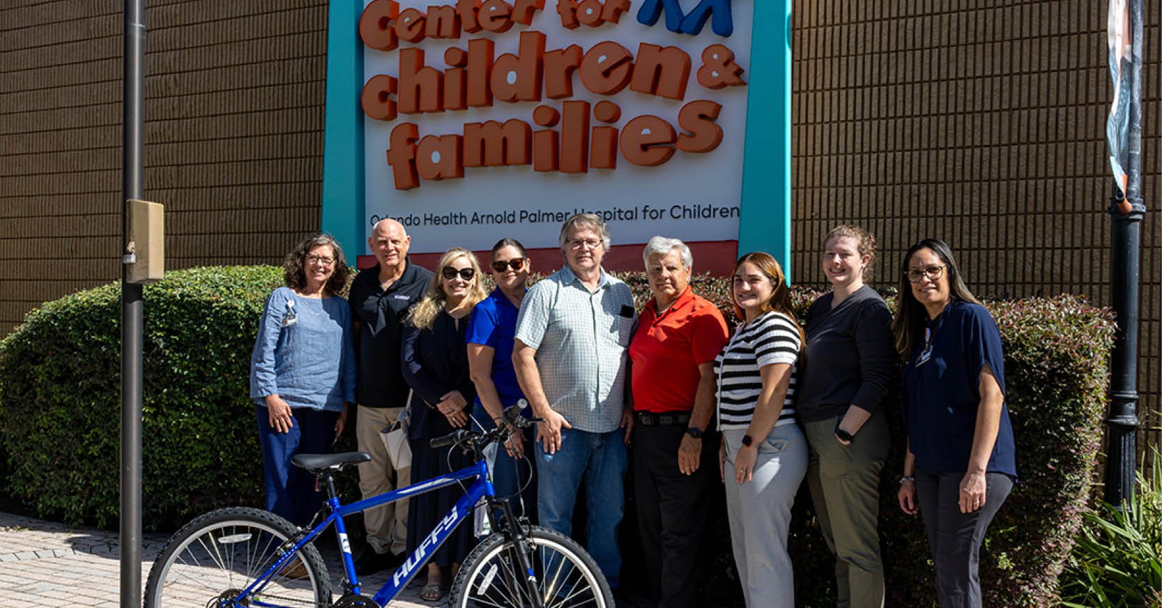 Jul23DRMP Gives Families a Lift Through Its Charity Bike BuildDRMP employees took time out of their da...See Details
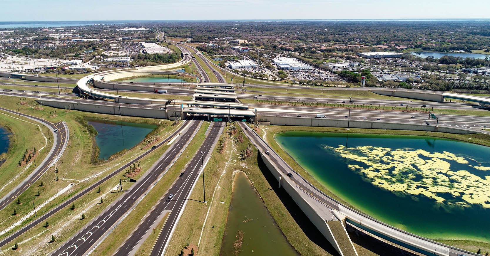 Jul21Wekiva Parkway Section 8 Interchange Closes Gap, Improves Regional Travel The Wekiva Parkway Section 8 Interchange...See Details
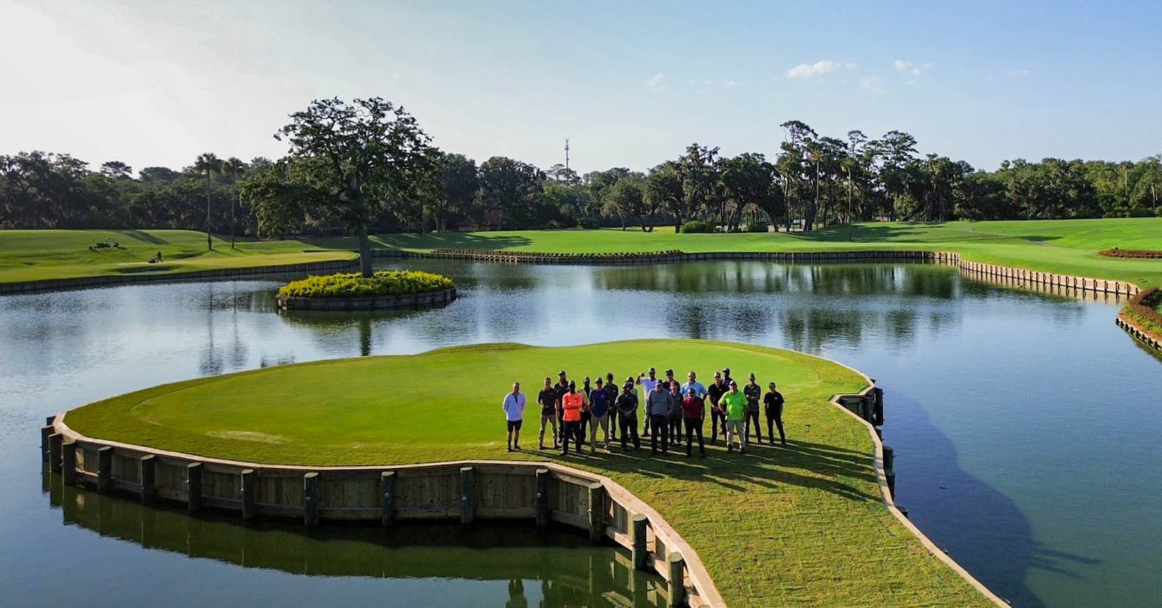 Jul14Surveying One of Golf’s Most Legendary Holes DRMP provided survey services for the re...See Details
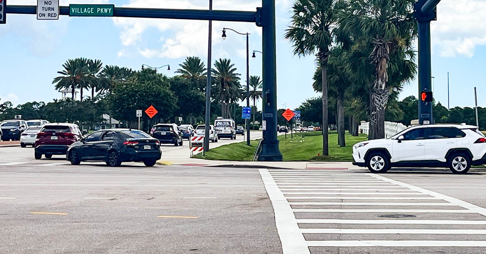 Jul7Port St. Lucie Intersection Upgrade Improves Safety at Village and Tradition ParkwaysDRMP delivered a comprehensive redesign ...See Details

Categories
- All
- Alternative Delivery
- Civil Services
- Construction Services
- Disaster Resilience and Sustainability
- DRMPCares
- Ecological Services
- Electrical Engineering
- eWIRE
- Federal Services
- Geographic Information Systems
- Hurricane
- Land Development
- Learning & Development
- NEPA
- Project Development & Environment
- Structural Engineering
- Subsurface Utility Engineering
- Surveying & Mapping
- Traffic Impact Analysis
- Transportation
- Transportation Planning/Project Development
- Utilities Engineering
- Water Resources/Stormwater Management
Contributors
- Michael K. Albano, PE
- Bruno J. Arriola, PE, ENV SP
- Alia Awwad, PE
- Brent Bass, PE, PSM
- Cody Bayer, PE
- Maria Bazemore, PWS, AICP
- Paul Benvie, PE
- Donald W. Brown, PE
- Kyle Brown, PE
- Jake Burton
- Zach J. Carnahan, PE
- David Couch
- Brian Crowl, PE
- Patrick Day, PE
- Nick DeVito, PE
- Joe Di Benedetto, PLS, LS
- Scott Garth, PE, LEED AP ND
- Ryan M. Grab, CST II
- Robyn Hartz, INCE
- Justin Hayes, EI
- Lucas S. Helms, PE
- Jim Highland, PE
- Ryan Ianacone, CST II
- Erica Jernigan, PE
- Ravneet Kathuria
- TJ Lallathin, Jr., PE, DBIA
- Jay McInnis, PE, CPM
- George McLatchey, PWS, CEP
- Ryan Mitchell, PE
- Megan E. Mott, PE
- Josh Norman
- Melissa Padilla Cintron, SIT
- Pavan Paiavula, PE
- Ryan Pellarin, PE, CCM
- AJ Perkinson, PLS
- Julian Poole, PE
- Kayla Poulos, PE
- Kim Sadowski, PE, RSP1
- John Schick, PTP
- Rachel L. Schmidt, PWS
- Logan Shappell
- Rynal Stephenson, PE
- Albert Taylor
- Deston Taylor, PE, PTOE
- Keelyn Taylor, PhD
- August Thick II, PLS
- Thomas Tracz, PSM
- Hung Tu, PE, SE
- Grady Vaughan, PE, PTOE, PTP
- Orville Williams
- Amanda E. Woods, PE


