- Discover
-
Expertise
-
Alternative Delivery
- I-275 at I-4 Downtown Tampa Interchange Design-Build
- Wekiva Parkway Section 8 Interchange
- US 17/92 Interchange at SR 436
- SR 9B Extension from I-95 to US 1
- A. Max Brewer Bridge Replacement
- I-95 Widening from the Indian River/Brevard County Line to Malabar Road
- SR 528 (Beachline Expressway) at Innovation Way Interchange
- SR 570 Polk Parkway Widening from I-4 to Pace Road
- I-95 Express Lanes and Ramp Signals – Phase 3A-1
- Pollard Road Extension over Peace Creek
- I-485 Widening from I-77 to Rea Road
- Monroe Bypass/Connector Design-Build
- Construction Services
- Ecological Services
-
Federal Services
- Range of the Future Study
- US Coast Guard Air Station (Clearwater)
- Ascension Island Fire Station Renovation
- Patrick Space Force Base Water Lines Repair
- Patrick Space Force Base Living Shoreline Restoration
- P-505 Electrical Hardening and Black Start CHP at Marine Corps Air Station Beaufort
- Naval Station at Guantanamo Bay Survey Services
- Repair Phillips Parkway and Speed Limit Study
- Ascension Island Auxiliary Airfield Surveying and Mapping Services
-
Geographic Information Systems (GIS)
- Thermal Design/Comprehensive Campus LiDAR Collection
- Greater Orlando Aviation Authority (GOAA) Strategic Commerical Land Development Program
- University of Florida Sanitary Sewer GIS Mapping
- Ascension Island Auxiliary Airfield GIS Integration
- Santa Rosa County School District's School Transportation & Capacity GIS Analysis
- Gainesville Community Redevelopment Agency Socioeconomic Analysis and Site Suitability Report
- Real Estate Site Suitability and Development Analysis
- SR 836 (Dolphin Expressway) GIS Asset Inventory of Pre-Post Construction
- Alachua County Public Schools GIS and School Planning Professional Services
- Patrick Space Force Base Living Shoreline Restoration GIS Analysis
- Florida Army National Guard Readiness Center GIS Inventory & Integration
- Comprehensive Transit Study Puerto Rico GIS Analysis
- Land Development
- Structural Engineering
-
Subsurface Utility Engineering (SUE)
- Thermal Design/Comprehensive Campus LiDAR Collection
- P-505 Electrical Hardening and Black Start CHP at Marine Corps Air Station Beaufort
- Resurface & Safety Improvements Turnpike Mainline
- University of Florida Rabon Utility Mapping
- FP&L Subsurface Utility Engineering Continuing On-Call Contract
- Lockheed Martin Subsurface Utility Engineering Services
- Palm Coast Parkway Subsurface Utility Engineering Services
- Surveying & Mapping/Geospatial
-
Traffic Impact Analysis
- 505 West Chapel Hill Street
- 5th Street Station
- Beale Farm Industrial Park
- Blue Mountain Mist Resort
- The Villages at McCullers Walk
- Fredericksburg National Baseball Stadium
- Hendrick Southpoint Auto Mall
- Apex Friendship Elementary School
- Whole Foods Center
- Barclay West
- Grove 98
- Pullen Drive Extension/Catholic Diocese
- Trails/Parks & Recreation Facilities
- Transportation
-
Utilities Engineering
- Ascension Island Fire Station Renovation
- M-1 Canal Water Main Extension
- 5th Street Bridge Utility Replacement
- Captain’s Cove Wastewater Plant Revisions & Permit Renewal
- City of Fort Myers Downtown Utility & Streetscape Improvement
- Florida Caverns State Park Lift Station Rehab
- Tween Waters Inn Wastewater Plant Permit Renewal
- City of Fort Myers Wastewater Capacity Studies
- Patrick Space Force Base Water Lines Repair
- Big Lagoon Boat Ramp Wastewater System
- St. Joseph State Park Septic Tank Replacement
- WildBlue Development Wastewater Modeling
- A-1 Gator Wastewater Capacity Increase
- Water Resources/Stormwater Management
-
Alternative Delivery
- Careers
- News
- #DRMPerspective
- Team With Us
- Locations
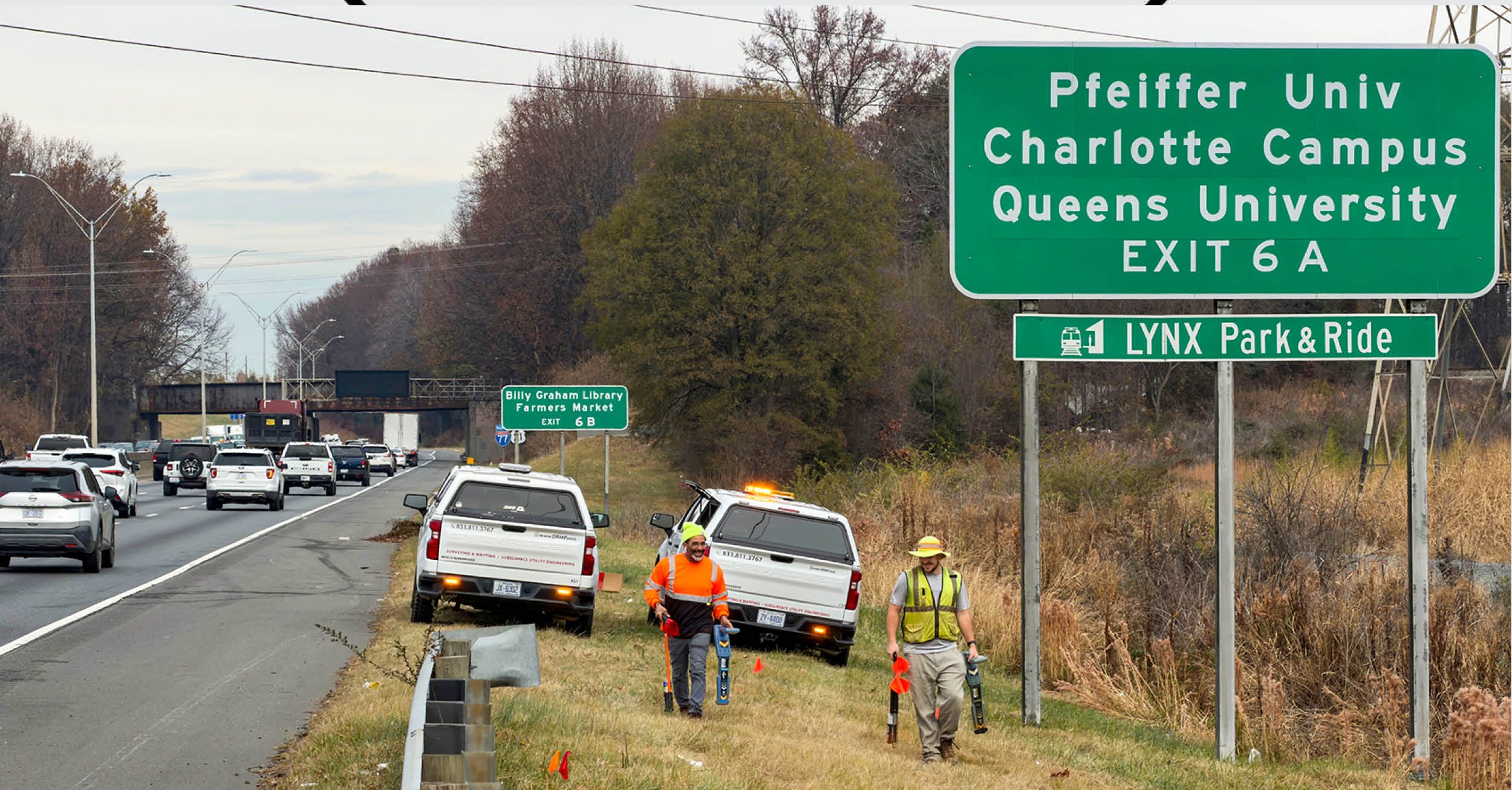
Inside DRMP's Survey and SUE Effort Powering North Carolina's I-77 South Charlotte Express Lanes
December 8th, 2025


Few corridors in North Carolina challenge a survey and subsurface utility engineering (SUE) team the way the southern stretch of Interstate 77 through Charlotte does. I’ve worked in dense urban highway environments before, but this one stands apart. According to the North Carolina Department of Transportation (NCDOT), this segment has a crash rate more than twice the statewide average for urban interstates, making it one of the most crash-prone highway sections in the state. It also serves as a critical link for commuters and freight moving between the Carolinas, where daily traffic routinely exceeds capacity during peak periods.
When NCDOT selected DRMP to provide survey and SUE services for the I-77 South Express Lanes project, we were stepping into the largest undertaking our North Carolina survey and SUE teams had ever taken on. The project will add two new express toll lanes in each direction, reconstruct key interchanges and bridges, and introduce direct connectors to improve access and traffic flow along an 11-mile corridor. With an estimated cost between $3.2 billion and $3.7 billion, delivered as a public-private partnership with NCDOT contributing about $600 million, the project is already advancing through design surveys, SUE mapping, and environmental and planning reviews. Construction is anticipated to begin about 2030.
Under DRMP’s on-call location and surveys contract with NCDOT, my team is responsible for Section 2, a 3.7-mile middle portion extending from 2,000 feet south of Nations Ford Road to Pressley Road. The segment is a vital connector between major interchanges, and its complexity is reflected in the survey limits, which extend beyond the interstate to include more than 1,300 acres and 400 properties, along with ramps, greenways, adjacent parcels and dense utility corridors.
NCDOT’s aggressive schedule requires real-time responsiveness, and our survey and SUE teams adjust field crews frequently, coordinate constantly with multiple stakeholders, and integrate new data streams quickly. Managing such a large volume of survey and SUE work with high accuracy reflects our team’s technical capability, adaptability, and commitment to delivering consistent results under pressure.
The survey and SUE data we collect is foundational for the project’s planning, engineering and construction. Topographic surveys define ground conditions, roadway geometry, and infrastructure locations needed to design new lanes, interchanges, and direct connectors. Property boundaries and right-of-way information guide acquisition needs and ensure compliance with state requirements. Accuracy at this phase is essential because it establishes the foundation for all work that follows.
Field Challenges Across a Contained Corridor
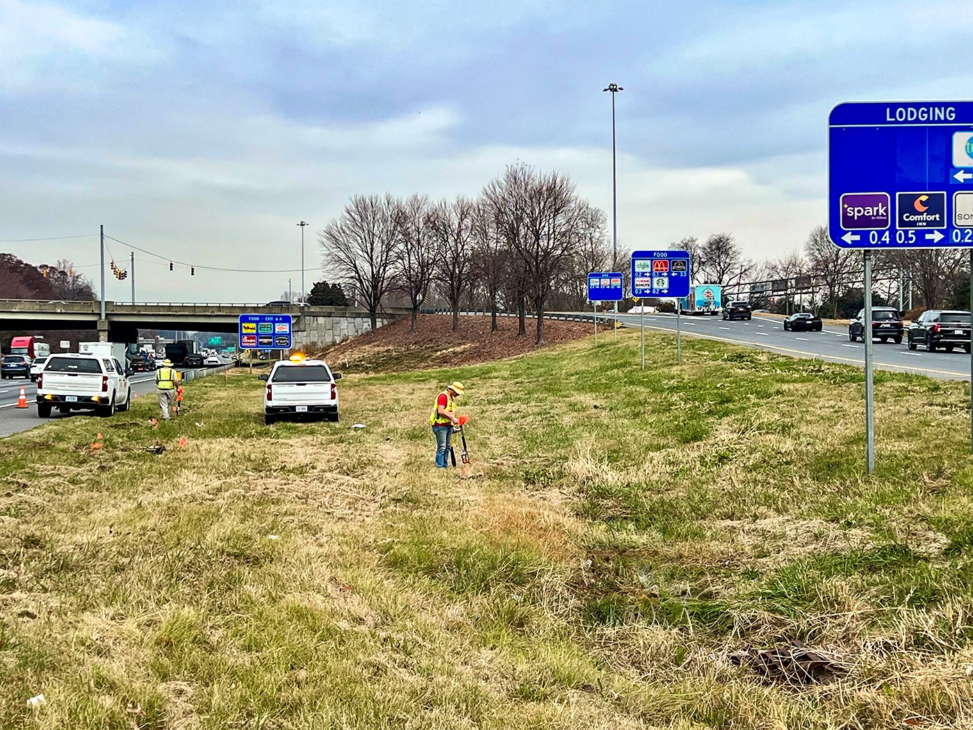
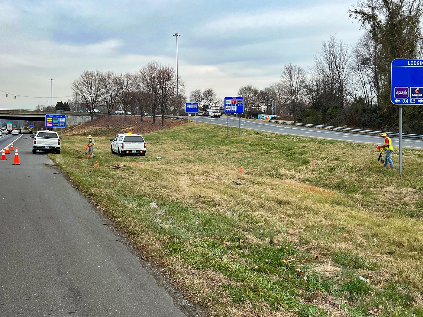
This project tests every aspect of mapping and surveying. The corridor’s dense urban setting, heavy traffic volumes, complex interchanges, and extensive underground utilities create one of the most challenging environments we work in. Identifying existing conditions, resolving utility conflicts, and ensuring reliable information for design and construction are critical responsibilities for our crews.
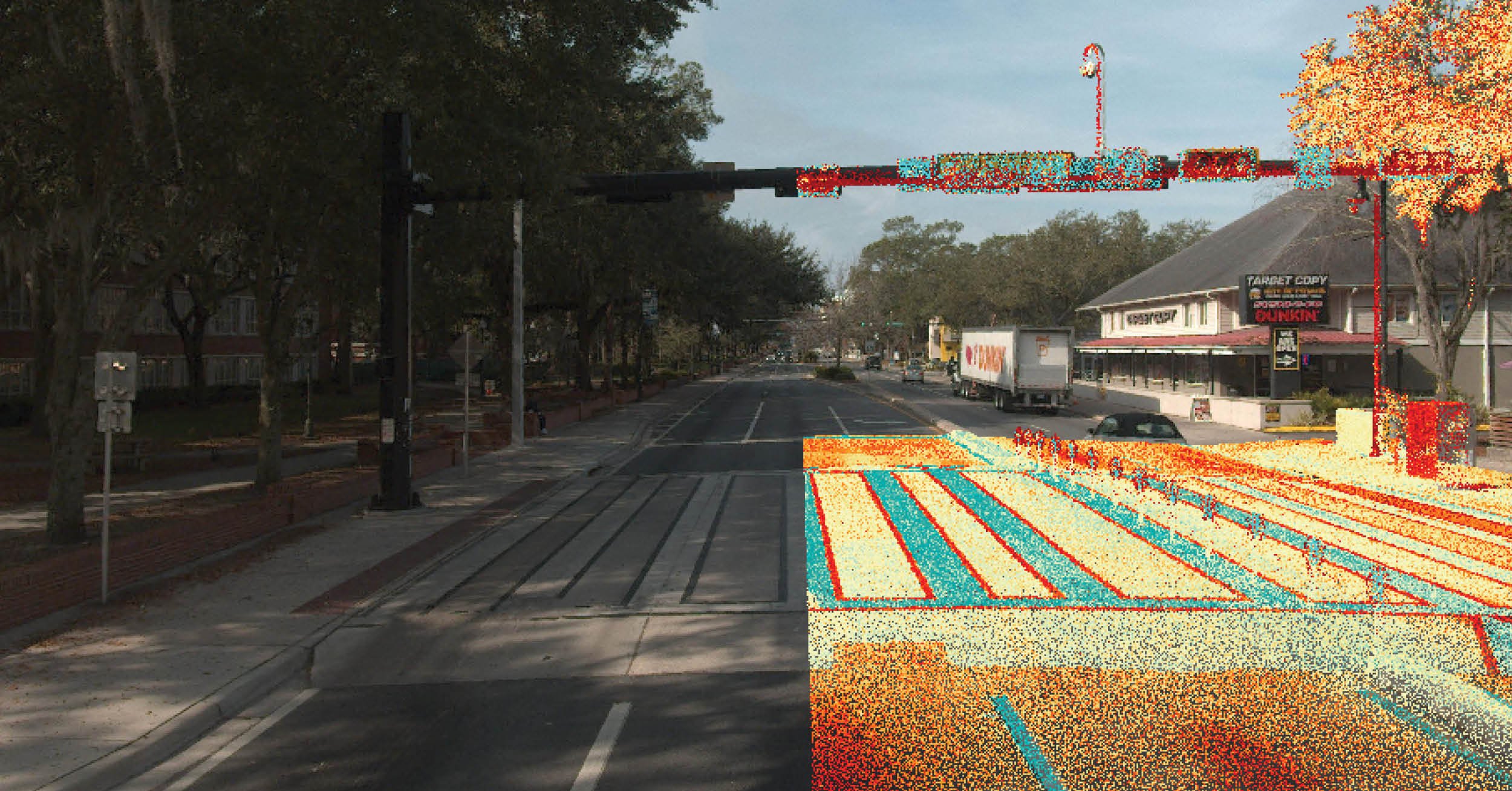
To collect high-accuracy survey data efficiently and safely, our field crews rely on real-time kinematic (RTK) GPS and robotic total stations, even in areas with limited satellite visibility. Standardized field procedures and centralized data management ensure consistency across multiple survey and SUE crews operating simultaneously along the corridor. Daily quality assurance and quality control (QA/QC) reviews verify accuracy and completeness before data moves to the design teams.
Designating and Mapping Underground Utilities
Designating and mapping more than 700,000 linear feet of underground utilities for more than 20 utility owners requires extensive coordination and technical precision. We begin by collecting existing records – plans, GIS datasets, and as-built drawings – from each utility owner. These sources provide valuable background information but rarely deliver the precision required for engineering and construction.
Our experts then perform Quality Level B (QL-B) utility designation using electromagnetic locators and ground-penetrating radar. QL-B, as defined in the American Society of Civil Engineers’ (ASCE) SUE guidelines, determines the horizontal position of buried utilities from surface indicators and geophysical methods without excavation. After designating utilities in the field, crews survey the markings using RTK GPS or robotic total stations and upload the results daily for review. Coordination with utility owners continues throughout the process to verify data, resolve discrepancies, and plan for future relocations or adjustments.
Ensuring Data Accuracy and Consistency
In this corridor, GPS signal obstruction is routine, especially near bridges and tall structures. When satellite visibility drops, our crews switch to robotic total stations, which provide millimeter-level accuracy using measured angles and distances. For property corners and critical structures, we conduct multiple observations at different times and with varying satellite conditions to ensure repeatability and minimize error.
All field data undergoes internal QA/QC review, cross-checked against benchmarks and control points that meet or exceed NCDOT standards. This level of scrutiny ensures that the data is reliable enough to support precise design and construction decisions.
Project Coordination
A project of this scale requires close coordination. Multiple DRMP survey and SUE crews work simultaneously along the corridor, making consistent field practices essential. Centralized data management, daily data uploads, and regular team meetings maintain alignment and prevent discrepancies.
Externally, we collaborate with the firms responsible for adjacent sections and with the LiDAR scanning team. Together, we verify horizontal and vertical datums, coordinate tie-in locations, confirm coverage limits, exchange datasets, and conduct joint field reviews. These efforts ensure compatibility between terrestrial and aerial mapping and maintain consistency across the entire 11-mile project.
As work continues along the corridor, our survey and SUE teams remain focused on delivering precise, dependable data that will help provide a safer, more efficient I-77 for drivers.

August A. Thick II, PLS, serves as a Vice President and the North Carolina Survey Division Leader for DRMP’s Survey and Mapping/Geospatial Market Sector.
Related Articles
 Mar26DRMP’s Gainesville Team Enhances Infrastructure with Survey and SUE ExpertiseDRMP delivers comprehensive survey and s...See Details
 Mar2650 Years in Surveying: Joe Di Benedetto, PLS, LS, Shares Wisdom and ForesightDRMP Senior Vice President and Director ...See Details
 Mar6Women in Construction: Rising, Leading, and Inspiring at DRMP For Women in Construction Week, DRMP Sen...See Details
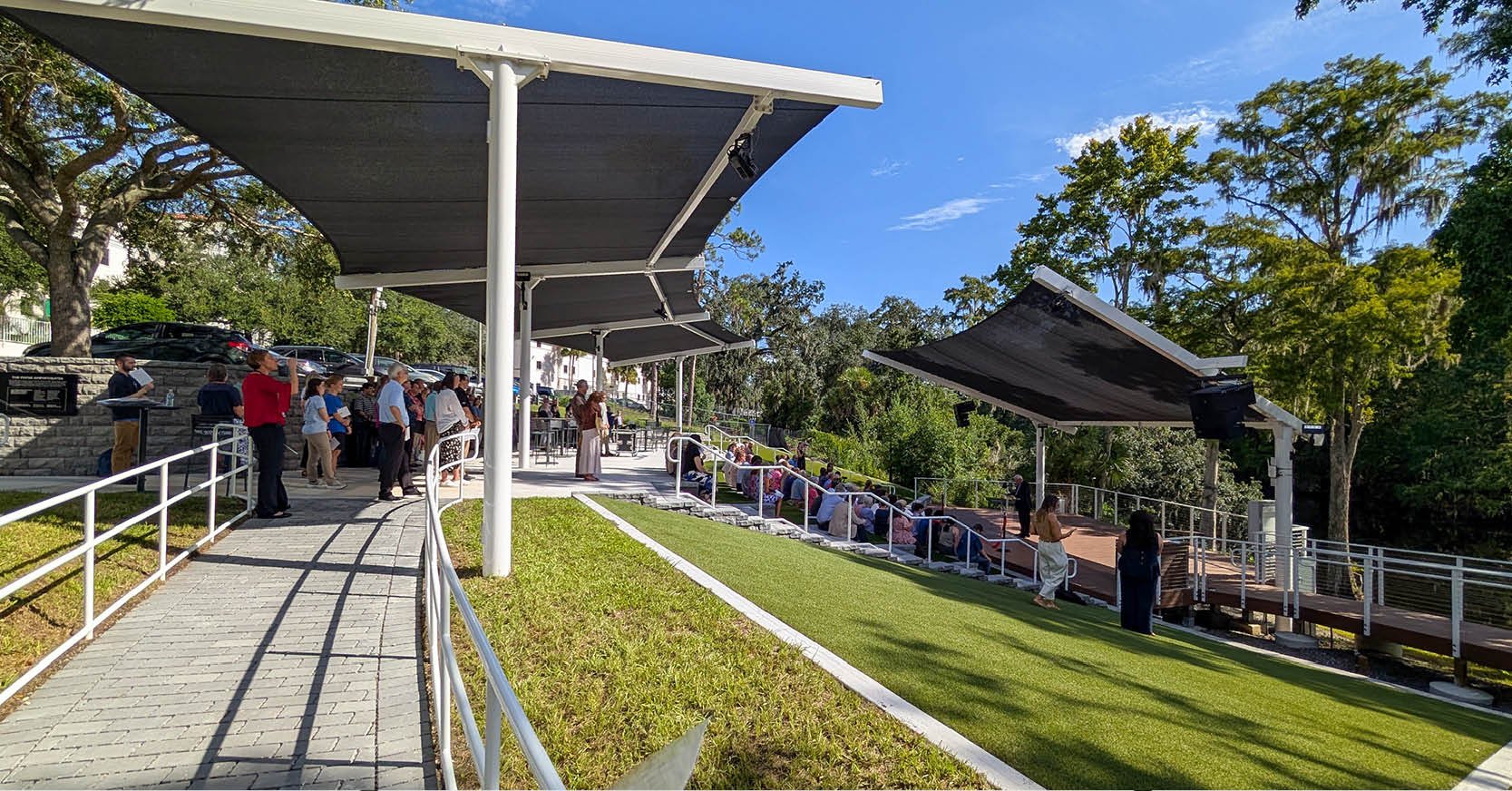 Feb25DRMP Design Revitalizes Florida College Renamed Payne AmphitheaterFlorida College engaged DRMP to restore ...See Details

Categories
- All
- Alternative Delivery
- Civil Services
- Construction Services
- Disaster Resilience and Sustainability
- DRMPCares
- Ecological Services
- Electrical Engineering
- eWIRE
- Federal Services
- Geographic Information Systems
- Hurricane
- Land Development
- Learning & Development
- NEPA
- Project Development & Environment
- Structural Engineering
- Subsurface Utility Engineering
- Surveying & Mapping
- Traffic Impact Analysis
- Transportation
- Transportation Planning/Project Development
- Utilities Engineering
- Water Resources/Stormwater Management
Contributors
- Michael K. Albano, PE
- Bruno J. Arriola, PE, ENV SP
- Alia Awwad, PE
- Brent Bass, PE, PSM
- Cody Bayer, PE
- Maria Bazemore, PWS, AICP
- Paul Benvie, PE
- Donald W. Brown, PE
- Kyle Brown, PE
- Jake Burton
- Zach J. Carnahan, PE
- Brian Crowl, PE
- Patrick Day, PE
- Nick DeVito, PE
- Joe Di Benedetto, PLS, LS
- Scott Garth, PE, LEED AP ND
- Ryan M. Grab, CST II
- Robyn Hartz, INCE
- Justin Hayes, EI
- Lucas S. Helms, PE
- Jim Highland, PE
- Ryan Ianacone, CST II
- Erica Jernigan, PE
- TJ Lallathin, Jr., PE, DBIA
- Jay McInnis, PE, CPM
- George McLatchey, PWS, CEP
- Ryan Mitchell, PE
- Megan E. Mott, PE
- Josh Norman
- Melissa Padilla Cintron, SIT
- Pavan Paiavula, PE
- Ryan Pellarin, PE, CCM
- AJ Perkinson, PLS
- Julian Poole, PE
- Kayla Poulos, PE
- Joce Pritchett, PE
- Kim Sadowski, PE, RSP1
- John Schick
- Rachel L. Schmidt, PWS
- Logan Shappell
- Rynal Stephenson, PE
- Albert Taylor
- Deston Taylor, PE, PTOE
- Keelyn Taylor, PhD
- August Thick II, PLS
- Tanya Thompson, AICP
- Thomas Tracz, PSM
- Hung Tu, PE, SE
- Orville Williams
- Amanda E. Woods, PE


