- Discover
-
Expertise
-
Alternative Delivery
- I-275 at I-4 Downtown Tampa Interchange Design-Build
- Wekiva Parkway Section 8 Interchange
- US 17/92 Interchange at SR 436
- SR 9B Extension from I-95 to US 1
- A. Max Brewer Bridge Replacement
- I-95 Widening from the Indian River/Brevard County Line to Malabar Road
- SR 528 (Beachline Expressway) at Innovation Way Interchange
- SR 570 Polk Parkway Widening from I-4 to Pace Road
- I-95 Express Lanes and Ramp Signals – Phase 3A-1
- Pollard Road Extension over Peace Creek
- I-485 Widening from I-77 to Rea Road
- Monroe Bypass/Connector Design-Build
- Construction Services
- Ecological Services
-
Federal Services
- Range of the Future Study
- US Coast Guard Air Station (Clearwater)
- Ascension Island Fire Station Renovation
- Patrick Space Force Base Water Lines Repair
- Patrick Space Force Base Living Shoreline Restoration
- P-505 Electrical Hardening and Black Start CHP at Marine Corps Air Station Beaufort
- Naval Station at Guantanamo Bay Survey Services
- Repair Phillips Parkway and Speed Limit Study
- Ascension Island Auxiliary Airfield Surveying and Mapping Services
-
Geographic Information Systems (GIS)
- Thermal Design/Comprehensive Campus LiDAR Collection
- Greater Orlando Aviation Authority (GOAA) Strategic Commerical Land Development Program
- University of Florida Sanitary Sewer GIS Mapping
- Ascension Island Auxiliary Airfield GIS Integration
- Santa Rosa County School District's School Transportation & Capacity GIS Analysis
- Gainesville Community Redevelopment Agency Socioeconomic Analysis and Site Suitability Report
- Real Estate Site Suitability and Development Analysis
- SR 836 (Dolphin Expressway) GIS Asset Inventory of Pre-Post Construction
- Alachua County Public Schools GIS and School Planning Professional Services
- Patrick Space Force Base Living Shoreline Restoration GIS Analysis
- Florida Army National Guard Readiness Center GIS Inventory & Integration
- Comprehensive Transit Study Puerto Rico GIS Analysis
- Land Development
- Structural Engineering
-
Subsurface Utility Engineering (SUE)
- Thermal Design/Comprehensive Campus LiDAR Collection
- P-505 Electrical Hardening and Black Start CHP at Marine Corps Air Station Beaufort
- Resurface & Safety Improvements Turnpike Mainline
- University of Florida Rabon Utility Mapping
- FP&L Subsurface Utility Engineering Continuing On-Call Contract
- Lockheed Martin Subsurface Utility Engineering Services
- Palm Coast Parkway Subsurface Utility Engineering Services
- Surveying & Mapping/Geospatial
-
Traffic Impact Analysis
- 505 West Chapel Hill Street
- 5th Street Station
- Beale Farm Industrial Park
- Blue Mountain Mist Resort
- The Villages at McCullers Walk
- Fredericksburg National Baseball Stadium
- Hendrick Southpoint Auto Mall
- Apex Friendship Elementary School
- Whole Foods Center
- Barclay West
- Grove 98
- Pullen Drive Extension/Catholic Diocese
- Trails/Parks & Recreation Facilities
- Transportation
-
Utilities Engineering
- Ascension Island Fire Station Renovation
- M-1 Canal Water Main Extension
- 5th Street Bridge Utility Replacement
- Captain’s Cove Wastewater Plant Revisions & Permit Renewal
- City of Fort Myers Downtown Utility & Streetscape Improvement
- Florida Caverns State Park Lift Station Rehab
- Tween Waters Inn Wastewater Plant Permit Renewal
- City of Fort Myers Wastewater Capacity Studies
- Patrick Space Force Base Water Lines Repair
- Big Lagoon Boat Ramp Wastewater System
- St. Joseph State Park Septic Tank Replacement
- WildBlue Development Wastewater Modeling
- A-1 Gator Wastewater Capacity Increase
- Water Resources/Stormwater Management
-
Alternative Delivery
- Careers
- Insights
- Connect
- Powered By Trilon
« Back
DRMP Showcases Innovative School Planning Solution at the 2026 ESRI Education Summit
August 6th, 2026
Situated in the Tampa, Fla., region, Hillsborough County Public Schools (HCPS) serves more than 220,000 students across one of the fastest-growing areas in the state. As the seventh largest school district in the country, HCPS experiences the ongoing challenge of balancing current student needs with long-term planning for continued community growth.
Attendance boundaries change as communities grow, new schools open, and districts adjust plans to meet evolving enrollment needs. To make these decisions effectively, district leaders need tools that bring together data, mapping, and analysis to better understand current conditions and evaluate future scenarios.
At the 2026 Esri Education Summit in San Diego, we joined HCPS to share how a GIS-based Growth Management Tool is helping the district address these challenges. During the “Better Decisions for Better Student Outcomes” Lightning Talk session, we presented alongside HCPS’s department manager of Growth Management, Planning, and Siting to demonstrate how the partnership combines district planning expertise with GIS technology to support more strategic decisions about growth planning.
The Esri Education Summit brings together K-12 educators, administrators, and GIS professionals from across North America to explore strategies, best practices, and emerging geospatial technologies that support innovation in education.
A Modern Approach to School Planning
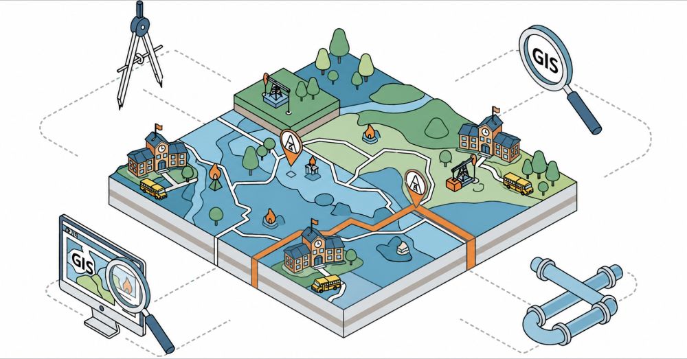
Traditional planning methods often rely on disconnected spreadsheets, static maps, and manual analysis. Through our partnership with HCPS, we developed a Growth Management Tool designed to help district staff better understand enrollment growth, school capacity, boundary planning, and long-term capital investments. Rather than relying on separate systems and manual analysis, the tool brings together data, mapping, analytics, and reporting into one platform, allowing planners to evaluate current conditions and explore potential scenarios.
To address these challenges, DRMP partnered with HCPS to develop a comprehensive Growth Management and School Planning Application using ArcGIS Experience Builder Developer Edition and ArcGIS Enterprise.
The application combines data, mapping, analytics, and reporting into a single interactive platform, allowing planners to make faster, more informed decisions.
Key capabilities include:
- Enrollment and capacity analysis
- School boundary visualization and scenario planning
- Student assignment modeling
- Automated stakeholder reporting
- Integration with multiple enterprise data sources and Representational State Transfer (REST) services
- Address dictionary management for Student Information Systems (SIS)
- Interactive dashboards and spatial analytics for district-wide planning
By consolidating these workflows into one platform, the application provides district staff with actionable insights while reducing manual processes and improving collaboration across departments.
Collaboration That Delivers Results
A key part of our presentation was highlighting the success of our partnership with HCPS. Combining HCPS's planning expertise with DRMP's GIS development capabilities resulted in a solution tailored to the district’s needs.
Rather than displaying data on a map, the application empowers staff to answer critical questions such as:
- Which schools are approaching capacity?
- How will new residential developments affect enrollment?
- What boundary adjustments produce the best outcomes?
- Where should future schools be considered?
These insights support strategic planning while helping districts provide better educational opportunities for students.
Where’s My School?
One of the most useful applications to the public developed through our partnership with HCPS is the school locator tool, which helps families and students quickly determine their assigned schools and access enrollment information.
Three years ago, our GIS team developed the school locator tool to provide a simple, accessible way for families to find accurate school assignment information. Since its implementation, the tool has consistently served between 700,000 and 1 million users annually, demonstrating its value as a trusted resource for the HCPS community.
The tool combines address information with HCPS school boundary data to provide school assignments for the current and upcoming school years. This capability is especially important as attendance boundaries change due to rezoning, new schools opening, school closures, and continued residential growth.
Designed with the user experience in mind, the school locator tool provides:
- Assigned elementary, middle, and high schools
- School addresses and map locations
- Phone numbers
- Links to school websites
- Resources related to enrollment, transportation, and school choice
While the experience for families is a simple exercise, the GIS technology behind the tool supports much larger planning efforts within the district. By maintaining accurate address and boundary data, the application helps HCPS improve access to information for the community while supporting its broader growth management and school planning efforts.
Sharing Innovation with the GIS Community
The Esri Education Summit provides a unique opportunity for GIS professionals, educators, and technology leaders to exchange ideas and showcase innovative solutions. Presenting at the conference allowed our team to demonstrate how modern GIS technology can streamline complex planning workflows while supporting transparent, data-driven decision making.
The session generated strong interest from attendees looking to modernize their own school planning processes and illustrated the growing role GIS plays in educational planning across the country.
As school districts continue to navigate rapid growth, changing demographics, and evolving community needs, intelligent GIS solutions will become increasingly important.
DRMP remains committed to developing innovative, scalable applications that help organizations turn data into confident decisions. We are honored to have shared our work at the 2026 Esri Education Summit and look forward to continuing to support educational institutions with GIS solutions that make an impact.
Interested in partnering with us? Click here.
Mark Brown, GISP, serves as a GIS Project Group Leader for DRMP's Surveying and Mapping/Geospatial Division.
Ravneet Kathuria serves as a GIS Analyst for DRMP's Surveying and Mapping/Geospatial Division.

Posted in the categories All, Geographic Information Systems.
Related Articles
Aug3The Engineering Behind Downtown Orlando’s Magnolia Avenue Two-Way ConversionThe Magnolia Avenue Phase 1 Improvements...See Details
Aug2Behind the Drawings: A CAD Designer’s 30-Year Career in Bridge DesignIn recognition of National CAD Day, DRMP...See Details
Jul28A Major Central Florida Traffic Headache Gets a Long-Term Fix at I-4 and Sand Lake RoadThe I-4 at Sand Lake Road Interchange is...See Details
Jul23DRMP Gives Families a Lift Through Its Charity Bike Build 2026DRMP employees took time out of their da...See Details
Categories
- All
- Alternative Delivery
- Civil Services
- Construction Services
- Disaster Resilience and Sustainability
- DRMPCares
- Ecological Services
- Electrical Engineering
- eWIRE
- Federal Services
- Geographic Information Systems
- Hurricane
- Land Development
- Learning & Development
- NEPA
- Project Development & Environment
- Structural Engineering
- Subsurface Utility Engineering
- Surveying & Mapping
- Traffic Impact Analysis
- Transportation
- Transportation Planning/Project Development
- Utilities Engineering
- Water Resources/Stormwater Management
Contributors
- Michael K. Albano, PE
- Jim Arnemann
- Bruno J. Arriola, PE, ENV SP
- Alia Awwad, PE
- Brent Bass, PE, PSM
- Cody Bayer, PE
- Maria Bazemore, PWS, AICP
- Paul Benvie, PE
- Donald W. Brown, PE
- Kyle Brown, PE
- Jake Burton
- Zach J. Carnahan, PE
- David Couch
- Brian Crowl, PE
- Patrick Day, PE
- Nick DeVito, PE
- Joe Di Benedetto, PLS, LS
- Scott Garth, PE, LEED AP ND
- Ryan M. Grab, CST II
- Robyn Hartz, INCE
- Justin Hayes, EI
- Lucas S. Helms, PE
- Jim Highland, PE
- Ryan Ianacone, CST II
- Erica Jernigan, PE
- Ravneet Kathuria
- TJ Lallathin, Jr., PE, DBIA
- Jay McInnis, PE, CPM
- George McLatchey, PWS, CEP
- Ryan Mitchell, PE
- Megan E. Mott, PE
- Josh Norman
- Melissa Padilla Cintron, SIT
- Pavan Paiavula, PE
- Ryan Pellarin, PE, CCM
- AJ Perkinson, PLS
- Julian Poole, PE
- Kayla Poulos, PE
- Kim Sadowski, PE, RSP1
- John Schick, PTP
- Rachel L. Schmidt, PWS
- Logan Shappell
- Rynal Stephenson, PE
- Albert Taylor
- Deston Taylor, PE, PTOE
- Keelyn Taylor, PhD
- August Thick II, PLS
- Thomas Tracz, PSM
- Grady Vaughan, PE, PTOE, PTP
- Orville Williams
- Amanda E. Woods, PE
Recent Articles
- 08/6/26DRMP Showcases Innovative School Planning Solution at the 2026 ESRI Education Summit
- 08/3/26The Engineering Behind Downtown Orlando’s Magnolia Avenue Two-Way Conversion
- 08/2/26Behind the Drawings: A CAD Designer’s 30-Year Career in Bridge Design
- 07/28/26A Major Central Florida Traffic Headache Gets a Long-Term Fix at I-4 and Sand Lake Road
- 07/23/26DRMP Gives Families a Lift Through Its Charity Bike Build 2026
- 07/21/26Wekiva Parkway Section 8 Interchange Closes Gap, Improves Regional Travel