- Discover
-
Expertise
-
Alternative Delivery
- I-275 at I-4 Downtown Tampa Interchange Design-Build
- Wekiva Parkway Section 8 Interchange
- US 17/92 Interchange at SR 436
- SR 9B Extension from I-95 to US 1
- A. Max Brewer Bridge Replacement
- I-95 Widening from the Indian River/Brevard County Line to Malabar Road
- SR 528 (Beachline Expressway) at Innovation Way Interchange
- SR 570 Polk Parkway Widening from I-4 to Pace Road
- I-95 Express Lanes and Ramp Signals – Phase 3A-1
- Pollard Road Extension over Peace Creek
- I-485 Widening from I-77 to Rea Road
- Monroe Bypass/Connector Design-Build
- Construction Services
- Ecological Services
-
Federal Services
- Range of the Future Study
- US Coast Guard Air Station (Clearwater)
- Ascension Island Fire Station Renovation
- Patrick Space Force Base Water Lines Repair
- Patrick Space Force Base Living Shoreline Restoration
- P-505 Electrical Hardening and Black Start CHP at Marine Corps Air Station Beaufort
- Naval Station at Guantanamo Bay Survey Services
- Repair Phillips Parkway and Speed Limit Study
- Ascension Island Auxiliary Airfield Surveying and Mapping Services
-
Geographic Information Systems (GIS)
- Thermal Design/Comprehensive Campus LiDAR Collection
- Greater Orlando Aviation Authority (GOAA) Strategic Commerical Land Development Program
- University of Florida Sanitary Sewer GIS Mapping
- Ascension Island Auxiliary Airfield GIS Integration
- Santa Rosa County School District's School Transportation & Capacity GIS Analysis
- Gainesville Community Redevelopment Agency Socioeconomic Analysis and Site Suitability Report
- Real Estate Site Suitability and Development Analysis
- SR 836 (Dolphin Expressway) GIS Asset Inventory of Pre-Post Construction
- Alachua County Public Schools GIS and School Planning Professional Services
- Patrick Space Force Base Living Shoreline Restoration GIS Analysis
- Florida Army National Guard Readiness Center GIS Inventory & Integration
- Comprehensive Transit Study Puerto Rico GIS Analysis
- Land Development
- Structural Engineering
-
Subsurface Utility Engineering (SUE)
- Thermal Design/Comprehensive Campus LiDAR Collection
- P-505 Electrical Hardening and Black Start CHP at Marine Corps Air Station Beaufort
- Resurface & Safety Improvements Turnpike Mainline
- University of Florida Rabon Utility Mapping
- FP&L Subsurface Utility Engineering Continuing On-Call Contract
- Lockheed Martin Subsurface Utility Engineering Services
- Palm Coast Parkway Subsurface Utility Engineering Services
- Surveying & Mapping/Geospatial
-
Traffic Impact Analysis
- 505 West Chapel Hill Street
- 5th Street Station
- Beale Farm Industrial Park
- Blue Mountain Mist Resort
- The Villages at McCullers Walk
- Fredericksburg National Baseball Stadium
- Hendrick Southpoint Auto Mall
- Apex Friendship Elementary School
- Whole Foods Center
- Barclay West
- Grove 98
- Pullen Drive Extension/Catholic Diocese
- Trails/Parks & Recreation Facilities
- Transportation
-
Utilities Engineering
- Ascension Island Fire Station Renovation
- M-1 Canal Water Main Extension
- 5th Street Bridge Utility Replacement
- Captain’s Cove Wastewater Plant Revisions & Permit Renewal
- City of Fort Myers Downtown Utility & Streetscape Improvement
- Florida Caverns State Park Lift Station Rehab
- Tween Waters Inn Wastewater Plant Permit Renewal
- City of Fort Myers Wastewater Capacity Studies
- Patrick Space Force Base Water Lines Repair
- Big Lagoon Boat Ramp Wastewater System
- St. Joseph State Park Septic Tank Replacement
- WildBlue Development Wastewater Modeling
- A-1 Gator Wastewater Capacity Increase
- Water Resources/Stormwater Management
-
Alternative Delivery
- Careers
- Insights
- Connect
- Powered By Trilon
Florida SR 50 Widening Improves Safety and Wildlife Connectivity in Withlacoochee State Forest
February 12th, 2026


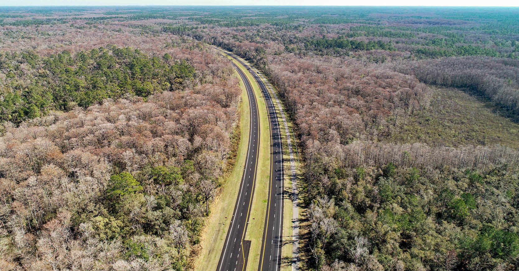
A 21-mile gap of Florida’s State Road (SR) 50 from US 301 to Groveland remained the highway’s last two-lane segment. Heavy truck traffic along this corridor had become a growing safety concern with drivers often trapped behind slow-moving trucks for miles. Frustration on the narrow roadway led some motorists to pass in no-passing zones, creating dangerous conditions and contributing to head-on collisions.
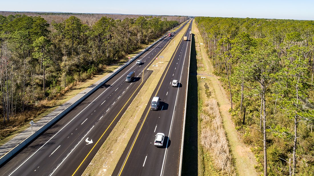
To address safety concerns, the Florida Department of Transportation (FDOT), with support from the Florida Legislature to accelerate the project timeline, advanced a $70 million project on the western end of the gap to widen an 8-mile stretch of SR 50 through the Withlacoochee State Forest in Sumter and Hernando counties. The project transformed the corridor into a four-lane, divided highway. FDOT selected DRMP as the prime design consultant under a single contract spanning FDOT districts five and seven. DRMP managed and delivered the two projects as a coordinated effort, overseeing all disciplines and ensuring consistency within district boundaries.
In FDOT District 7, DRMP provided services using all its disciplines including roadway and drainage design, signing and pavement markings, structural design, surveying, environmental permitting, maintenance of traffic, right-of-way coordination, and public involvement. For the FDOT District 5 segment, DRMP designed the bridges and led environmental permitting efforts while working closely with major subconsultant Kisinger, Campo & Associates (KCA), which delivered roadway design, drainage, and pavement marking services. Pevida Highway Designers, Dannick Engineering Services, and Tierra, Inc., provided engineering assistance while Geodata Consultants provided right-of-way (ROW) mapping and survey services on this project.
Engineering with Nature
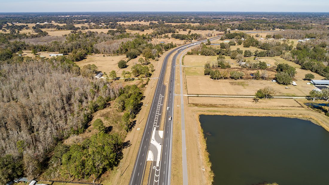
SR 50 is an east-west corridor that spans the state of Florida and connects the Gulf Coast to the Space Coast. While much of the roadway had already been widened to four lanes, this segment - from east of US 301 to east of CR 757 – through the Withlacoochee State Forest represented the final two-lane gap. The corridor passes through environmentally sensitive state lands that are home to Florida black bears, gopher tortoises, and numerous other protected animal and plant species, making this final widening effort especially complex.
Environmental coordination was one of the defining aspects of the project, requiring close collaboration with the Florida Forest Service (FFS), the Acquisition and Restoration Council (ARC), the U.S. Fish and Wildlife Service (FWS), the Southwest Florida Water Management District (SWFMD), the Florida Department of Environmental Protection (FDEP), the U.S. Forest Service (USFS), Audubon Society representatives, two FDOT districts, local governments, and utility providers. These commitments were documented during a prior Project Development & Environment (PD&E) study and carried out through final design.
Working closely with the FFS, DRMP sought to minimize impacts to state lands wherever possible. Early concepts included multiple stormwater ponds within the forest, but DRMP refined the design to convey roadway runoff to treatment ponds located outside forest boundaries. This approach reduced land acquisition within the forest, minimized wetland impacts, and still met all stormwater and water quality requirements.
The Forestry Service agreed to minor increases in internal water levels, allowing the design team to eliminate several in-forest ponds and preserve sensitive habitats. Impacted state lands were replaced with multiple times the acreage, coordinating with the FFS and FDOT to acquire contiguous properties supporting the forest. DRMP also aligned a pedestrian underpass with a state multi-use trail, improving connectivity for wildlife and recreational users. Rather than installing large wildlife fences through the forest, DRMP incorporated oversized culverts to allow smaller wildlife to pass beneath the roadway and designed a larger wildlife underpass to safely funnel larger species. Additional wildlife enhancement features were integrated throughout the corridor in response to input from environmental stakeholders, which resulted in broad support for the final design.
Full-Service Engineering
Nearly every DRMP discipline contributed to the project. Survey services included topographic surveys of the mainline roadway, pond sites, and channel cross sections of the Little Withlacoochee River. DRMP managed survey coordination with subconsultants, supervised data processing and quality control, and oversaw scheduling and invoicing. Drainage design focused on reducing the footprint within state lands by strategically locating treatment facilities outside the forest and minimizing right-of-way impacts. Right-of-way parcels for treatment ponds outside the forest were acquired early, and runoff from the roadway within the forest was conveyed to these off-forest ponds, minimizing environmental impacts while meeting stormwater and water quality requirements.
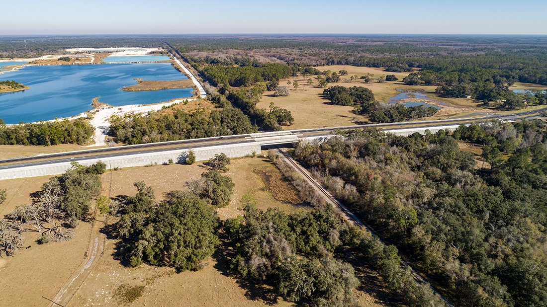
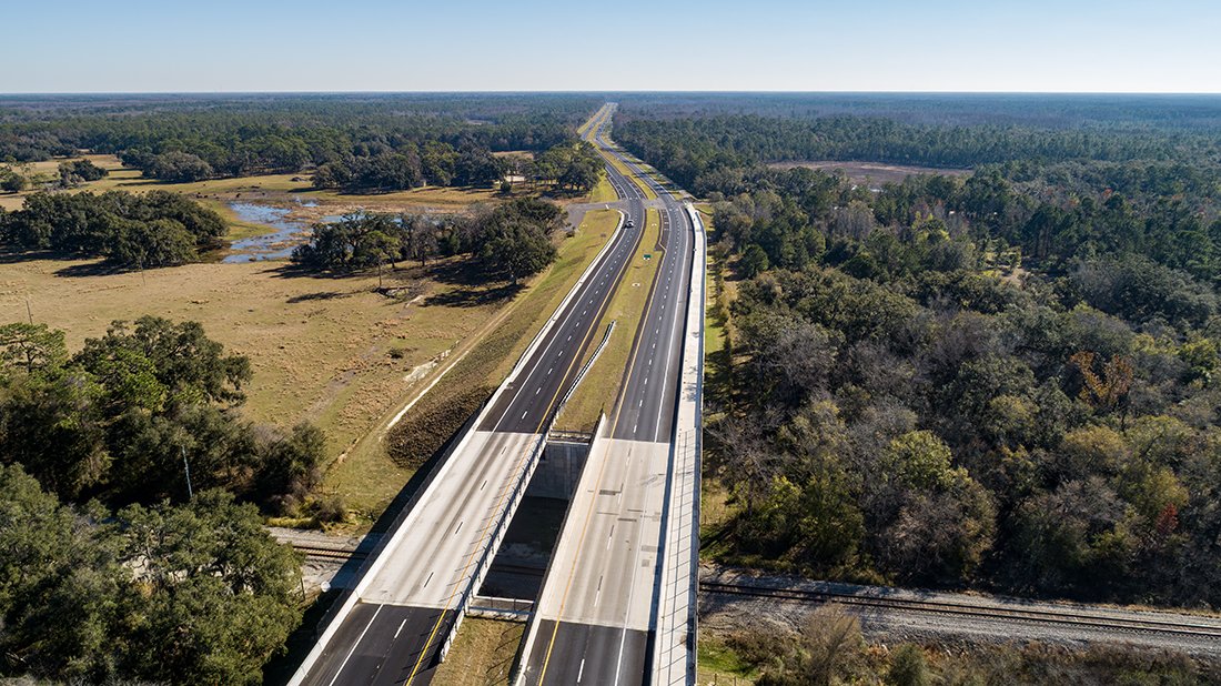
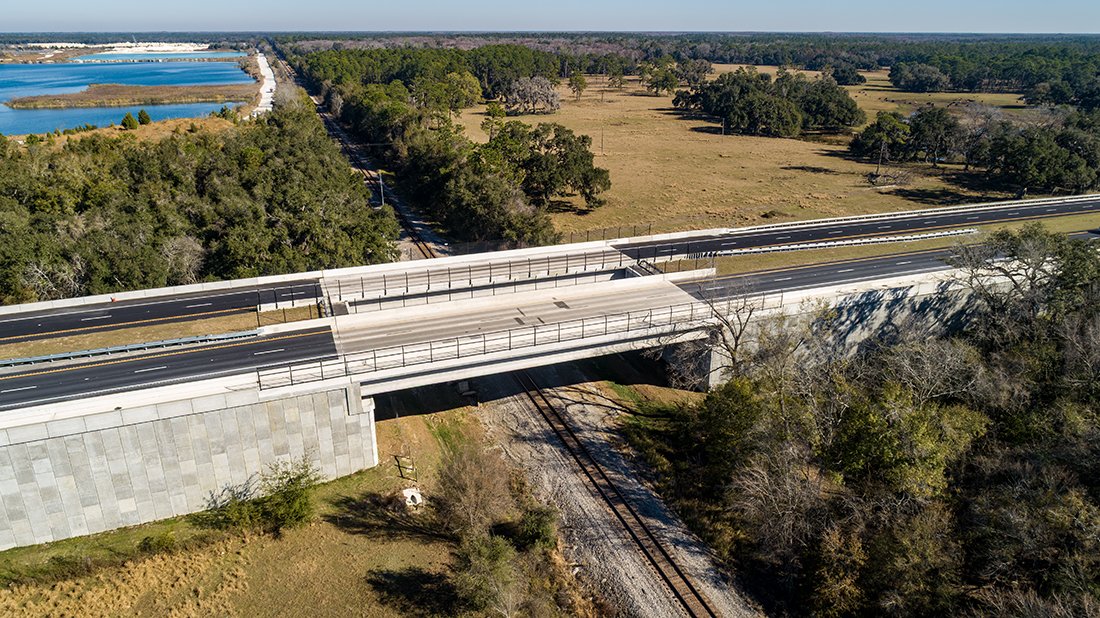
The project included multiple complex structural elements. DRMP designed and replaced a bridge over the Withlacoochee River using a five-span structure composed of AASHTO Type II beams founded on driven concrete piles, matching the configuration of the existing crossing. To improve safety and eliminate an at-grade rail crossing, DRMP also designed a bridge over the CSX railroad, spanning the full railroad right-of-way with a single span of Florida-I 63 beams and retaining walls at each end. This work required extensive coordination with CSX and a nearby mining operation.
Coordination and schedule management were among the project’s greatest challenges. The work spanned two FDOT districts, multiple regulatory agencies, and an accelerated timeline driven by legislative priorities to complete the final four-lane segment of SR 50.
Through advanced design, early identification of right-of-way needs, and close collaboration with FDOT and the ARC committee, DRMP helped compress the project schedule and save approximately a year in design time. Construction was completed and all four lanes through the forest opened in 2025. Early right-of-way acquisition, coordination with environmental agencies, and permitting efforts enabled FDOT to advance construction efficiently.
With construction completed and the corridor open to traffic, the SR 50 Widening project represents the final step in transforming SR 50 into a continuous four-lane corridor across Florida. The project significantly improves safety, mobility, and regional connectivity while demonstrating how sound engineering, strong partnerships, and legislative support can deliver infrastructure solutions that respect the traveling public and the surrounding natural environment.

Don Brown, PE, is a Vice President and Drainage Division Leader in DRMP’s Transportation Market Sector.
Posted in the categories All, Ecological Services, Structural Engineering, Transportation, Water Resources/Stormwater Management .
Related Articles
 Jul23DRMP Gives Families a Lift Through Its Charity Bike BuildDRMP employees took time out of their da...See Details
 Jul21Wekiva Parkway Section 8 Interchange Closes Gap, Improves Regional Travel The Wekiva Parkway Section 8 Interchange...See Details
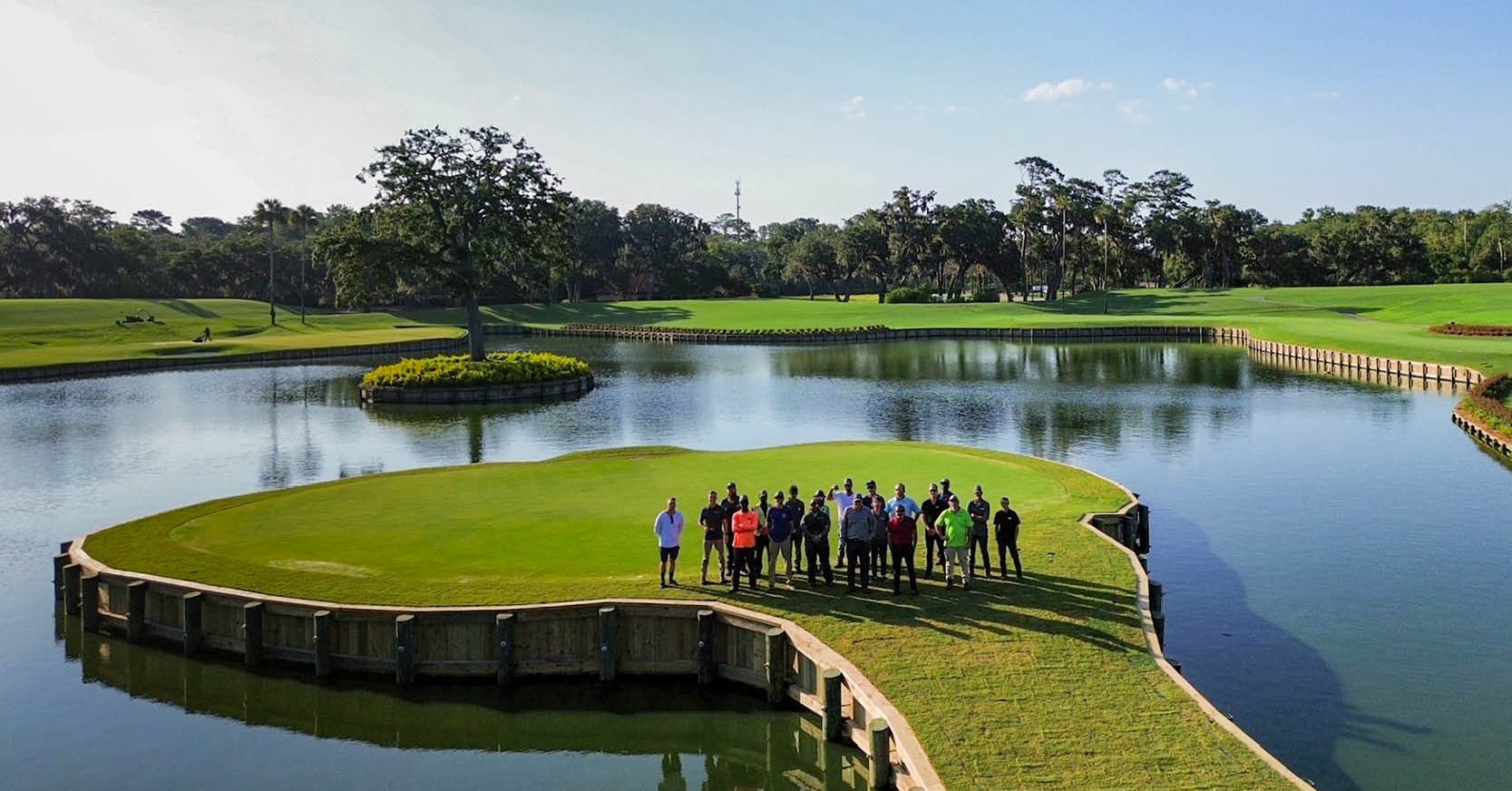 Jul14Surveying One of Golf’s Most Legendary Holes DRMP provided survey services for the re...See Details
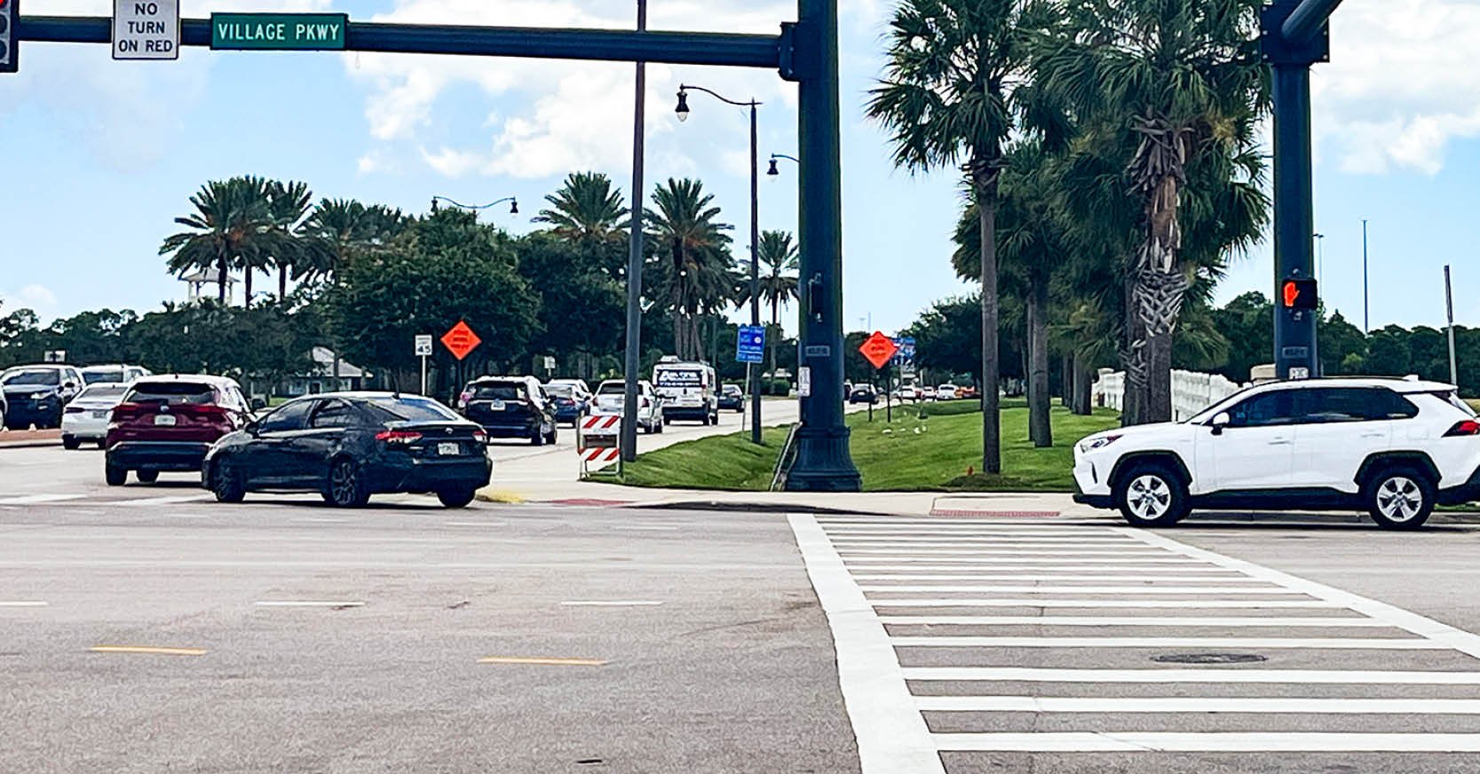 Jul7Port St. Lucie Intersection Upgrade Improves Safety at Village and Tradition ParkwaysDRMP delivered a comprehensive redesign ...See Details

Categories
- All
- Alternative Delivery
- Civil Services
- Construction Services
- Disaster Resilience and Sustainability
- DRMPCares
- Ecological Services
- Electrical Engineering
- eWIRE
- Federal Services
- Geographic Information Systems
- Hurricane
- Land Development
- Learning & Development
- NEPA
- Project Development & Environment
- Structural Engineering
- Subsurface Utility Engineering
- Surveying & Mapping
- Traffic Impact Analysis
- Transportation
- Transportation Planning/Project Development
- Utilities Engineering
- Water Resources/Stormwater Management
Contributors
- Michael K. Albano, PE
- Bruno J. Arriola, PE, ENV SP
- Alia Awwad, PE
- Brent Bass, PE, PSM
- Cody Bayer, PE
- Maria Bazemore, PWS, AICP
- Paul Benvie, PE
- Donald W. Brown, PE
- Kyle Brown, PE
- Jake Burton
- Zach J. Carnahan, PE
- David Couch
- Brian Crowl, PE
- Patrick Day, PE
- Nick DeVito, PE
- Joe Di Benedetto, PLS, LS
- Scott Garth, PE, LEED AP ND
- Ryan M. Grab, CST II
- Robyn Hartz, INCE
- Justin Hayes, EI
- Lucas S. Helms, PE
- Jim Highland, PE
- Ryan Ianacone, CST II
- Erica Jernigan, PE
- Ravneet Kathuria
- TJ Lallathin, Jr., PE, DBIA
- Jay McInnis, PE, CPM
- George McLatchey, PWS, CEP
- Ryan Mitchell, PE
- Megan E. Mott, PE
- Josh Norman
- Melissa Padilla Cintron, SIT
- Pavan Paiavula, PE
- Ryan Pellarin, PE, CCM
- AJ Perkinson, PLS
- Julian Poole, PE
- Kayla Poulos, PE
- Kim Sadowski, PE, RSP1
- John Schick, PTP
- Rachel L. Schmidt, PWS
- Logan Shappell
- Rynal Stephenson, PE
- Albert Taylor
- Deston Taylor, PE, PTOE
- Keelyn Taylor, PhD
- August Thick II, PLS
- Thomas Tracz, PSM
- Hung Tu, PE, SE
- Grady Vaughan, PE, PTOE, PTP
- Orville Williams
- Amanda E. Woods, PE


