- Discover
-
Expertise
-
Alternative Delivery
- I-275 at I-4 Downtown Tampa Interchange Design-Build
- Wekiva Parkway Section 8 Interchange
- US 17/92 Interchange at SR 436
- SR 9B Extension from I-95 to US 1
- A. Max Brewer Bridge Replacement
- I-95 Widening from the Indian River/Brevard County Line to Malabar Road
- SR 528 (Beachline Expressway) at Innovation Way Interchange
- SR 570 Polk Parkway Widening from I-4 to Pace Road
- I-95 Express Lanes and Ramp Signals – Phase 3A-1
- Pollard Road Extension over Peace Creek
- I-485 Widening from I-77 to Rea Road
- Monroe Bypass/Connector Design-Build
- Construction Services
- Ecological Services
-
Federal Services
- Range of the Future Study
- US Coast Guard Air Station (Clearwater)
- Ascension Island Fire Station Renovation
- Patrick Space Force Base Water Lines Repair
- Patrick Space Force Base Living Shoreline Restoration
- P-505 Electrical Hardening and Black Start CHP at Marine Corps Air Station Beaufort
- Naval Station at Guantanamo Bay Survey Services
- Repair Phillips Parkway and Speed Limit Study
- Ascension Island Auxiliary Airfield Surveying and Mapping Services
-
Geographic Information Systems (GIS)
- Thermal Design/Comprehensive Campus LiDAR Collection
- Greater Orlando Aviation Authority (GOAA) Strategic Commerical Land Development Program
- University of Florida Sanitary Sewer GIS Mapping
- Ascension Island Auxiliary Airfield GIS Integration
- Santa Rosa County School District's School Transportation & Capacity GIS Analysis
- Gainesville Community Redevelopment Agency Socioeconomic Analysis and Site Suitability Report
- Real Estate Site Suitability and Development Analysis
- SR 836 (Dolphin Expressway) GIS Asset Inventory of Pre-Post Construction
- Alachua County Public Schools GIS and School Planning Professional Services
- Patrick Space Force Base Living Shoreline Restoration GIS Analysis
- Florida Army National Guard Readiness Center GIS Inventory & Integration
- Comprehensive Transit Study Puerto Rico GIS Analysis
- Structural Engineering
-
Subsurface Utility Engineering (SUE)
- Thermal Design/Comprehensive Campus LiDAR Collection
- P-505 Electrical Hardening and Black Start CHP at Marine Corps Air Station Beaufort
- Resurface & Safety Improvements Turnpike Mainline
- University of Florida Rabon Utility Mapping
- FP&L Subsurface Utility Engineering Continuing On-Call Contract
- Lockheed Martin Subsurface Utility Engineering Services
- Palm Coast Parkway Subsurface Utility Engineering Services
- Surveying & Mapping/Geospatial
-
Traffic Impact Analysis
- 505 West Chapel Hill Street
- 5th Street Station
- Beale Farm Industrial Park
- Blue Mountain Mist Resort
- The Villages at McCullers Walk
- Fredericksburg National Baseball Stadium
- Hendrick Southpoint Auto Mall
- Apex Friendship Elementary School
- Whole Foods Center
- Barclay West
- Grove 98
- Pullen Drive Extension/Catholic Diocese
- Trails/Parks & Recreation Facilities
- Transportation
-
Utilities Engineering
- Ascension Island Fire Station Renovation
- M-1 Canal Water Main Extension
- 5th Street Bridge Utility Replacement
- Captain’s Cove Wastewater Plant Revisions & Permit Renewal
- City of Fort Myers Downtown Utility & Streetscape Improvement
- Florida Caverns State Park Lift Station Rehab
- Tween Waters Inn Wastewater Plant Permit Renewal
- City of Fort Myers Wastewater Capacity Studies
- Patrick Space Force Base Water Lines Repair
- Big Lagoon Boat Ramp Wastewater System
- St. Joseph State Park Septic Tank Replacement
- WildBlue Development Wastewater Modeling
- A-1 Gator Wastewater Capacity Increase
- Water Resources/Stormwater Management
-
Alternative Delivery
- Careers
- Insights
- Connect
- Powered By Trilon
« Back
How DRMP Leverages GIS and Mobile LiDAR for Asset Management and Planning
November 18th, 2026
DRMP helps clients turn location-based data into tools for managing infrastructure, prioritizing maintenance and planning facilities. Through GIS services, field data collection and in-house mobile LiDAR capabilities, the firm develops asset inventories, custom maps, dashboards and applications around the decisions clients need to make.
DRMP GIS Analyst Ravneet Kathuria, GISP, explains how the team helps clients put that information to work.
What is GIS, and how can organizations use it?
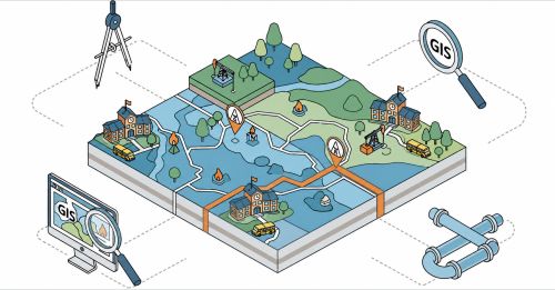
Geographic information systems (GIS) connect information to locations, helping organizations see where things are, understand their characteristics and evaluate relationships among them.
For asset management, that can mean mapping roads, signs, culverts, utility poles or water pumps and recording their condition and maintenance needs. For planning, it can mean evaluating how new development could affect demand for facilities or services.
DRMP helps clients identify the information they need and develop tools to use it. The application depends on the client’s priorities, whether that involves managing infrastructure, planning facilities or presenting information to decision-makers.
How can GIS help clients make decisions when budgets are tight?
GIS helps clients prioritize maintenance spending by connecting asset locations with condition information. Infrastructure owners can use that information to identify repair needs and support budget recommendations with data.
Maps and dashboards can show which assets need repairs and where those needs are concentrated. That information can support maintenance schedules and replacement planning.
DRMP helps make the data accessible so clients can consider those needs alongside their available resources.
Where should an organization begin with GIS?
Begin with the decisions you need to make, and the information required to make them. That establishes a practical purpose for the data collection and the resulting GIS tool.
For an organization managing infrastructure, the priority may be assets whose failure could affect safety or essential operations. For a school district, it may be understanding where residential growth could increase enrollment.
DRMP works with clients to identify those needs and establish consistent ways to record the relevant information. Using the same condition ratings or asset descriptions across an inventory, for example, makes comparisons easier and supports analysis as records are updated.
What are the benefits of DRMP’s in-house mobile LiDAR and GIS teams working together?
DRMP’s in-house mobile LiDAR and GIS capabilities connect field collection with asset management. Our teams coordinate what to capture, how to organize it and how clients will access it, so the collected data supports the intended inventory or application.
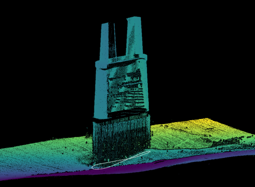
Our mobile LiDAR team uses vehicle-mounted scanning equipment to quickly and accurately capture infrastructure along roadways. Asset locations and measurements can then be extracted from the collected data and incorporated into GIS.
The GIS team helps identify the information needed for the inventory or application, while the mobile LiDAR team determines how to capture the relevant field data. Clients can work with DRMP from collection through application development. Collection methods depend on the project’s needs.
How has DRMP used asset data to support a client’s infrastructure needs?
For a sign inventory project in Sumter County, Fla., DRMP inventoried 10,387 sign panels and 4,959 support structures. The work included nighttime driving in The Villages, a Central Florida community spanning portions of Sumter, Lake and Marion counties.
Our survey and GIS teams handled the inventory collection, and our GIS team evaluated sign retroreflectivity, which describes how light reflects from a sign back toward a driver.
DRMP delivered a GIS file structured to match the client’s existing sign inventory GIS data. It included evaluations of sign condition, sign retroreflectivity and support structure condition. We also provided a summary report of overall conditions.
By matching the file to the client’s existing GIS data, DRMP delivered detailed condition findings in a familiar data structure. The client is using those findings to determine possible future repairs to signs and support structures.
Can DRMP customize GIS tools for different organizations and workflows?
DRMP builds GIS tools around the client’s workflow and decisions. We determine who needs the information, what they need to see and how they will use it, then tailor the maps, dashboards or applications to those requirements.
A dashboard might provide an overview of asset conditions, while an interactive map allows users to locate individual assets and access their records. Other applications can support planning, analysis and reporting.
Our experience with other GIS assignments also helps us recommend approaches the client may not have considered.
Learn more about DRMP's GIS applications, asset management capabilities and more.
Related Articles
Oct28Below the Surface: DRMP Brings Bathymetric Expertise to HMB Bridge Project
When HMB needed special...See Details
Sep3LAUNCH Gives DRMP Interns Head Start on Their Careers
For engineering student...See Details
Aug6DRMP Showcases Innovative School Planning Solution at the 2026 ESRI Education Summit
Situated in the Tampa, ...See Details
Aug3The Engineering Behind Downtown Orlando’s Magnolia Avenue Two-Way ConversionThe Magnolia Avenue Phase 1 Improvements...See Details
Categories
- All
- Alternative Delivery
- Civil Services
- Construction Services
- Disaster Resilience and Sustainability
- DRMPCares
- Ecological Services
- Electrical Engineering
- eWIRE
- Federal Services
- Geographic Information Systems
- Hurricane
- Land Development
- Learning & Development
- NEPA
- Project Development & Environment
- Structural Engineering
- Subsurface Utility Engineering
- Surveying & Mapping
- Traffic Impact Analysis
- Transportation
- Transportation Planning/Project Development
- Utilities Engineering
- Water Resources/Stormwater Management
Contributors
- Michael K. Albano, PE
- Jim Arnemann
- Bruno J. Arriola, PE, ENV SP
- Alia Awwad, PE
- Brent Bass, PE, PSM
- Cody Bayer, PE
- Maria Bazemore, PWS, AICP
- Paul Benvie, PE
- Donald W. Brown, PE
- Kyle Brown, PE
- Jake Burton
- Zach J. Carnahan, PE
- David Couch
- Brian Crowl, PE
- Patrick Day, PE
- Nick DeVito, PE
- Joe Di Benedetto, PLS, LS
- Scott Garth, PE, LEED AP ND
- Ryan M. Grab, CST II
- Robyn Hartz, INCE
- Justin Hayes, EI
- Lucas S. Helms, PE
- Jim Highland, PE
- Ryan Ianacone, CST II
- Erica Jernigan, PE
- Ravneet Kathuria
- TJ Lallathin, Jr., PE, DBIA
- Jay McInnis, PE, CPM
- George McLatchey, PWS, CEP
- Ryan Mitchell, PE
- Megan E. Mott, PE
- Josh Norman
- Melissa Padilla Cintron, SIT
- Pavan Paiavula, PE
- Ryan Pellarin, PE, CCM
- AJ Perkinson, PLS
- Julian Poole, PE
- Kayla Poulos, PE
- Kim Sadowski, PE, RSP1
- John Schick, PTP
- Rachel L. Schmidt, PWS
- Logan Shappell
- Rynal Stephenson, PE
- Albert Taylor
- Deston Taylor, PE, PTOE
- Keelyn Taylor, PhD
- August Thick II, PLS
- Thomas Tracz, PSM
- Grady Vaughan, PE, PTOE, PTP
- Orville Williams
- Amanda E. Woods, PE